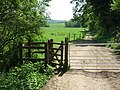
The Mole Gap Trail is a 10-kilometre (6.2 mi) official walking route alongside the River Mole, linking the Surrey towns of Dorking and Leatherhead. The...
3 KB (169 words) - 10:14, 30 January 2024

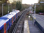
footpath from Kingston upon Thames, and lies close to the midpoint of the Mole Gap Trail between Leatherhead and Dorking. The station is within 1⁄2 mile (800 m)...
11 KB (738 words) - 13:19, 31 December 2023

district of Mole Valley. The Mole crosses the North Downs between Dorking and Leatherhead, where it cuts a steep-sided valley, known as the Mole Gap, through...
105 KB (10,170 words) - 15:01, 28 November 2023
populated north from the more rural south; it is pierced by the rivers Wey and Mole, both tributaries of the Thames. The north of the county is a lowland, part...
113 KB (13,093 words) - 19:06, 23 May 2024

The North Downs Way National Trail is a long-distance path in southern England, opened in 1978. It runs from Farnham to Dover, past Guildford, Dorking...
7 KB (549 words) - 13:25, 11 January 2024

5-mile-long (16.9 km) scarp slope of the North Downs between the Wey and Mole valleys. It discharges between 1 and 10 megalitres (220,000 to 2.2 million...
8 KB (824 words) - 09:46, 27 April 2024

North Downs is intersected by the valleys of a series of rivers: the Wey, Mole, Darent, Medway and Stour. These drain much of the Weald to the south. The...
30 KB (3,256 words) - 08:41, 9 March 2024

"Area of Great Landscape Value Designation". Surrey Hills AONB. Retrieved 26 March 2011. Surrey Hills AONB Inspiring Views Trail in the Surrey Hills...
8 KB (360 words) - 19:08, 28 February 2024

Colley Hill Combe Bottom Gatton Park Hackhurst and White Downs Hog's Back Mole Gap to Reigate Escarpment Newlands Corner Norbury Park Ranmore Common Seale...
13 KB (1,358 words) - 17:26, 20 May 2024

Colley Hill Combe Bottom Gatton Park Hackhurst and White Downs Hog's Back Mole Gap to Reigate Escarpment Newlands Corner Norbury Park Ranmore Common Seale...
3 KB (317 words) - 18:43, 14 February 2024

river. A broad basin of aquifers drain steeply to the river so, as with the Mole, in its natural state, much of the flood plains were prone to regular flooding...
22 KB (1,895 words) - 19:12, 24 May 2024

E2 European long distance path (category Hiking trails in France)
border to Standedge, the Oldham Way from Standedge to Mossley, the Tameside Trail from Mossley to Broadbottom, the Etherow/Goyt Valley Way from Broadbottom...
5 KB (511 words) - 09:52, 4 May 2024

The Sutton and Mole Valley lines were constructed between 1847 and 1868 by the London, Brighton and South Coast Railway, the London and South Western Railway...
16 KB (1,659 words) - 13:08, 25 May 2024

Norbury Park (category Mole Valley)
Mole, it is close to the village of Mickleham. The park is Grade II listed on the Register of Historic Parks and Gardens. It is part of the Mole Gap to...
16 KB (1,705 words) - 21:04, 11 January 2024

Windrush, Evenlode, Cherwell, Ock, Thame, Pang, Kennet, Loddon, Colne, Wey and Mole. In addition, there are occasional backwaters and artificial cuts that form...
134 KB (14,776 words) - 12:52, 12 June 2024

discovered in the area was a Stone Age era dugout canoe found in the River Mole/River Ember, which is now on display in the museum at Henley-on-Thames. The...
6 KB (673 words) - 12:47, 2 April 2024

St Swithun's Way also links up with the Pilgrims' Trail from Winchester to Portsmouth; this trail then extends across the sea to Mont Saint-Michel in...
6 KB (642 words) - 19:23, 23 December 2022

National Trails North Downs Way Thames Path Long-distance footpaths Blackwater Valley Path Downs Link E2 Greensand Way London Outer Orbital Path Mole Gap Trail...
9 KB (832 words) - 18:49, 14 May 2024

in Kent and links with the Stour Valley Walk near Pluckley in Kent. The trail was opened on 15 June 1980 and is jointly managed by Surrey and Kent Councils...
5 KB (403 words) - 15:40, 28 May 2024
National Trails North Downs Way Thames Path Long-distance footpaths Blackwater Valley Path Downs Link E2 Greensand Way London Outer Orbital Path Mole Gap Trail...
13 KB (1,422 words) - 02:51, 5 April 2024

National Trails North Downs Way Thames Path Long-distance footpaths Blackwater Valley Path Downs Link E2 Greensand Way London Outer Orbital Path Mole Gap Trail...
84 KB (11,599 words) - 20:24, 8 June 2024

Colley Hill Combe Bottom Gatton Park Hackhurst and White Downs Hog's Back Mole Gap to Reigate Escarpment Newlands Corner Norbury Park Ranmore Common Seale...
15 KB (1,887 words) - 19:30, 22 August 2023

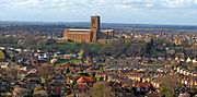
Box Hill, Surrey (category Mole Valley)
Surrey Hills Area of Outstanding Natural Beauty and forms part of the Mole Gap to Reigate Escarpment Site of Special Scientific Interest. The north- and...
123 KB (12,019 words) - 18:13, 27 April 2024

Downs Link (category Rail trails in England)
Downs Link is not a National Trail within the meaning of the National Parks and Access to the Countryside Act 1949, but a trail of regional importance supported...
9 KB (908 words) - 04:29, 6 May 2024

National Trails North Downs Way Thames Path Long-distance footpaths Blackwater Valley Path Downs Link E2 Greensand Way London Outer Orbital Path Mole Gap Trail...
5 KB (386 words) - 17:32, 27 April 2024

media related to Epsom railway station. Route Map and Timetable for Sutton & Mole Valley Line Train times and station information for Epsom railway station...
13 KB (1,054 words) - 10:58, 29 March 2024

Colley Hill Combe Bottom Gatton Park Hackhurst and White Downs Hog's Back Mole Gap to Reigate Escarpment Newlands Corner Norbury Park Ranmore Common Seale...
16 KB (1,605 words) - 19:20, 23 August 2023

National Trails North Downs Way Thames Path Long-distance footpaths Blackwater Valley Path Downs Link E2 Greensand Way London Outer Orbital Path Mole Gap Trail...
4 KB (333 words) - 12:48, 2 April 2024

island platforms which have since been removed - this is evident with wide gaps between station platforms at stations such as Winchfield. The island platforms...
22 KB (2,468 words) - 23:42, 27 March 2024
[citation needed] The Vanguard Way connects with central London with the Wandle Trail along the River Wandle from Croydon and is sometimes used as a walking route...
6 KB (435 words) - 19:44, 15 January 2024