
List of A roads in zone 8 in Great Britain starting north of the A8 and west of the A9 (roads beginning with 8). B roads in Zone 8 of the Great Britain numbering...
20 KB (51 words) - 23:50, 6 June 2024
B roads are numbered routes in Great Britain of lesser importance than A roads. See the article Great Britain road numbering scheme for the rationale...
18 KB (71 words) - 18:25, 28 December 2023
the original on 8 August 2010. Retrieved 29 June 2010. Wikimedia Commons has media related to A roads in Zone 1 of the Great Britain numbering scheme....
99 KB (79 words) - 14:43, 23 May 2024
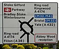
In Great Britain, there is a numbering scheme used to classify and identify all roads. Each road is given a single letter (representing a category) and...
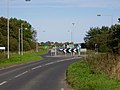
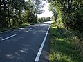
29 KB (3,579 words) - 08:28, 20 May 2024
B roads are numbered routes in Great Britain of lesser importance than A roads. See the article Great Britain road numbering scheme for the rationale...
86 KB (29 words) - 15:49, 17 March 2024
B roads are numbered routes in Great Britain of lesser importance than A roads. See the article Great Britain road numbering scheme for the rationale...
64 KB (58 words) - 19:16, 24 April 2024
List of A roads in zone 6 in Great Britain starting east of the A6 and A7 roads, and west of the A1 (road beginning with 6). "A613 (Gateshead)". sabre-roads...
48 KB (76 words) - 02:15, 9 June 2024
B roads are numbered routes in Great Britain of lesser importance than A roads. See the article Great Britain road numbering scheme for the rationale...
19 KB (72 words) - 12:10, 6 March 2024
B roads are numbered routes in Great Britain of lesser importance than A roads. See the article Great Britain road numbering scheme for the rationale...
172 KB (4,580 words) - 09:02, 22 April 2024
A roads are numbered routes in Great Britain. See the article Great Britain road numbering scheme for the rationale behind the numbers allocated. Depending...
2 KB (144 words) - 05:50, 14 March 2023
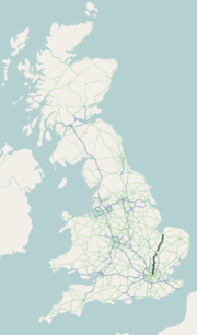
In the Great Britain road numbering scheme, the country is divided into numbered zones, the boundaries of which are usually defined by single-digit roads...
26 KB (357 words) - 18:37, 29 December 2023
designated in 1921 by the Ministry of Transport under the Great Britain road numbering scheme. The earliest documented northern routes are the roads created...
76 KB (4,443 words) - 19:22, 10 May 2024

The United Kingdom of Great Britain and Northern Ireland, commonly known as the United Kingdom (UK) or Britain, is a country in Northwestern Europe, off...
348 KB (30,189 words) - 19:41, 8 June 2024

precedes the name of the street. A house numbering scheme was present in Pont Notre-Dame in Paris in 1512. However, the purpose of the numbering was generally...
49 KB (6,873 words) - 09:57, 5 April 2024

A unified numbering system is in place for Great Britain, whilst in Northern Ireland, there is no available explanation for the allocation of road numbers...
69 KB (7,189 words) - 07:16, 6 June 2024
encourage traffic to use the A452 or A46 instead. British road numbering scheme A roads in Zone 4 of the Great Britain numbering scheme "Directions to A429"...
5 KB (367 words) - 17:23, 9 May 2024
scheme: Zone 1 Zone 2 Zone 3 Zone 4 Zone 5 Zone 6 Zone 7 Zone 8 Zone 9 Zone 1 Zone 2 Zone 3 Zone 4 Zone 5 Zone 6 Zone 7 Zone 8 Zone 9 List of roads that...
2 KB (131 words) - 17:39, 2 May 2022
in Labuan have a three-digit number beginning with '7'. The United Kingdom has two road numbering schemes, one for Great Britain and the other for Northern...
67 KB (8,348 words) - 22:09, 28 March 2024

road in Great Britain. The main part of the road connects Brighton, Peacehaven, Eastbourne, Hastings, Rye, and Folkestone. The road is below the expected...
21 KB (1,983 words) - 15:54, 2 April 2024

Showground, which is based around the Roman Road. List of A roads in Zone 1 of the Great Britain numbering scheme Ermine Street Lincoln & Newark-on-Trent (Map)...
6 KB (551 words) - 10:45, 27 March 2024

safety improvements along the road. British road numbering scheme Wikimedia Commons has media related to A68 road (Great Britain). Priestley, Catherine (26...
10 KB (924 words) - 00:46, 9 June 2024

is anomalously numbered since west of Penrith it trespasses into numbering zone 5; this is because it originally terminated at the A6 in Penrith but was...
19 KB (1,479 words) - 14:26, 24 March 2024

replaced part of the A2 as the strategic route. Unlike the other single digit A-roads in Great Britain, the A2 does not form a zone boundary. The boundary...
29 KB (2,105 words) - 08:12, 17 January 2024

the E-road E 24, and from Ipswich to Felixstowe it is part of E 30. The numbering of the A14 is inconsistent with the national road numbering scheme,...
57 KB (4,749 words) - 21:17, 16 April 2024
Retrieved 8 January 2023. "1922 Road Lists/Zone 1 Class I". SABRE. Retrieved 8 January 2023. "Numbers for A and B-roads". roads.org.uk. Archived from the original...
33 KB (1,834 words) - 10:37, 14 April 2024
charging scheme, known as the 'HGV Road User Levy' in order to ensure that foreign hauliers make a contribution towards the upkeep of British roads. The HGV...
26 KB (2,978 words) - 10:51, 27 September 2023
unlike the rest of Europe (kilometres and metres). Signs in Wales and parts of Scotland are bilingual. A range of signs are used on British roads, such...
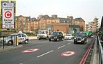
98 KB (10,362 words) - 01:44, 9 June 2024

east of the junction with Mansell Street. In a complex reworking of the roads since the days of the Aldgate gyratory system, it is two-way, but the east-bound...
21 KB (2,166 words) - 21:48, 20 May 2024

"CLASSIFICATION: Re-numbering of classified routes". The National Archives. 1933–1942. Fort 2012, p. 34. Ten Mile Road Map of Great Britain (Map). Ordnance...
51 KB (4,594 words) - 18:40, 5 June 2024

improvements to the road, including a bypass of Selkirk. Note: Junctions are listed northbound from Carlisle to Edinburgh. British road numbering scheme "Bar Solo...
12 KB (570 words) - 04:27, 1 February 2024