
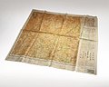
The Army Map Service (AMS) was the military cartographic agency of the United States Department of Defense from 1941 to 1968, subordinated to the United...
16 KB (2,092 words) - 19:47, 6 June 2025

discussion that captured Japanese maps had been deliberately falsified to confuse the Allied troops. The Army Map Service put out an announcement toward...
25 KB (3,631 words) - 08:28, 7 February 2025

bear. U.S.Army Map Service (LU), Corps of Engineers "8661"(feet) toposheet "Dindigul, NC 43-8, Series U502" prepared by the Army Map Service (LU), Corps...
3 KB (289 words) - 05:56, 24 March 2025

National Geospatial-Intelligence Agency (redirect from US Army Topographic Command)
1942, by General Order 22, OCE, June 19, 1942. The Army Map Service also combined many of the Army's remaining geographic intelligence organizations and...
52 KB (4,448 words) - 05:29, 19 May 2025

Geography of Arunachal Pradesh (category Articles containing OSM location maps)
2021 U.S. Army Map Service (1955), NG 47-1 Putao. Tile of the Map Burma 1:250,000. Series U542, retrieved 5 July 2021 U.S. Army Map Service (1955), NG...
46 KB (2,750 words) - 00:16, 27 May 2025
by the draft so he instead joined the Army Map Service Corps of Engineers as a civilian producing improved maps for the war effort. He continued this...
9 KB (1,165 words) - 21:10, 27 October 2024

(Map). 1:250,000. India and Pakistan 1:250,000. Army Map Service, Corps of Engineers, U.S. Army. 1955. Sheet NI 44-5. Retrieved 28 May 2025. Leh (Map)...
31 KB (2,543 words) - 14:34, 17 June 2025

Chinese postal romanization (redirect from Postal map spelling)
map. "China, administrative divisions," United States. Central Intelligence Agency, 1969. "China 1:250,000," 1954, Series L500, U.S. Army Map Service...
22 KB (2,237 words) - 11:07, 4 June 2025
began to produce its own escape maps." Most of the American maps supplied by the Army Map Service from World War II were actually printed on rayon acetate...
16 KB (2,197 words) - 18:03, 20 March 2025

States Army Air Service (USAAS) (also known as the "Air Service", "U.S. Air Service" and before its legislative establishment in 1920, the "Air Service, United...
108 KB (14,244 words) - 10:34, 3 June 2025

Ahmadnagar, India, Sheet NE 43-02 (topographic map, scale 1:250,000), Series U-502, United States Army Map Service, February 1962 The mouth of the Aria River...
18 KB (1,966 words) - 11:25, 11 June 2025

Retrieved 2023-07-09. Prentice-Hall, Inc., American World Atlas 1985 Army Map Service 1967 GEOnet Names Server Wikimedia Commons has media related to Rivers...
3 KB (292 words) - 10:11, 25 October 2024

United States. Army Map Service. Washington: Corps of Engineers, U.S. Army, Army Map Service, 1964. Series: United States.; Army Map Service.; Technical...
23 KB (2,916 words) - 05:44, 18 February 2025
Charles H. Ruth (category United States Army officers)
father of the Army Map Service. Ruth was first commanding officer of the Army Engineer Reproduction Plant (ERP). Prior to 1917 the Army Corps of Engineers...
2 KB (215 words) - 22:27, 2 March 2024

Reischauer. According to Reischauer, McCune "persuaded the American Army Map Service to adopt [the McCune–Reischauer system], and through the Korean War...
33 KB (2,908 words) - 11:36, 11 June 2025
Agricultural Marketing Service, US Army Map Service, US, later National Geospatial-Intelligence Agency Army Medical Services, UK Alma Mater Society of...
3 KB (355 words) - 04:54, 31 December 2024
Army Map Service's facilities adjacent to the Dalecarlia Reservoir. The facility served as headquarters of a succession of agencies: Army Map Service...
10 KB (933 words) - 00:14, 29 August 2024

States Army on June 14, 1775, the oldest of the six branches of the United States Armed Forces. The parade celebrated veterans and active-duty service members...
51 KB (4,760 words) - 23:02, 18 June 2025
MacArthur Highway (category Infobox road maps tracking category)
Manila (Map). 1:250,000. Washington D.C.: Army Map Service, Corps of Engineers. 1954. Retrieved November 20, 2021. 1944 Army Map Service Road Map of Northern...
22 KB (1,418 words) - 07:22, 12 February 2025

Philippines (Map). 1:1000000. Washington D.C.: Army Maps Service, Corps of Engineers. 1944. Retrieved September 23, 2021. 1944 Army Map Service Road Map of the...
42 KB (3,246 words) - 10:48, 25 May 2025
to rapidly mass-produce raised-relief maps. The Vacuum Forming technique, invented in 1947 by the Army Map Service in Washington, D.C., uses vacuum-formed...
13 KB (1,663 words) - 21:06, 4 April 2025

298 Johannesburg Sheet 34, Edition 5, TPC, 1970, Series 2201, U.S. Army Map Service "Profile. Okavango" (PDF). UN. Hogan, C. Michael (2008) "Makgadikgadi"...
6 KB (499 words) - 22:31, 10 November 2024

its location see Belgaum (topographic map, 1:250,000), series U502, sheet ND 43-02, United States Army Map Service, May 1960 Bommanalli, Haliyal Taluka...
11 KB (960 words) - 12:59, 11 June 2025

The Distinguished Service Cross (DSC) is the United States Army's second highest military decoration for soldiers who display extraordinary heroism in...
65 KB (6,329 words) - 11:50, 17 June 2025

Frank Kameny (category United States Army personnel of World War II)
Kameny was dismissed from his position as an astronomer in the U.S. Army's Army Map Service in Washington, D.C., because of his homosexuality, leading him...
58 KB (5,976 words) - 04:53, 13 June 2025
Pali, India, Sheet NG 43-09 (topographic map, scale 1:250,000), Series U-502, United States Army Map Service, November 1959 "About City". www.gsmmttcollege...
7 KB (608 words) - 23:28, 2 June 2025

August 16, 2021. 1944 Army Map Service Road Map of Northern Luzon, Philippines (Map). 1:500000. Washington D.C.: Army Map Service. 1944. Retrieved August...
12 KB (867 words) - 20:39, 25 May 2025

produced musket in the armies of the Kingdom of Morocco, the Deylik of Algiers and the Beylik of Tunis. Service, United States Army Map (1942). Glossary of...
5 KB (575 words) - 08:59, 15 June 2025

Tigers Perry–Castañeda Library Map Collection, China 1:250,000, Series L500, U.S. Army Map Service, 1954– . Topographic Maps of China during the Second World...
192 KB (22,845 words) - 20:43, 17 June 2025

NF 46-3" U.S. Army Map Service, March 1960; and "1:250,000 topographic map, Series U542, Gangaw, Burma, NF 46-7" U.S. Army Map Service, April 1958 Ireland...
4 KB (416 words) - 17:38, 6 March 2025