The Canada Geographic Information System (CGIS) was an early geographic information system (GIS) developed for the Government of Canada beginning in the...
5 KB (580 words) - 01:26, 6 September 2024

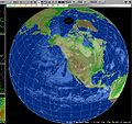
A geographic information system (GIS) consists of integrated computer hardware and software that store, manage, analyze, edit, output, and visualize geographic...
103 KB (13,339 words) - 19:11, 26 June 2025
A historical geographic information system (also written as historical GIS or HGIS) is a geographic information system that may display, store and analyze...
5 KB (684 words) - 12:44, 12 June 2025
support the use of a geographic information system, providing the ability to create, store, manage, query, analyze, and visualize geographic data, that is,...
26 KB (2,782 words) - 17:47, 8 April 2025
China portal Geography portal Canada Geographic Information System China Historical Geographic Information System Geographic information system Geoinformatics...
9 KB (994 words) - 14:49, 2 May 2025
The Geographic Names Information System (GNIS) is a database of name and location information about more than two million physical and cultural features...
31 KB (3,688 words) - 04:11, 10 June 2025
Address geocoding (redirect from Geographic coding)
early 1960s. In 1960, the first operational GIS – named the Canada Geographic Information System (CGIS) – was invented by Dr. Roger Tomlinson, who has since...
29 KB (3,771 words) - 10:07, 24 May 2025
applications in cartography, surveying, navigation and geographic information systems. In geodesy, geographic coordinate conversion is defined as translation...
34 KB (5,207 words) - 08:18, 10 August 2024
In geography and particularly in geographic information science, a geographic feature or simply feature (also called an object or entity) is a representation...
20 KB (2,354 words) - 14:36, 30 April 2025
Volunteered geographic information (VGI) is the harnessing of tools to create, assemble, and disseminate geographic data provided voluntarily by individuals...
11 KB (1,241 words) - 19:35, 12 September 2024
early adoption of the world's first geographic information system (GIS), called the Canada Geographic Information System (CGIS). Since 1995, the CLI agriculture...
3 KB (312 words) - 14:25, 20 November 2023
GIS Day (category Geographic information systems)
that are making a difference in society. Originally the Canada Geographic Information System developed in the 1960s by Roger Tomlinson, it is now used...
3 KB (257 words) - 19:27, 21 November 2024
BC Geographical Names (formerly BC Geographical Names Information System or BCGNIS) is a geographic name web service and database for the Canadian province...
1 KB (106 words) - 08:17, 30 December 2024
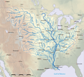
List of longest rivers of the United States (category Geographic coordinate lists)
coordinates are from the Geographic Names Information System (United States Geological Survey) or the Canadian Geographical Names Data Base except for...
60 KB (3,200 words) - 06:43, 30 April 2025
information on Canada's health systems and the health of Canadians. CIHI provides comparable and actionable data and information that are used to accelerate...
26 KB (2,683 words) - 17:23, 12 March 2025
Geospatial metadata (redirect from Geographic metadata)
(also geographic metadata) is a type of metadata applicable to geographic data and information. Such objects may be stored in a geographic information system...
17 KB (2,003 words) - 07:56, 12 March 2025
distinguish geographic feature of the area in its name. Federal Information Processing Standard GeoBase Geographic Names Information System GPS·C Canadian Geographical...
5 KB (522 words) - 02:17, 18 February 2025

In the context of spatial analysis, geographic information systems, and geographic information science, a field is a property that fills space, and varies...
17 KB (1,998 words) - 18:22, 21 December 2024

Geomatics (redirect from Spatial information science)
distribution, storage, analysis, processing, presentation of geographic data or geographic information". Under another definition, it consists of products, services...
17 KB (1,712 words) - 19:18, 14 April 2025
for encoding geographical information into a computer file. It is a specialized type of file format for use in geographic information systems (GIS), remote...
23 KB (2,996 words) - 09:53, 2 April 2025
Roger Tomlinson (category Geographic information scientists)
February 2014) was an English-Canadian geographer and the primary originator of modern geographic information systems (GIS), and has been acknowledged...
10 KB (869 words) - 06:30, 4 June 2025
Reverse 911 (category Emergency population warning systems)
safety organizations in Canada and the United States to communicate with groups of people in a defined geographic area. The system uses a database of telephone...
8 KB (669 words) - 23:35, 1 May 2025

The Atlas of Canada. Natural Resources Canada. {{cite web}}: Missing or empty |url= (help) "Milk River". Geographic Names Information System. United States...
63 KB (2,899 words) - 22:40, 3 June 2024

429. ISBN 978-1-317-48718-0. Canadian Geographic. Royal Canadian Geographical Society. 2008. p. 20. "Where is Canada in the World?". World Population...
277 KB (23,770 words) - 21:36, 27 June 2025
and Regional Information Systems Association (URISA)) is a non-profit association of professionals using geographic information systems (GIS) and other...
11 KB (874 words) - 19:30, 24 June 2025
List of mountain ranges in Washington (category Geographic coordinate lists)
Range". Geographic Names Information System. United States Geological Survey, United States Department of the Interior. "Beezley Hills". Geographic Names...
17 KB (1,126 words) - 18:46, 5 May 2025
Tomlinson leads development of the Canada Geographic Information System, the world's first geographic information system (GIS). Simula I, the first object-oriented...
17 KB (1,761 words) - 18:42, 26 May 2025
Vector overlay (category Geographic information systems)
Vector overlay is an operation (or class of operations) in a geographic information system (GIS) for integrating two or more vector spatial data sets....
20 KB (2,659 words) - 02:58, 9 October 2024

Ocean Biodiversity Information System (OBIS), formerly Ocean Biogeographic Information System, is a web-based access point to information about the distribution...
17 KB (1,937 words) - 15:09, 28 February 2025

"Canada: Geographic variations in health care". Geographic Variations in Health Care: What do We Know and What Can be Done to Improve Health System Performance...
231 KB (25,577 words) - 21:26, 23 June 2025