The Global Sea Level Observing System (GLOSS) is an Intergovernmental Oceanographic Commission (IOC) program whose purpose is to measure sea level globally...
3 KB (392 words) - 00:25, 18 January 2024

Automated airport weather station (redirect from Automated Weather Observing System)
automated weather observing system (AWOS) and the automated surface observing system (ASOS). The automated weather observing system (AWOS) units are mostly...
30 KB (3,569 words) - 14:21, 15 July 2025

around the world. Oceans portal Tsunamis portal Global Sea Level Observing System Tsunami warning system Tsunami NOAA Center for Tsunami Research SMART...
14 KB (1,825 words) - 07:46, 30 June 2025
(RAWS) Automated Surface Observing System (ASOS) NEXRAD radar Global Sea Level Observing System SST buoys Hurricane Hunters Dropsonde SNOTEL Weather balloon...
4 KB (260 words) - 19:17, 7 April 2025

data for tropical cyclones over the South China Sea. In September 2016 they introduced the dropsonde system, which collects extra meteorological data on...
25 KB (2,532 words) - 17:42, 21 July 2025

atmosphere above, such as in the formation of sea breezes and sea fog. It is very likely that global mean sea surface temperature increased by 0.88 °C between...
43 KB (4,825 words) - 22:31, 18 July 2025

ACARS (redirect from Aircraft Communication Addressing and Reporting System)
Hawaii in the aircraft lanes. In 2002, ACARS was added to the NOAA Observing System Architecture. Thus commercial aircraft can act as weather data providers...
16 KB (1,851 words) - 18:01, 25 July 2025
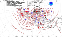
ground level over land and from weather buoys at sea. The World Meteorological Organization acts to standardize the instrumentation, observing practices...
76 KB (7,769 words) - 08:30, 5 August 2025

planes. Atmospheric science Radiosonde "NCAR and Dropsonde History". Earth Observing Laboratory. 25 March 2019. Archived from the original on 20 March 2019...
8 KB (861 words) - 19:04, 7 October 2024

Cooperative Observer Program Significant Weather Observing Program (SWOP) Skywarn Safecast Citizens Weather Observing Program. Hourly Number of WX Stations sending...
5 KB (534 words) - 10:52, 20 August 2024

the purpose of the system. The system may report in near real time via the Argos System, LoRa and the Global Telecommunications System, or save the data...
9 KB (1,050 words) - 14:20, 15 July 2025

The Remote Automatic Weather Stations (RAWS) system is a network of automated weather stations run by the U.S. Forest Service (USFS) and Bureau of Land...
4 KB (376 words) - 14:24, 15 July 2025
time the PIREP was received from the pilot (UTC) /FL flight level or altitude above sea level at the time the PIREP is filed; it is essential for turbulence...
11 KB (1,488 words) - 15:51, 16 July 2025

possible location for a monitoring station as part of the Global Sea Level Observing System (GLOSS) survey. The scientists, unaware of the location of...
15 KB (1,397 words) - 19:08, 8 June 2025

Sea Level Rise Key Message (US government agencies) Fifth National Climate Assessment (2023) Coastal Effects Chapter The Global Sea Level Observing System...
214 KB (22,607 words) - 04:30, 9 July 2025
monitoring pollution out at sea. At the same time, the transmission of the weather data using Morse code was replaced by a system using telex-over-radio....
31 KB (3,627 words) - 18:22, 4 April 2025

NEXRAD (redirect from Supplemental Adaptive Intra-Volume Low-Level Scan)
Canadian weather radar network Australian Weather Radars Low level windshear alert system (LLWAS) Terminal Doppler Weather Radar (TDWR) High Resolution...
89 KB (4,948 words) - 01:36, 5 August 2025

A low-level windshear alert system (LLWAS) measures average surface wind speed and direction using a network of remote sensor stations, situated near runways...
7 KB (990 words) - 01:29, 23 December 2024
writer Dillon v. Gloss, a 1921 U.S. constitutional court case Global Sea Level Observing System, an Intergovernmental Oceanographic Commission program G.L...
1 KB (207 words) - 04:11, 22 April 2022
TAMDAR (section System capabilities)
Meteorological Data Reporting (TAMDAR) system based on requirements provided by the Global Systems Division (GSD) of NOAA's Earth System Research Laboratories (ESRL)...
13 KB (1,677 words) - 16:13, 17 July 2025
David Thomas Pugh (redirect from Tides, surges, and mean sea-level)
was a British marine scientist and academic. He founded the Global Sea Level Observing System, was President of the Intergovernmental Oceanographic Commission...
9 KB (698 words) - 19:37, 9 June 2025

io's Historic Satellite Launch Paves Way for Groundbreaking Advancement in Global Weather Forecasting". Tomorrow.io. 14 May 2023. Olick, Diana (16 May 2023)...
106 KB (12,857 words) - 02:51, 9 July 2025
contributing to the World Meteorological Organization, the Global Sea-level Observing System, the International Seismological Center, and the Intermagnet...
9 KB (487 words) - 19:21, 5 August 2025

Physical oceanography (section Sea level change)
dynamics Global Sea Level Observing System Global warming Hydrothermal circulation List of ocean circulation models List of Oceanic Landforms Marginal sea Mediterranean...
36 KB (4,538 words) - 09:53, 12 May 2025
Tsunamis (DART) FluxNet Project (FluxNet) Global Atmosphere Watch (GAW) Global Sea Level Observing System (GLOSS) Prediction and Research Moored Array...
10 KB (1,223 words) - 09:05, 19 July 2025

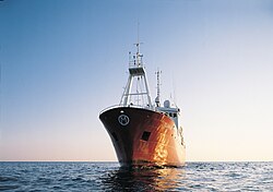
weather buoy in the Southern Ocean was deployed by the Integrated Marine Observing System (IMOS) on March 17, 2010. Weather buoys, like other types of weather...
19 KB (2,129 words) - 05:04, 30 May 2025

radar, radio direction finding, or navigation systems (such as the satellite-based Global Positioning System, GPS). Balloons meant to stay at a constant...
13 KB (1,314 words) - 16:16, 5 August 2025
Global Biodiversity Information Facility GCOS: Global Climate Observing System GSDI: Global Spatial Data Infrastructure GOOS: Global Ocean Observing System...
20 KB (1,984 words) - 01:00, 6 July 2025
were also responsible for monitoring ozone, establishing the Global Ozone Observing System (GO3OS) in 1957, in the International Geophysical Year. In 1968...
10 KB (1,038 words) - 17:46, 5 October 2024
EOSDIS (redirect from Earth Observing System Data and Information System)
The Earth Observing System Data and Information System (EOSDIS) is a core capability in NASA's Earth Science Data Systems Program. Designed and maintained...
14 KB (1,469 words) - 08:45, 31 July 2025