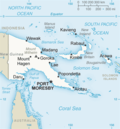
The Hydrographers Range is a forested mountain range in the Oro Province of southeastern Papua New Guinea. It extends from the eastern margin of Mount...
2 KB (135 words) - 07:08, 2 February 2025
Hydrographers can refer to: Hydrographers Cove Hydrographers Passage Hydrographers Range This disambiguation page lists articles about distinct geographical...
323 bytes (44 words) - 20:34, 17 August 2024

Lamington is situated within the Hydrographers Range; a small, forested coastal mountain range. The mountain range is the remnant of a heavily eroded...
31 KB (4,002 words) - 14:43, 14 June 2025
beacon by ships, due to the red crater glow. It last erupted in 1935. Hydrographers Range, Mount Lamington, and Mount Trafalgar are three other large Quaternary...
3 KB (369 words) - 01:49, 3 May 2025

inhabited was marked by the Owen Stanley Range in the south, German New Guinea in the west, and the Hydrographers Range in the south. The people of Orokaiva...
3 KB (341 words) - 20:11, 26 April 2025
Peninsula"): 25 : 4 in the east contains Mount Lamington volcano and the Hydrographers Range on its northern side. Further east, the area around Cape Nelson has...
159 KB (15,851 words) - 13:55, 19 June 2025
Hagen) ~ 210,000 years ago Hydrographers Range 1915 6283 9°00′S 148°22′E / 9.00°S 148.37°E / -9.00; 148.37 (Hydrographers Range) - Koranga 1500 4921 7°19′48″S...
10 KB (69 words) - 00:11, 27 May 2025
stratovolcano famous for the 1951 eruption which killed 3,000 people. Hydrographers Range Victory Mount Trafalgar Vokeo Island Koil Island Blup Blup Bam Island...
33 KB (2,769 words) - 07:30, 20 May 2025
Moresby named the mountain after the naval battle of Trafalgar. Hydrographers Range, Mount Lamington, and Mount Victory are three other large Quaternary...
2 KB (113 words) - 13:32, 20 July 2024
Peninsula"): 25 : 4 in the east contains Mount Lamington volcano and the Hydrographers Range on its northern side. Further east, the area around Cape Nelson has...
61 KB (5,531 words) - 08:34, 19 June 2025

620 kW. Complement : 4 officers, 18 petty officers, 15 crew members, 11 hydrographers. Armament: Two AANF1 7.5 mm machine guns and two Browning M2 12.7 mm...
5 KB (437 words) - 07:12, 17 January 2025
The Betekhtin Range (71°54′S 11°32′E / 71.900°S 11.533°E / -71.900; 11.533 (Betekhtin Range)) is a mountain range about 14 nautical miles (26 km;...
5 KB (805 words) - 23:08, 11 July 2024

Beaufort wind force scale. It was devised in 1805 by Francis Beaufort a hydrographer in the Royal Navy. It was officially adopted by the Royal Navy and later...
24 KB (1,812 words) - 01:59, 12 June 2025
the coast (East) to the peaks of the Owen Stanley Range (West), the peak of the Hydrographers Range and edge of Mount Lamington (North) and the Sibium...
4 KB (402 words) - 06:53, 11 March 2025

Hydrography (redirect from Hydrographer)
water municipalities and other users of captured water. River/stream hydrographers use handheld and bank mounted devices, to capture a sectional flow rate...
14 KB (1,614 words) - 06:35, 14 April 2025

range is named for Sir Francis Beaufort, hydrographer to the Royal Navy.: 16 List of mountain ranges Beaufort Range in the Canadian Mountain Encyclopedia...
2 KB (147 words) - 16:05, 5 December 2024

Alexander Dalrymple (category Hydrographers of the Royal Navy)
Alexander Dalrymple (24 July 1737 – 19 June 1808) was a Scottish geographer, hydrographer, and publisher. He spent the greater part of his career with the British...
55 KB (6,847 words) - 15:43, 8 June 2025

Weyland Mountains (redirect from Weyland Range)
Weyland Mountains are the westernmost mountains in New Guinea's Central Range, which extends eastwards to the island's southeastern tip. Rising up to...
6 KB (250 words) - 18:08, 16 June 2025
with the Hydrographers of France and Spain, using HMS Chanticleer. In 1829, at the age of 55, Rear-Admiral Sir Francis Beaufort became Hydrographer. During...
21 KB (2,086 words) - 14:28, 16 June 2025

Francis Beaufort (category Hydrographers of the Royal Navy)
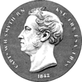
MRIA (/ˈboʊfərt/ BOH-fərt; 27 May 1774 – 17 December 1857) was an Irish hydrographer and naval officer who created the Beaufort cipher and the Beaufort scale...
22 KB (2,396 words) - 06:28, 25 May 2025
The Douglas Range (70°0′S 69°35′W / 70.000°S 69.583°W / -70.000; -69.583) is a sharp-crested range, with peaks rising to 3,000 metres, extending 120 km...
6 KB (545 words) - 16:05, 11 February 2025

Survey Corps ensign on board the survey ship USC&GS Hydrographer inserted a radio acoustic ranging bomb in the mouth of a shark and released the shark...
25 KB (3,100 words) - 19:41, 20 October 2024
Hydrographic Organization as an annual celebration to publicise the work of hydrographers and the importance of hydrography. The International Hydrographic Bureau...
5 KB (585 words) - 18:12, 26 May 2025
January 1788 – 8 September 1865) was an English Royal Navy officer, hydrographer, astronomer and numismatist. He is noted for his involvement in the early...
28 KB (3,263 words) - 23:59, 4 June 2025

George Henry Richards (category English hydrographers)
Britannia Range, and Brunswick Mountain and many features in the Howe Sound, Sunshine Coast, and Jervis Inlet areas. In 1863 he was appointed Hydrographer to...
6 KB (609 words) - 11:49, 23 October 2024
Bond. In 1982, Bond and Flinders discovered, surveyed and charted the Hydrographers Passage, providing a faster, more efficient route through the Great...
8 KB (721 words) - 23:05, 6 May 2023

Sarychev Range, Sarichef Strait and Sarichef Island in Alaska were named by explorer Lt. Otto von Kotzebue after Gavril Sarychev, who was the Hydrographer General...
5 KB (563 words) - 22:05, 3 November 2024

Georg von Schleinitz (category Hydrographers)
administrator, and hydrographer who served as the colonial governor of German New Guinea from 1886 to 1888. He is the namesake of the Schleinitz Range of Papua...
6 KB (531 words) - 21:06, 3 June 2025

propellers Range 6,000 nmi (11,000 km) at 12 kn (14 mph; 22 km/h) Complement 3 officers 10 non-commissioned officers 18 enlisted personnel 11 hydrographers Armament...
4 KB (228 words) - 07:05, 2 July 2021

in 1819. Later, the whole group was named Ellice Islands by English hydrographer Alexander George Findlay. In the late 19th century, Great Britain claimed...
251 KB (23,981 words) - 12:12, 15 June 2025