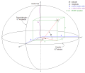
The International Terrestrial Reference System (ITRS) describes procedures for creating reference frames suitable for use with measurements on or near...
9 KB (783 words) - 11:33, 25 February 2025
to be consistent with the International Terrestrial Reference Frame (ITRF2008) and earth orientation parameters (EOP) systems. ICRF3 is the third major...
22 KB (2,360 words) - 11:38, 9 February 2025
Geodetic datum (redirect from Terrestrial reference frame)
or geodetic system (also: geodetic reference datum, geodetic reference system, or geodetic reference frame, or terrestrial reference frame) is a global...
32 KB (3,377 words) - 03:19, 15 May 2025
global time and reference frame standards, notably through its Earth Orientation Parameter (EOP) and International Celestial Reference System (ICRS) groups...
7 KB (579 words) - 16:58, 29 March 2025
The European Terrestrial Reference System 1989 (ETRS89) is an ECEF (Earth-Centered, Earth-Fixed) geodetic Cartesian reference frame, in which the Eurasian...
6 KB (615 words) - 22:40, 28 February 2025
(ECI) Geodetic system International Terrestrial Reference System and Frame (ITRS) Orbital state vectors Planetary coordinate system Leick, Alfred (2004)...
9 KB (912 words) - 16:39, 14 December 2024
for the Global Positioning System, and the several realizations of the International Terrestrial Reference System and Frame (such as ITRF2020 with subcentimeter...
23 KB (2,540 words) - 22:18, 14 May 2025
coordinate systems. The goal of any spatial reference system is to create a common reference frame in which locations can be measured precisely and consistently...
15 KB (1,570 words) - 12:19, 7 May 2025
Pacific Terrestrial Reference Frame of 2022 (PTRF2022) Caribbean Terrestrial Reference Frame of 2022 (CTRF2022) Mariana Terrestrial Reference Frame of 2022...
6 KB (574 words) - 21:36, 8 February 2025
versions, the ideal International Terrestrial Reference System (ITRS) and its realization, the International Terrestrial Reference Frame (ITRF). The most...
14 KB (826 words) - 18:09, 29 April 2025
In physics and astronomy, a frame of reference (or reference frame) is an abstract coordinate system, whose origin, orientation, and scale have been specified...
30 KB (3,465 words) - 19:51, 19 October 2024
1984 Datum and is based on lines of longitude (LONG) and latitude (LAT). It is intended to provide an integrated common frame of reference for joint force...
3 KB (470 words) - 12:54, 13 December 2022
of the World Geodetic System 1984 (WGS 84) Terrestrial Reference Frame" (PDF). Retrieved 15 January 2023. "World Geodetic System 1984 ensemble". EPSG Geodetic...
24 KB (2,842 words) - 03:41, 26 April 2025
Galileo (satellite navigation) (redirect from Galileo satellite navigation system)
signals and modernized GPS signals International Terrestrial Reference System and Frame – the coordinate system used by Galileo Orbital periods and speeds...
104 KB (10,186 words) - 08:22, 4 June 2025
EPSG Geodetic Parameter Dataset (category Geographic coordinate systems)
including Google Maps and OpenStreetMap. EPSG:9989 - International Terrestrial Reference Frame 2020 (ITRF2020) for 3D coordinates (latitude, longitude...
5 KB (444 words) - 20:42, 28 January 2025
GLONASS (redirect from GLObal NAvigation Satellite System)
PZ-90.11 is being broadcast, which is aligned to the International Terrestrial Reference System and Frame 2008 at epoch 2011.0 at the centimetre level, but...
72 KB (6,243 words) - 04:16, 16 May 2025
Mazurova; S.M. Kopeikin; A.P. Karpik (2017). "Development of a terrestrial reference frame in the Russian Federation". Studia Geophysica et Geodaetica....
2 KB (168 words) - 04:39, 21 December 2024
television sets and set top boxes, as a form of "International Cooperation". Previously known as DMB-T/H (Digital Multimedia Broadcast-Terrestrial/Handheld)...
14 KB (1,235 words) - 17:44, 3 June 2025
television systems (or terrestrial television systems outside the US and Canada) are the encoding or formatting systems for the transmission and reception...
47 KB (5,138 words) - 17:13, 26 April 2025
increase northward from and eastward around the fundamental plane. This description of the orientation of the reference frame is somewhat simplified;...
17 KB (1,657 words) - 07:37, 20 March 2025
GPS, but it still contributes to the International Terrestrial Reference Frame (ITRF). Argos (satellite system) Australia, c\=AU\;o\=Australia...
4 KB (411 words) - 06:42, 8 August 2023
Geodesy (redirect from Geodetic and Geomatic Engineering)
geocentric coordinate frame. One such frame is WGS84, as well as frames by the International Earth Rotation and Reference Systems Service (IERS). GNSS...
38 KB (4,261 words) - 06:28, 6 May 2025
the sensor frame with respect to the inertial reference frame. By using the original orientation of the system in the inertial reference frame as the initial...
47 KB (5,954 words) - 00:31, 11 June 2025
Etalon-1 and Etalon-2 are geodetic satellites. They are designed to determine, with high accuracy, terrestrial reference frame and Earth rotation parameters...
2 KB (75 words) - 23:40, 5 October 2023
coordinate systems are used for specifying positions of celestial objects (satellites, planets, stars, galaxies, etc.) relative to a given reference frame, based...
29 KB (3,971 words) - 18:25, 17 April 2025
terrestrial planets (Mercury, Venus, Earth and Mars); two gas giants (Jupiter and Saturn); and two ice giants (Uranus and Neptune). All terrestrial planets...
224 KB (21,988 words) - 14:05, 14 June 2025
Regional Reference Frame Sub-Commission for Europe (EUREF) is the sub-commission of the International Association of Geodesy (IAG), part of the Sub-Commission...
6 KB (566 words) - 18:16, 9 September 2024
Very-long-baseline interferometry (redirect from International VLBI Service for Geodesy and Astrometry)
and local uplift or subsidence. Earth's orientation parameters and fluctuations in the length of day. Maintenance of the terrestrial reference frame....
21 KB (2,440 words) - 23:27, 1 March 2025
on European digital terrestrial TV. However, Angola reviewed the adoption to ISDB-T International system in March 2019. Brazil and Japan are presenting...
71 KB (7,148 words) - 15:51, 29 March 2025
definition of the international terrestrial reference frames by providing the information about the scale and the origin of the reference frame, the so-called...
21 KB (2,338 words) - 10:15, 25 November 2024


