
Kentucky Route 189 (KY 189) is a 32.027-mile-long (51.542 km) state highway in Kentucky that runs from Kentucky Route 507 and Flat Rock Road west of Allegre...
7 KB (341 words) - 17:49, 16 February 2024

highway that runs from Kentucky Route 32 just east of Elliottville to Kentucky Route 7 at Green via Ault and Gimlet. Kentucky Route 505 (KY 505) is a 18...
113 KB (5,096 words) - 23:22, 14 May 2024

KML file (edit • help) Template:Attached KML/Kentucky Route 13 KML is not from Wikidata Kentucky Route 13 is a 5.516-mile-long (8.877 km) rural secondary...
107 KB (11,131 words) - 17:26, 1 May 2024

Bus.) and US 431 Bus. in Dothan, Alabama, to Owensboro, Kentucky, at US 60 and Kentucky Route 2831. The major cities US 431 connects to (from south to...
18 KB (2,056 words) - 14:16, 18 February 2024
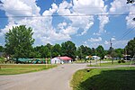
situated along U.S. Route 62 between Central City to the northeast and Greenville to the southwest. Kentucky Route 189 serves as a bypass route around Powderly...
9 KB (791 words) - 03:36, 18 July 2023

Route 62 (US 62) in Kentucky runs for a total of 391.207 miles (629.587 km) across 20 counties in western, north-central, and northeastern Kentucky....
53 KB (1,265 words) - 01:09, 13 May 2024

62 just north of KY 189. From here, the highway heads north along a frontage road to the ending of state maintenance. Kentucky Route 6116 (KY 6116) is a...
58 KB (4,880 words) - 00:24, 14 May 2024

miles (11 km) to Central and west 17 miles (27 km) to Nortonville. Kentucky Route 189 passes through the northern part of Greenville and bypasses the downtown...
16 KB (1,454 words) - 07:10, 14 February 2024

have portions within the State Primary and State Secondary systems. Kentucky Route 800 is a 18.919-mile-long (30.447 km) rural secondary and state supplemental...
19 KB (1,904 words) - 09:41, 22 September 2023
Connecticut Route 189 Florida State Road 189 Georgia State Route 189 K-189 (Kansas highway) Kentucky Route 189 Maine State Route 189 Maryland Route 189 Massachusetts...
2 KB (151 words) - 23:29, 4 April 2024

travels east until the end of state maintenance. Kentucky Route 1583 (KY 1583) was a 1.360-mile (2.189 km) state highway in Ohio County. It followed Horse...
53 KB (5,054 words) - 21:54, 20 January 2024

U.S. Route 31E (US 31E) is the eastern parallel route for U.S. Highway 31 from Nashville, Tennessee, to Louisville, Kentucky. US 31E begins as the Ellington...
33 KB (1,342 words) - 01:29, 5 December 2023

Kentucky Route 15 begins at a junction of US 119/Corridor F & Business KY 15 in Whitesburg, and terminates in Winchester at US 60. It is a major route...
20 KB (556 words) - 23:56, 8 April 2023
Muhlenberg County High School (category Schools in Muhlenberg County, Kentucky)
school located in Greenville, Kentucky, United States. The high school is located at 501 Robert Draper Way (Kentucky Route 189) in Greenville. The school...
2 KB (105 words) - 01:16, 28 April 2024

Kentucky Route 1031 (KY 1031) is a 3.203-mile-long (5.155 km) state highway in Muhlenberg County, Kentucky. It runs from U.S. Route 62, U.S. Route 431...
4 KB (269 words) - 17:54, 16 February 2024

Kentucky Route 80 (KY 80) is a 483.55-mile-long (778.20 km) state highway in the southern part of the U.S. state of Kentucky. The route originates on...
64 KB (1,742 words) - 21:16, 14 May 2024

U.S. Route 60 (US 60) is a major U.S. Highway in the American state of Kentucky. In the early days of the U.S. Highway System, US 60 was originally to...
75 KB (1,848 words) - 23:01, 8 March 2024

in Kentucky to Interstate 64 at Charleston, West Virginia. In Kentucky, US 119 is a two- and four-lane highway running from Pineville at U.S. Route 25E...
55 KB (2,222 words) - 16:55, 3 June 2024

Kentucky (US: /kənˈtʌki/ kən-TUK-ee, UK: /kɛn-/ ken-), officially the Commonwealth of Kentucky, is a landlocked state in the Southeastern region of the...
212 KB (18,986 words) - 13:51, 4 June 2024

U.S. Route 42 (US 42) is an east–west United States highway that runs southwest–northeast for 350 miles (560 km) from Louisville, Kentucky to Cleveland...
48 KB (2,017 words) - 03:13, 2 April 2024

census-designated place and former city in Todd County, Kentucky, in the United States. The population was 189 at the 2000 census. Settled in the 19th century...
9 KB (881 words) - 06:29, 4 February 2024
U.S. Route 431 (US 431) in Kentucky runs 86.93 miles (139.90 km) from the Tennessee state line south of Adairville to US 60 at Owensboro. It crosses the...
16 KB (849 words) - 23:44, 1 June 2024
Kentucky are maintained by the Kentucky Transportation Cabinet, which classifies routes as either primary or secondary. Some routes, such as Kentucky...
31 KB (125 words) - 16:22, 18 May 2024

791299; -89.011398. U.S. Route 51 and Kentucky Route 80 intersect in the city. US 51 leads north 6 miles (10 km) to Bardwell, Kentucky, and 21 miles (34 km)...
9 KB (743 words) - 19:28, 22 January 2024

U.S. Route 68 (US 68) is a United States highway that runs for 560 miles (900 km) from northwest Ohio to Western Kentucky. The highway's western terminus...
68 KB (1,546 words) - 05:30, 9 February 2024

Kentucky Route 70 (KY 70) is a long east-east state highway that originates at a junction with U.S. Route 60 (US 60) in Smithland in Livingston County...
58 KB (3,304 words) - 18:56, 22 May 2024

Interstate 71 (redirect from Interstate 71 (Kentucky))
course, with some east–west sections, and is mainly a regional route serving Kentucky and Ohio. It links I-80 and I-90 to I-70 and ultimately (via I-65)...
46 KB (1,983 words) - 21:21, 8 May 2024

Kentucky Route 144 (KY 144) is a 95.325-mile (153.411 km) state highway running northeast from KY 603 in Owensboro, Kentucky to US 31W in Radcliff near...
12 KB (132 words) - 17:48, 16 February 2024
List of highways numbered 1000–1499 (redirect from Route 1128)
listed below are all in the United States, primarily Louisiana, Texas, and Kentucky, though there are some roads in this range in Georgia and New Mexico. The...
55 KB (154 words) - 14:05, 5 April 2024

Kentucky Route 1682 (KY 1682) is an east–west state highway that traverses central and eastern Christian County in western Kentucky. It is 15.295 miles...
4 KB (199 words) - 17:51, 16 February 2024