The National Elevation Dataset (NED) consists of high precision topography or ground surface elevation data (digital elevation model) for the United States...
2 KB (227 words) - 01:30, 18 December 2023
also discusses how the USGS incorporates LIDAR data into the National Elevation Dataset. In addition to USGS and NASA, numerous government agencies have...
19 KB (395 words) - 10:02, 27 May 2025
Countries with national lidar datasets either completed or in progress include: Digital elevation model National Elevation Dataset Remote sensing Topography...
4 KB (97 words) - 16:43, 16 February 2025
Nipple (5226 ft [1593 m], Milford Flat quad, in Beaver county, National Elevation Dataset 38°22′30″N 113°04′27″W / 38.3749657°N 113.0741243°W / 38.3749657;...
8 KB (788 words) - 10:29, 5 January 2025
The National Hydrography Dataset (NHD) is a digital database of surface water features used to make maps. It contains features such as lakes, ponds, streams...
3 KB (394 words) - 18:03, 8 October 2024

Sharp 1997, p. 1 "USGS National Elevation Dataset (NED) 1 meter Downloadable Data Collection from The National Map 3D Elevation Program (3DEP)". United...
68 KB (7,069 words) - 22:49, 3 June 2025

2007. "USGS National Elevation Dataset (NED) 1 meter Downloadable Data Collection from The National Map 3D Elevation Program (3DEP) – National Geospatial...
50 KB (5,706 words) - 05:31, 3 June 2025
astronomical objects outside the Milky Way galaxy National Elevation Dataset, topographic data NED, National edeposit, an Australian online depository for...
2 KB (362 words) - 05:45, 3 May 2025

square kilometers), all of which is land. As per the USGS National Elevation Dataset, the elevation is 492 feet (150 m). Takotna first appeared on the 1930...
10 KB (693 words) - 22:08, 19 May 2025

NASA WorldWind (section Datasets available)
WorldWind uses digital elevation model (DEM) data collected by NASA's Shuttle Radar Topography Mission (SRTM), National Elevation Dataset (NED) and Advanced...
20 KB (2,027 words) - 15:04, 1 November 2024
Extremes on Earth (section Elevation)
September 2015). "New Elevation for Nation's Highest Peak" (Press release). USGS. Retrieved 26 September 2015. "USGS National Elevation Dataset (NED) 1 meter...
94 KB (9,185 words) - 11:13, 9 May 2025

the concentration drops within a few feet. Sidoarjo mud flow National Elevation Dataset via gpsvisualizer.com Reyes-Velarde, Alejandra; Lin II, Rong-Gong...
16 KB (1,749 words) - 10:53, 25 May 2025

grades than those listed in the Guinness Book. Drawing on the U.S. National Elevation Dataset, 7x7 (magazine) identified ten blocks of public streets in San...
30 KB (3,065 words) - 03:50, 6 May 2025

represent the surface (topography) of a place, through a raster (grid) dataset of elevations. Digital terrain models are another way to represent terrain in...
6 KB (561 words) - 17:58, 4 May 2025

Death Valley (category Death Valley National Park)
2020. "USGS National Elevation Dataset (NED) 1 meter Downloadable Data Collection from The National Map 3D Elevation Program (3DEP) – National Geospatial...
44 KB (4,062 words) - 09:37, 7 June 2025

(formerly TerraServer-USA) National Elevation Dataset This article incorporates public domain material from The National Map. United States Geological...
8 KB (719 words) - 00:44, 8 April 2025

complex "USGS National Elevation Dataset (NED) 1 meter Downloadable Data Collection from The National Map 3D Elevation Program (3DEP) – National Geospatial...
21 KB (2,290 words) - 22:24, 20 December 2024

sampled elevation datasets (by GPS or ground survey) are not DEMs, but may be considered digital terrain models. A DEM implies that elevation is available...
32 KB (3,352 words) - 06:36, 9 June 2025

2012. "USGS National Elevation Dataset (NED) 1 meter Downloadable Data Collection from The National Map 3D Elevation Program (3DEP) - National Geospatial...
45 KB (7,021 words) - 10:10, 4 June 2025

387 feet based on the National Elevation Dataset. Suffolk County, which owns the peak, calls it Jayne's Hill and lists its elevation on its website as 400...
7 KB (784 words) - 18:47, 1 April 2024
2010. "USGS National Elevation Dataset (NED) 1 meter Downloadable Data Collection from The National Map 3D Elevation Program (3DEP) - National Geospatial...
14 KB (2,158 words) - 06:03, 5 May 2025

park visitor center, traversing Pigeon Hill and both mountains. "National Elevation Dataset". United States Geological Survey. Retrieved August 8, 2014. "Little...
3 KB (196 words) - 06:03, 3 June 2025

Computerized methods for watershed delineation use digital elevation models (DEMs), datasets that represent the height of the Earth's land surface. Computerized...
30 KB (3,165 words) - 20:37, 22 May 2025

the original on December 26, 2014. Retrieved June 27, 2013. "National Elevation Dataset". U.S. Geological Survey. Retrieved June 27, 2013. U.S. Geological...
62 KB (5,861 words) - 01:11, 8 October 2024

Places of interest in the Death Valley area (category Wikipedia articles incorporating text from the National Park Service)
2012. "USGS National Elevation Dataset (NED) 1 meter Downloadable Data Collection from The National Map 3D Elevation Program (3DEP) - National Geospatial...
32 KB (4,106 words) - 10:44, 8 June 2025

Crampton's Gap (category Journey Through Hallowed Ground National Heritage Area)
1862, during the Maryland Campaign of the American Civil War. National Elevation Dataset GNIS Older, Curtis L., The Land Tracts of the Battlefield of South...
3 KB (138 words) - 18:15, 21 October 2023

following sortable table lists land surface elevation extremes by country or dependent territory. Topographic elevation is the vertical distance above the reference...
51 KB (2,165 words) - 18:03, 2 June 2025

Cuyahoga Valley Scenic Railroad (category Wikipedia articles incorporating text from the National Park Service)
^ A: Elevation or Altitude approximations obtained through Wiki ToolServer GeoHack link to United States Geological Survey National Elevation Dataset: Where...
32 KB (1,953 words) - 05:11, 3 June 2025
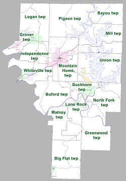
045 sq mi (2.71 km2) is water (3.88%). As per the USGS National Elevation Dataset, the elevation is 732 feet (223 m). "County Subdivisions (2010): Arkansas"...
7 KB (368 words) - 17:47, 22 April 2024

Shuttle Radar Topography Mission (category Digital elevation models)
from ASTER GDEM2, and secondarily from USGS GMTED2010 – or USGS National Elevation Dataset (NED) for the United States (except Alaska) and northernmost Mexico...
21 KB (2,113 words) - 11:06, 26 April 2025