OpenHistoricalMap (also spelled Open Historical Map and abbreviated OHM) is an online collaborative mapping project developing a historical map of the...
21 KB (1,984 words) - 18:47, 16 July 2025
software. OpenHistoricalMap is a world historical map that tracks the evolution of human geography over time, from prehistory to the present day. OpenGeofiction...
111 KB (10,665 words) - 04:45, 1 August 2025
OpenStreetMap OpenHistoricalMap UniProt PubChem DBLP OpenCitations IMDb Integrated Authority File YAGO DBpedia Wallscope Olympics database For OpenStreetMap...
5 KB (474 words) - 04:41, 2 August 2025
OpenWeatherMap is an online service, owned by OpenWeather Ltd, that provides global weather data via API, including current weather data, forecasts, nowcasts...
5 KB (460 words) - 00:21, 31 March 2025
Hack. Make.), a 2013 outdoor hacker conference OpenHistoricalMap, a collaboratively edited historical atlas of the world OHM (band), a rock/jazz fusion...
2 KB (326 words) - 19:14, 10 December 2023
Jerusalem, and the modern region. OpenHistoricalMap "Historical Atlas by William R. Shepherd - Perry-Castañeda Map Collection - UT Library Online". legacy...
5 KB (537 words) - 05:36, 25 May 2025
Google Maps is a web mapping platform and consumer application developed by Google. It offers satellite imagery, aerial photography, street maps, 360°...
164 KB (14,286 words) - 00:43, 17 July 2025
OpenDroneMap is an open source photogrammetry toolkit to process aerial imagery (usually from a drone) into maps and 3D models. The software is hosted...
5 KB (466 words) - 09:33, 4 June 2025
Open Food Facts gathers information and data on food products from around the world. OpenHistoricalMap is a historical map of the world using OpenStreetMap...
82 KB (9,070 words) - 21:30, 16 June 2025

JOSM (category OpenStreetMap)
United States. JOSM can also be used for editing an OSM sister project OpenHistoricalMap. It's included as a package in many Linux distributions like Ubuntu...
12 KB (893 words) - 12:20, 20 July 2025
and other legal matters. It has been incorporated into OpenHistoricalMap, an open source map of history. List of GIS data sources Territorial evolution...
5 KB (570 words) - 04:45, 31 July 2025
tract changes in the United States. OpenHistoricalMap is an open-source historical world atlas based on OpenStreetMap technology and practices. Google Earth...
5 KB (684 words) - 12:44, 12 June 2025
Web Mercator projection (category Google Maps)
used by virtually all major online map providers, including Google Maps, CARTO, Mapbox, Bing Maps, OpenStreetMap, Mapquest, Esri, and many others. Its...
16 KB (1,712 words) - 13:28, 25 May 2025
California Historical Landmarks located in Plumas County, California are listed. Note the "Map of all coordinates using: OpenStreetMap" link below. Click...
5 KB (105 words) - 02:22, 2 July 2025
List of individual trees (section Historical)
Map all coordinates using OpenStreetMap Download coordinates as: KML GPX (all coordinates) GPX (primary coordinates) GPX (secondary coordinates) The following...
125 KB (2,617 words) - 11:41, 29 July 2025

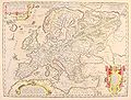
The David Rumsey Historical Map Collection is a large private map collection with over 150,000 maps and cartographic items. The collection was created...
5 KB (527 words) - 20:55, 17 July 2025
Khakassia (in Russian). Litres. ISBN 978-5-457-11792-1. "OpenHistoricalMap". OpenHistoricalMap. Retrieved 3 June 2022. "Черный Июс in the State Water Register...
20 KB (2,042 words) - 23:39, 4 January 2025
Retrieved 14 April 2025. "Node: Tarana Quarry Station (2100300936)". OpenHistoricalMap. 26 November 2022. Retrieved 14 February 2025. "Tarana Quarry Station"...
5 KB (254 words) - 01:38, 19 May 2025
List of Cadw properties (section Location map)
Map all coordinates using OpenStreetMap Download coordinates as: KML GPX (all coordinates) GPX (primary coordinates) GPX (secondary coordinates) Cadw...
61 KB (782 words) - 21:04, 27 May 2024
as recorded by the Historical Bureau. There are 4 historical markers located in Perry County. Map all coordinates using OpenStreetMap Download coordinates...
3 KB (183 words) - 04:26, 22 April 2025

when available. There are ten historical markers located in Susquehanna County. Map all coordinates using OpenStreetMap Download coordinates as: KML GPX...
5 KB (136 words) - 20:26, 9 April 2022

Map all coordinates using OpenStreetMap Download coordinates as: KML GPX (all coordinates) GPX (primary coordinates) GPX (secondary coordinates) This...
45 KB (2,422 words) - 03:34, 1 August 2025

below when available. There are 12 historical markers located in Mifflin County. Map all coordinates using OpenStreetMap Download coordinates as: KML GPX...
5 KB (136 words) - 20:25, 9 April 2022
included below. There are currently 71 historical markers located in Cecil County. Map all coordinates using OpenStreetMap Download coordinates as: KML GPX...
29 KB (827 words) - 11:57, 13 March 2022

Map all coordinates using OpenStreetMap Download coordinates as: KML GPX (all coordinates) GPX (primary coordinates) GPX (secondary coordinates) Pennsylvania...
14 KB (86 words) - 11:37, 1 August 2025
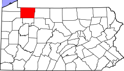
below when available. There are 12 historical markers located in Warren County. Map all coordinates using OpenStreetMap Download coordinates as: KML GPX...
6 KB (136 words) - 13:09, 17 May 2024
The Gangnido ("Map of Integrated Lands and Regions of Historical Countries and Capitals (of China)") is a world map and historical map of China, made...
74 KB (8,610 words) - 04:58, 21 July 2025

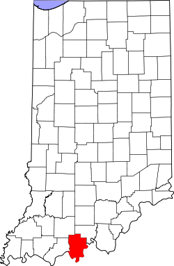
recorded by the Historical Bureau. There are 109 historical markers located in Marion County. Map all coordinates using OpenStreetMap Download coordinates...
51 KB (1,423 words) - 03:19, 26 July 2025
Historical negationism, also called historical denialism, is the falsification, trivialization, or distortion of the historical record. This is distinct...
181 KB (20,438 words) - 17:57, 26 July 2025

below when available. There are 66 historical markers located in Berks County. Map all coordinates using OpenStreetMap Download coordinates as: KML GPX...
21 KB (136 words) - 03:05, 8 June 2023