
The Oregon Trail, Wells Springs Segment, also known as the Oregon Trail, Boardman Bombing Range Segment, is part of an historic east–west migration route...
4 KB (377 words) - 19:39, 22 September 2023

The Oregon Trail was a 2,170-mile (3,490 km) east–west, large-wheeled wagon route and emigrant trail in the United States that connected the Missouri River...
144 KB (19,249 words) - 20:27, 3 June 2024
The Oregon Trail is an educational strategy video game developed and published by the Minnesota Educational Computing Consortium (MECC). It was first released...
39 KB (4,360 words) - 21:24, 20 May 2024
Kansas Oregon Trail, Wells Springs Segment, Boardman, Oregon, listed on the NRHP in Morrow County, Oregon Oregon Trail, Barlow Road Segment, near Wemme...
1 KB (157 words) - 03:55, 21 March 2013

half of the California Trail followed the same corridor of networked river valley trails as the Oregon Trail and the Mormon Trail, namely the valleys of...
214 KB (31,611 words) - 19:20, 24 May 2024

The Oregon Coast Trail (OCT) is a long-distance hiking route along the Pacific coast of the U.S. state of Oregon in the United States. It follows the coast...
13 KB (1,417 words) - 01:24, 3 August 2023
of the Missouri-based routes—the Oregon, California, and Mormon Trails—were collectively known as the Emigrant Trails. Historians have estimated at least...
24 KB (3,491 words) - 23:11, 3 June 2024

consists of five shorter, disconnected trail segments. The Trails for America report said, "Each National Scenic Trail should stand out in its own right as...
60 KB (2,726 words) - 15:08, 2 January 2024

growth. More than 80 miles (130 km) of recreational trails, including the Wildwood Trail segment of the city's 40-Mile Loop system, crisscross the park...
48 KB (5,127 words) - 17:57, 7 April 2024

Deschutes River (redirect from Deschutes River (Oregon))
pioneers on the Oregon Trail. The river flows mostly through rugged and arid country, and its valley provides a cultural heart for central Oregon. Today the...
25 KB (2,465 words) - 13:32, 28 January 2024
Appalachian Trail Conservancy claims the Appalachian Trail to be the longest hiking-only trail in the world. More than three million people hike segments of the...
125 KB (12,269 words) - 12:21, 1 June 2024

6 km) above its surroundings. Mount Jefferson's eastern segment lies within the Warm Springs Indian Reservation, and its western portion within the Mount...
58 KB (6,630 words) - 04:12, 24 February 2024

Elijah, and Limestone. In 2012, the Oregon Caves Historic District was expanded to include several segments of the trail system. Hotels, bed and breakfasts...
51 KB (5,215 words) - 10:24, 18 April 2024

of road walking; those segments are frequently evaluated by the North Country Trail Association for transfer to off-road segments on nearby public or private...
54 KB (6,299 words) - 13:26, 22 April 2024
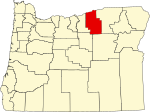
designated on the National Register of Historic Places in Morrow County, Oregon, and offers brief descriptive information about each of them. The National...
2 KB (369 words) - 09:21, 6 March 2022

"Three Trails" Trail Segment, Arrow Rock Ferry Landing, Santa Fe Trail – Grand Pass Trail Segments, and Santa Fe Trail – Saline County Trail Segments. The...
33 KB (3,737 words) - 00:25, 12 April 2024
Bridge Trail Vulcan Trail Chase Trail Iditarod National Historic Trail Tony Knowles Coastal Bicycle Trails Apache Railroad Trail Indian Springs Trail Iron...
38 KB (3,433 words) - 19:29, 4 June 2024

the Metolius Springs, which lie in the southwestern corner of Jefferson County. Accessible by roads branching off U.S. Route 20, the springs are located...
35 KB (3,906 words) - 05:44, 20 November 2023

Pony Express (redirect from Pony Express Trail)
Association, and Oregon-California Trails Association. From 1866 until 1889, the Pony Express logo was used by stagecoach and freight company Wells Fargo, which...
78 KB (8,018 words) - 15:30, 26 May 2024

Conservancy. Retrieved December 11, 2014. "Oregon Almanac: Dance to Hot Springs". The Oregon Blue Book. Oregon Secretary of State. Retrieved December 11...
19 KB (2,036 words) - 15:06, 7 December 2020
long-distance trails in the United States, with a minimum length of 30 miles (48 km). National Trails System National Millennium Trail project – 16 long-distance...
42 KB (537 words) - 00:36, 12 April 2024

1922 map of auto trails Old style highway markings The system of auto trails was an informal network of marked routes that existed in the United States...
24 KB (415 words) - 13:44, 26 December 2023

by a number of names, known alternately as 82nd Drive, the Oregon City Bypass or the Trails End Highway. It then continues south as a two-lane, undivided...
12 KB (937 words) - 06:21, 13 May 2024

Butterfield Overland Mail (redirect from Butterfield Overland Mail Trail)
Dos Cabezas Spring and then southwest to Dragoon Springs Stage Station at the foot of the Dragoon Mountains. In the spring of 1858 a new trail was made from...
79 KB (11,035 words) - 02:45, 23 May 2024

the trail follows much the same route as the Oregon Trail and the California Trail; these trails are collectively known as the Emigrant Trail. The Mormon...
49 KB (6,286 words) - 16:20, 28 May 2024
eastern end of the North Country National Scenic Trail, with that trail and the next segment of the Long Trail departing to the north. The AT then turns in...
44 KB (4,496 words) - 10:22, 28 May 2024

closely spaced volcanic peaks in the U.S. state of Oregon. They are part of the Cascade Volcanic Arc, a segment of the Cascade Range in western North America...
57 KB (6,281 words) - 02:25, 9 January 2024

Ezra Meeker (category People who traveled the Oregon Trail)
traveled the Oregon Trail by ox-drawn wagon as a young man, migrating from Iowa to the Pacific Coast. Later in life he worked to memorialize the Trail, repeatedly...
74 KB (10,009 words) - 17:12, 22 May 2024
Central Overland Route (redirect from Central Overland Trail)
shorter than the "standard" California Trail route along the Humboldt River. The Army then improved the trail and springs for use by wagons and stagecoaches...
9 KB (1,260 words) - 23:18, 1 November 2022

Interstate 5 (section Oregon)
auto trails and highways built in the early 20th century. The Pacific Highway was built in the 1910s and 1920s by the states of California, Oregon, and...
39 KB (3,829 words) - 20:04, 22 May 2024