
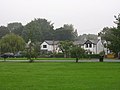
Pinfold Manor is a seven-bedroom Edwardian villa in Walton-on-the-Hill, Surrey, England. It was one of several houses built on land donated by Sir George...
5 KB (672 words) - 16:07, 29 March 2023

Walton-on-the-Hill (section Manor house)
David Lloyd George owned one such property, Pinfold Manor on Nursery Road. On 19 February 1913, Pinfold Manor was bombed by the Women's Social and Political...
15 KB (1,554 words) - 14:40, 29 December 2024

burnt the slogan "Votes for Women" into the grass of golf courses. Pinfold Manor in Surrey, which was being built for the Chancellor of the Exchequer...
85 KB (8,708 words) - 02:06, 4 June 2025

February, there was a suffragette bomb attack on Lloyd George's house, Pinfold Manor, with two bombs planted perhaps by Emily Davison. Only one exploded...
74 KB (9,054 words) - 09:18, 1 June 2025

Mayhill/Townhill Swansea (1910)- winner of a South Wales Cottage Exhibition Award. Pinfold Manor, Walton on the Hill, Banstead, Surrey (1912–13) Designed for David Lloyd...
23 KB (2,755 words) - 11:01, 26 October 2024

wider suffragette bombing and arson campaign, a bomb was set off in Pinfold Manor, the country home of the Chancellor of the Exchequer, Lloyd George,...
44 KB (4,716 words) - 04:28, 25 May 2025
buildings consist of a house, a cottage, a pigeoncote, a footbridge and a pinfold. Map all coordinates using OpenStreetMap Download coordinates as: KML GPX...
6 KB (253 words) - 12:14, 13 May 2023

Norwell, Nottinghamshire (section The Pinfold)
wooden gate is 20th century. The pinfold is approximately 10m (33') in diameter and is reputedly the largest round pinfold in the county (Nottinghamshire)...
12 KB (1,457 words) - 19:54, 1 July 2024

buildings on the site of the former manor house, the mill, the old vicarage, the village's historic farmhouses, and the pinfold. The village stocks were sold...
7 KB (846 words) - 06:50, 20 May 2025
Trustees. The green was unenclosed common land, used for grazing with a pinfold where stray animals were kept until released on the payment of a fine....
4 KB (434 words) - 19:39, 28 January 2025

12. "The Pinfold". Historic England. 19 September 1985. Retrieved 25 February 2023. Village pinfold. C19, raised 1897. "Pigeoncote at The Manor House"....
4 KB (381 words) - 12:04, 22 January 2025
Langlands Ruth Goodman Peter Ginn Alex Langlands Ruth Goodman Peter Ginn Tom Pinfold Director(s) Peter Sommer Stuart Elliot Stuart Elliot Stuart Elliot Naomi...
8 KB (716 words) - 19:36, 3 May 2025
the post-mistress's son. At the foot of Martlin Lane is the 'Pinfold'. Entering the Pinfold from the South is a public footpath which crosses the fields...
5 KB (638 words) - 23:47, 7 May 2025

Walton, Kents Hill and Walnut Tree. The manor house itself, built in 1830 in the Regency style for the Pinfold family, is home to the vice-chancellor's...
15 KB (1,452 words) - 23:03, 28 February 2025
poachers from hunting illegally The Pinherd, to impound stray animals in the pinfold The introduction of magistrates gradually rebalanced power away from manorial...
19 KB (2,413 words) - 04:07, 23 May 2025
special interest". The listed buildings consist of houses, a church, a pinfold, and two war memorials. Map all coordinates using OpenStreetMap Download...
11 KB (318 words) - 22:20, 22 March 2023

Skegby (section Skegby Manor House)
10 July. Several old buildings and features can be found in Skegby: The Pinfold on Mansfield Road, which dates from the 18th century. The Troughs on Old...
13 KB (1,480 words) - 22:30, 3 June 2025

Darlaston (section Darlaston Manor House)
Period. Disused coal mines are found near Queen Street in Moxley, behind Pinfold Street JMI School, near Hewitt Street and Wolverhampton Street, in George...
27 KB (2,803 words) - 22:17, 1 April 2025
Dringhouses (redirect from Dringhouse Manor)
Road in Dringhouses is a small brick enclosure that was once used as a pinfold. It is located opposite Royal Chase. Dringhouses is part of the Dringhouses...
29 KB (3,309 words) - 13:37, 9 May 2025
farmhouse, farm buildings, two former windmills, a road bridge, and a pinfold. Map all coordinates using OpenStreetMap Download coordinates as: KML GPX...
13 KB (455 words) - 13:15, 17 May 2022
buildings. The others include a packhorse bridge, a road bridge, a well, a pinfold, a water pump and a church. Map all coordinates using OpenStreetMap Download...
22 KB (675 words) - 09:13, 18 May 2025

a dungeon, once used as a lock-up.[citation needed] Nearby there is a pinfold, built to hold livestock, but now a picnic area.[citation needed] Heptonstall's...
16 KB (1,587 words) - 14:58, 8 December 2024
around the churchyard, a house, farmhouses and associated structures, and a pinfold. Map all coordinates using OpenStreetMap Download coordinates as: KML GPX...
10 KB (365 words) - 07:16, 13 September 2023
other listed buildings include a church, a former chapel, a former mill, a pinfold, a former library and a telephone kiosk. Map all coordinates using OpenStreetMap...
23 KB (667 words) - 15:54, 28 April 2023
houses and associated structures, farmhouses and farm buildings, and a pinfold, a boundary stone, and a former school. Map all coordinates using OpenStreetMap...
13 KB (410 words) - 01:22, 31 January 2025

of the area, published in 1840s, shows that the houses to the west of Pinfold Lane represent the older part of the village. The Old Hall is identified...
9 KB (907 words) - 17:00, 5 October 2024

smithy adjacent to the pinfold at the junction of Keeper Lane. In order to prevent over-population of the village the Lord of the Manor discouraged new development...
16 KB (1,970 words) - 07:28, 19 October 2024
and farmhouses, and the others include a church, a churchyard cross, a pinfold, and a village hall. Map all coordinates using OpenStreetMap Download coordinates...
17 KB (517 words) - 22:32, 1 June 2025
Egginton and the surrounding area. The listed buildings include a church, a pinfold, houses and farmhouses, various bridges, and an aqueduct carrying the Trent...
14 KB (422 words) - 09:58, 30 January 2025
structures, churches, farmhouses and farm buildings, a former watermill, a pinfold, a war memorial, and a telephone kiosk. Map all coordinates using OpenStreetMap...
19 KB (491 words) - 21:06, 17 April 2024