
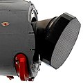
Spaceborne Imaging Radar (SIR) – full name 'Spaceborne Imaging Radar-C/X-band Synthetic Aperture Radar (SIR-C/X-SAR)', is a synthetic aperture radar which...
6 KB (546 words) - 08:25, 22 April 2025

2000. The radar system was based on the older Spaceborne Imaging Radar-C/X-band Synthetic Aperture Radar (SIR-C/X-SAR), previously used on the Shuttle...
21 KB (2,113 words) - 11:06, 26 April 2025

Satellite imagery (redirect from Satellite imaging)
Satellite images (also Earth observation imagery, spaceborne photography, or simply satellite photo) are images of Earth collected by imaging satellites...
32 KB (3,731 words) - 16:46, 14 May 2025

Space-based radar or spaceborne radar is a radar operating in outer space; orbiting radar is a radar in orbit and Earth orbiting radar is a radar in geocentric...
10 KB (1,334 words) - 23:41, 4 May 2025
scatterometer); it was later developed more extensively on the Spaceborne Imaging Radar (SIR) missions on the space shuttle in 1981, 1984 and 1994. The...
26 KB (3,688 words) - 10:31, 27 March 2025

Seasat (category Synthetic aperture radar satellites)
of the Earth's oceans and had on board one of the first spaceborne synthetic-aperture radar (SAR). The mission was designed to demonstrate the feasibility...
11 KB (815 words) - 20:32, 6 June 2024

Briole, P.; Arnaud, A. (1995), "Deflation of Mount Etna monitored by spaceborne radar interferometry", Nature, vol. 375, no. 6532, pp. 567–570, Bibcode:1995Natur...
39 KB (4,718 words) - 19:33, 9 April 2025

Lidar (redirect from Laser Imaging Detection and Ranging)
lidar allows imaging lidar without the need for an array detector. It can be used for imaging Doppler velocimetry, ultra-fast frame rate imaging (millions...
128 KB (14,548 words) - 20:47, 17 May 2025
norm to see the Great Wall from the Moon. The centimetre-band Spaceborne Imaging Radar of STS-59 and STS-68 was able to detect not only the Great Wall...
11 KB (1,157 words) - 20:46, 15 May 2025
Beamforming Microwave Imaging Radiometer with Aperture Synthesis (MIRAS), an example of a spaceborne STAR Synthetic aperture radar Piepmeier, J.R.; Pellerano...
2 KB (237 words) - 00:13, 30 June 2021

TerraSAR-X (category Synthetic aperture radar satellites)
TerraSAR-X is an imaging radar Earth observation satellite, a joint venture being carried out under a public-private-partnership between the German Aerospace...
14 KB (1,457 words) - 16:11, 2 March 2025

Endeavour Endeavour during STS-126 mission—MPLM visible in Payload Bay Image of Space Shuttle Endeavour docked to ISS during STS-127—created using a...
61 KB (4,640 words) - 16:38, 16 May 2025
to Airborne Radar, 2nd Ed.," SciTech Publishing, 1998 P. Lacomme, J.-P. Hardange, J.-C. Marchais, E. Normant: "Air and Spaceborne Radar Systems: An Introduction...
10 KB (1,410 words) - 15:24, 8 April 2024

Spacelab mission STS-59 Endeavour — April 1994 — Mission Specialist — Spaceborne Imaging Radar-C (SIR-C) operation STS-79 Atlantis — September 1996 — Mission...
31 KB (2,031 words) - 16:27, 31 August 2024
William C.; Butka, Brian (2011). "A passive bistatic radar for detection of aircraft using spaceborne transmitters". 2011 IEEE/AIAA 30th Digital Avionics...
34 KB (4,305 words) - 15:20, 20 April 2025

reported that the on-orbit checkout of the Spaceborne Imaging Radar-C (SIR-C) and the Synthetic Aperture Radar (X-SAR) had been completed, and that the...
33 KB (4,337 words) - 01:53, 26 March 2025

Space Radar Lab-2 (SRL-2), was the second flight of three advanced radars called SIR-C/X-SAR (Spaceborne Imaging Radar-C/X-Band Synthetic Aperture Radar),...
9 KB (1,054 words) - 05:14, 21 March 2024

Earth observation satellite (redirect from Imaging satellite)
Microwave radiometer#Spaceborne Radar earth observation satellite Radar imaging Synthetic-aperture radar Interferometric synthetic-aperture radar Satellite altimetry...
16 KB (1,696 words) - 02:52, 19 May 2025

around it. The two primary payloads were the Spaceborne Imaging Radar-C/X-band Synthetic Aperture Radar (SIR-C/X-SAR), and Measurement of Air Pollution...
12 KB (1,302 words) - 20:14, 11 September 2024
Euroradar CAPTOR (redirect from CAPTOR Active Electronically Scanning Array Radar)
Register". EuroRADAR: CAPTOR-E (PDF; 531 kB), retrieved 25 July 2013. Rodriguez-Cassola, V. Baumgartner, Krieger: Bistatic TerraSAR-X/F-SAR Spaceborne–Airborne...
47 KB (5,975 words) - 11:11, 18 April 2025

Jeffrey (April 1996). "Science Results from the Spaceborne Imaging Radar-C/X-Band Synthetic Aperture Radar (SIR-C/X-SAR): Progress Report" (PDF). NTRS –...
21 KB (1,964 words) - 14:15, 12 September 2024

ground controllers finished activating the Spaceborne Imaging Radar-C (SIR-C) and began processing its first images of the Earth, while engineers working with...
24 KB (2,850 words) - 18:45, 26 March 2025
Way, J. (July 1995). "Overview of results of Spaceborne Imaging Radar-C, X-Band Synthetic Aperture Radar (SIR-C/X-SAR)". IEEE Transactions on Geoscience...
7 KB (616 words) - 12:01, 15 May 2025

second flight of three advanced radars called SIR-C/X-SAR (Spaceborne Imaging Radar-C/X-Band Synthetic Aperture Radar), and a carbon-monoxide pollution...
10 KB (1,217 words) - 19:59, 28 April 2025

of three advanced radars called SIR-C/X-SAR (Spaceborne Imaging Radar-C/X-Band Synthetic Aperture Radar), and a carbon-monoxide pollution sensor, MAPS...
8 KB (998 words) - 17:02, 29 April 2025
Scatterometer (redirect from Radar scatterometer)
(launched 2016) F. Naderi; M. H. Freilich & D. G. Long (June 1991). "Spaceborne Radar Measurement of Wind Velocity Over the Ocean—An Overview of the NSCAT...
12 KB (1,457 words) - 06:14, 6 February 2025

The Advanced Spaceborne Thermal Emission and Reflection Radiometer (ASTER) is a Japanese remote sensing instrument onboard the Terra satellite launched...
13 KB (1,082 words) - 21:33, 9 February 2025

Fuk Li (category People associated with radar)
airborne rain mapping radar, an airborne cloud mapping radar, an experiment using spaceborne imaging radar to study rainfall effects on ocean roughness, and...
4 KB (375 words) - 07:51, 19 May 2024

(HRWS) imaging is an important branch in synthetic aperture radar (SAR) imaging, a remote sensing technique capable of providing high resolution images independent...
18 KB (2,713 words) - 00:08, 13 September 2024

using the same method, the Shuttle Radar Topography Mission (SRTM, 2000) using single-pass SAR and the Advanced Spaceborne Thermal Emission and Reflection...
31 KB (3,352 words) - 04:25, 21 February 2025