used the TerraServer brand name in a variety of ways including terraserver.homeadvisor.com, terraserver.microsoft.com, and terraserver.msn.com. In 2003...
4 KB (388 words) - 02:15, 27 January 2025
Microsoft Research Maps (redirect from Microsoft TerraServer)
renamed in 2010, prior to which it had been known as TerraServer-USA (formerly Microsoft TerraServer). The site had black and white USGS aerial photographs...
5 KB (511 words) - 05:48, 6 March 2025
Terraserver may refers to either of two databases for viewing geospatial imagery: Terraserver.com, a commercial web site TerraServer-USA, which hosts public...
262 bytes (64 words) - 20:26, 13 November 2015
2017, at Wayback Machine. "TerraServer - Viewer Aerial Photos & Satellite Images - The Leader In Online Imagery". terraserver.com. Archived from the original[usurped]...
17 KB (1,159 words) - 10:39, 24 January 2025

original (PDF) on 2017-02-02. "TerraServer - Viewer Aerial Photos & Satellite Images - The Leader In Online Imagery". terraserver.com. Archived from the original...
16 KB (1,287 words) - 10:40, 24 January 2025

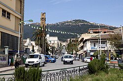
d’information sur les Sites Ramsar (in French). "TerraServer - Aerial Photos & Satellite Images". terraserver.com. "Lac du reghaia - historique" (in French)...
11 KB (1,045 words) - 23:21, 12 December 2024

at the Wayback Machine. "TerraServer - Viewer Aerial Photos & Satellite Images - The Leader In Online Imagery". terraserver.com. Archived from the original...
11 KB (638 words) - 21:42, 4 June 2025
Accessed on 2020-09-04. “TerraServer - Viewer Aerial Photos & Satellite Images - The Leader In Online Imagery”. terraserver.com. Archived from the original[usurped]...
4 KB (308 words) - 22:06, 16 January 2025

at the Wayback Machine. "TerraServer - Viewer Aerial Photos & Satellite Images - The Leader In Online Imagery". terraserver.com. Archived from the original...
17 KB (1,266 words) - 03:21, 27 January 2025
from the original on 2021-09-23. Accessed on 2020-03-05. http://www.terraserver.com/view.asp?cx=3.6201279&cy=36.7228968&proj=4326&mpp=1&sdrt=jax# Archived[usurped]...
7 KB (602 words) - 10:40, 24 January 2025

at the Wayback Machine. "TerraServer - Viewer Aerial Photos & Satellite Images - The Leader In Online Imagery". terraserver.com. Archived from the original...
23 KB (1,983 words) - 16:14, 30 December 2024
PrecisionHawk (section TerraServer)
drone (2012), founded DataMapper (2014), launched LATAS (2015), acquired TerraServer (2015), partnered with drone giant DJI (2016) and began manufacturing...
14 KB (1,483 words) - 02:34, 22 December 2024
TopoQuest (redirect from Topoquest.com)
program in July 2001 as a Linux, PHP and MySQL alternative to Microsoft's TerraServer-USA topographic mapviewer. The domain was registered at Go Daddy to Sunset...
2 KB (270 words) - 20:24, 27 October 2024

Wayback Machine. "TerraServer - Viewer Aerial Photos & Satellite Images - The Leader In Online Imagery"[usurped]. terraserver.com. Archived from the...
28 KB (2,146 words) - 04:29, 11 March 2025
TopoZone (redirect from Topozone.com)
eventually acquired by Locality LLC and relaunched in December 2015. TerraServer-USA TopoQuest Ed McNierney profile - discoverlife.org USGS and TopoZone...
3 KB (309 words) - 11:23, 20 February 2025
United States Geological Survey. Roadtrippers - covers the whole country TerraServer-USA - covers the whole country 2GIS, by 2GIS. "Vietbando Maps", by Vietbando...
9 KB (864 words) - 17:23, 1 June 2025
Wayback Machine Accessed April 20, 2015. "Microsoft TerraServer Imagery". www.terraserverusa.com. Archived from the original on October 8, 2007. Retrieved...
4 KB (452 words) - 06:27, 15 February 2025

Google Maps. Retrieved July 24, 2007. "I-70 at Route 7". Microsoft TerraServer. United States Geological Survey. February 28, 1996. Archived from the...
49 KB (2,172 words) - 23:24, 3 June 2025
Kingdom, 1895–present) Dorling Kindersley Atlas of the World 1994–present TerraServer-USA/MSR Maps (1998) NASA World Wind (2003) Yandex Maps (2004) Google...
3 KB (336 words) - 17:01, 12 May 2025
Florida Expressway Authority Terraserver "Urban Areas" image of SR 4080 Archived 2007-10-08 at the Wayback Machine TerraServer "Urban Areas" image of former...
29 KB (2,673 words) - 12:07, 31 May 2025
continuation of previous Microsoft technologies such as Microsoft MapPoint and TerraServer. Its original stand out feature was the aerial imagery. The original...
46 KB (3,322 words) - 11:19, 3 June 2025

mapping of starsPages displaying short descriptions of redirect targets TerraServer-USA – Online repository of US aerial imageryPages displaying short descriptions...
13 KB (1,374 words) - 21:03, 25 May 2025

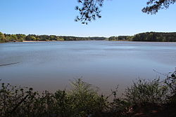
New South Wales at Wikimedia Commons Aerial photo of Nimmitabel from Terraserver[permanent dead link] Information about Nimmitabel, including history...
9 KB (623 words) - 17:25, 14 May 2025
based on existing Microsoft technologies such as Microsoft MapPoint and TerraServer that were already used in Bing Maps. It was first implemented on Windows...
20 KB (601 words) - 15:16, 29 April 2025

researcher Jim Gray had developed a satellite Earth-images database (Terraserver) and wanted to apply a similar technique to organizing the many disparate...
19 KB (2,186 words) - 01:58, 25 March 2025

become a standard throughout the world. For Microsoft, he worked on TerraServer-USA and Skyserver. Roger Sippl described Gray as among the "technical...
20 KB (1,747 words) - 08:01, 1 June 2025

individual placemarks can be viewed using Google Earth, Google Maps, TerraServer-USA or MapQuest. Google Earth Virtual Globe software Google Maps Keyhole...
4 KB (428 words) - 18:49, 1 June 2021

of Thunder Bay, Ontario, Canada". Topographic map. U.S.G.S via terraserver.microsoft.com. July 1, 1964. Archived from the original on October 9, 2013....
169 KB (14,784 words) - 06:14, 3 June 2025

States Geological Survey topographic maps and aerial photos, accessed via Terraserver-USA National Atlas of the United States, Hydrologic Units (Watersheds)...
46 KB (2,784 words) - 11:29, 5 June 2025
December 10, 2016. Retrieved December 15, 2016. "Tour Divide". www.tourdivide.com. Retrieved December 15, 2016. "Medicine Bow-Routt National Forests Thunder...
12 KB (1,487 words) - 02:39, 29 April 2025