
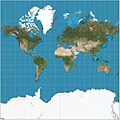
The World Geodetic System (WGS) is a standard used in cartography, geodesy, and satellite navigation including GPS. The current version, WGS 84, defines...
25 KB (2,857 words) - 01:38, 17 July 2025

A geodetic datum or geodetic system (also: geodetic reference datum, geodetic reference system, or geodetic reference frame, or terrestrial reference...
32 KB (3,392 words) - 01:33, 17 July 2025
The Geodetic Reference System 1980 (GRS80) consists of a global reference ellipsoid and a normal gravity model. The GRS80 gravity model has been followed...
7 KB (1,078 words) - 12:07, 24 August 2024

Retrieved December 25, 2018. National Geospatial Intelligence Agency. "World Geodetic System 1984 datasheet" (PDF). United Nations Office for Outer Space Affairs...
9 KB (912 words) - 16:39, 14 December 2024

A geographic coordinate system (GCS) is a spherical or geodetic coordinate system for measuring and communicating positions directly on Earth as latitude...
23 KB (2,540 words) - 23:07, 1 August 2025
EPSG Geodetic Parameter Dataset (also EPSG registry) is a public registry of geodetic datums, spatial reference systems, Earth ellipsoids, coordinate transformations...
5 KB (444 words) - 20:42, 28 January 2025
geographic coordinates (latitude and longitude). Examples include the World Geodetic System and the 1927 and 1983 North American Datum. A datum generally consists...
15 KB (1,570 words) - 12:19, 7 May 2025

Ellipsoid was used. The World Geodetic System WGS84 ellipsoid is now generally used to model the Earth in the UTM coordinate system, which means current...
18 KB (2,858 words) - 13:14, 29 May 2025
also known as MGRS-New, which is used for WGS84 and some other modern geodetic datums, the letter for the first row – just north of the equator – is A...
17 KB (2,278 words) - 01:21, 29 July 2025

of latitude, longitude and altitude are currently defined by the World Geodetic System (WGS), and take into account the flattening of the Earth at the...
43 KB (6,355 words) - 00:23, 2 August 2025
Web Mercator projection (category Geographic coordinate systems)
MEMBER["World Geodetic System 1984 (Transit)", ID["EPSG",1166]], MEMBER["World Geodetic System 1984 (G730)", ID["EPSG",1152]], MEMBER["World Geodetic System 1984...
16 KB (1,712 words) - 13:28, 25 May 2025
BeiDou (redirect from Compass navigation system)
Navigation Satellite System (BDS; Chinese: 北斗卫星导航系统; pinyin: běidǒu wèixīng dǎoháng xìtǒng) is a satellite-based radio navigation system owned and operated...
69 KB (5,974 words) - 17:24, 27 July 2025

Satellite geodesy (redirect from Space geodetic techniques)
worldwide triangulation networks allowed for the establishment of the World Geodetic System. The development of GPS by the United States in the 1980s allowed...
21 KB (2,338 words) - 10:15, 25 November 2024

Spherical Earth (redirect from Round World)
(Delambre, Everest). The modern value as determined by the US DoD World Geodetic System since the 1960s is close to 1/298.25. The scientific study of the...
17 KB (1,910 words) - 13:03, 28 July 2025
reference for the determining of locators should be based on the World Geodetic System 1984 (WGS-84). A Maidenhead locator compresses latitude and longitude...
16 KB (1,933 words) - 23:59, 7 June 2025

Center. "Department of Defense World Geodetic System 1984: Its Definition and Relationships with Local Geodetic Systems". Retrieved 2018-10-17. "Info"...
44 KB (4,825 words) - 23:25, 29 July 2025

Earth ellipsoid (section Geodetic coordinates)
TR8350.2, "Department of Defense World Geodetic System 1984, Its Definition and Relationships With Local Geodetic Systems", Third Edition, 4 July 1997 [1]...
24 KB (2,852 words) - 10:52, 21 July 2025

District on April 1, 1889 with the creation of the modern municipalities system. It was elevated to city status February 2, 2002. Moriya has a mayor-council...
11 KB (835 words) - 16:41, 5 January 2025
The Hellenic Geodetic Reference System 1987 or HGRS87 (Greek: Ελληνικό Γεωδαιτικό Σύστημα Αναφοράς 1987 or ΕΓΣΑ'87) is a geodetic system commonly used...
7 KB (827 words) - 10:33, 27 October 2024
Global Geodetic Observing System. Co-location in space between Satellite laser ranging and microwave observations for deriving global geodetic parameters...
185 KB (19,205 words) - 16:49, 1 August 2025
Geographic coordinate conversion (category Geographic coordinate systems)
of geographic coordinates, conversion of coordinate systems, or transformation to different geodetic datums. Geographic coordinate conversion has applications...
35 KB (5,221 words) - 14:02, 2 August 2025

space (the 3D case) Flight planning Geodesy Geodesics on an ellipsoid Geodetic system Geographical distance Isoazimuthal Loxodromic navigation Meridian arc...
13 KB (1,920 words) - 08:30, 23 January 2025

like North American Datum of 1983 for U.S. measurements, and the World Geodetic System for worldwide measurements. The latitude and longitude on a map...
103 KB (13,395 words) - 03:40, 19 July 2025
grid (for example, a spherical coordinate system or an ellipsoid-based system such as the World Geodetic System) or similar methods. For example, the position...
3 KB (380 words) - 19:36, 21 July 2025
the Earth are uniform, so a reference oblate spheroid such as the World Geodetic System is used to horizontally map the Earth. The current reference spheroid...
29 KB (1,887 words) - 01:41, 17 July 2025

position, the height of the geoid (e.g., the EGM96 geoid) over the World Geodetic System (WGS) ellipsoid. They are then able to correct the height above...
29 KB (3,444 words) - 09:22, 15 July 2025

Orders of magnitude Planetary coordinate system#Longitude Right ascension on celestial sphere World Geodetic System "Definition of LONGITUDE". Merriam-Webster...
38 KB (4,438 words) - 04:02, 11 June 2025

known as the reference ellipsoid, instead of a sphere. The current World Geodetic System model uses a spheroid whose radius is 6,378.137 km (3,963.191 mi)...
14 KB (2,046 words) - 00:53, 30 July 2025

1988 (NAVD 88). All geographic coordinates are adjusted to the World Geodetic System of 1984 (WGS 84). The mean elevation for each state, the District...
48 KB (3,108 words) - 04:29, 17 July 2025