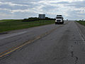
Highway 49 and Provincial Trunk Highway 49 (PTH 49) is a provincial highway in the Canadian provinces of Saskatchewan and Manitoba. Most of the highway...
15 KB (1,010 words) - 00:07, 29 December 2023
of rural municipality highways in the Canadian province of Saskatchewan between the numbers 600 and 699. The 600-series highways run north and south and...
69 KB (5,471 words) - 01:43, 17 February 2024
of rural municipality highways in the Canadian province of Saskatchewan between the numbers 700 and 799. The 700-series highways run west and east and...
70 KB (5,785 words) - 17:34, 1 May 2024
Highway 1 is the Saskatchewan section of the Trans-Canada Highway mainland route. The total distance of the Trans-Canada Highway in Saskatchewan is 654...
74 KB (5,614 words) - 04:14, 13 April 2024

366, in the Canadian province of Saskatchewan. Kelvington is located at the intersection of Highway 38 and Highway 49. It is east of Saskatoon. The town...
12 KB (734 words) - 19:53, 26 October 2023
Highway Alberta Highway 49 British Columbia Highway 49 Manitoba Highway 49 Highway 49 (Ontario) Saskatchewan Highway 49 D49 Motorway I/49 Highway; Czech: Silnice...
7 KB (477 words) - 22:28, 4 April 2024

Highway 16 is a provincial highway in the Canadian province of Saskatchewan. It is the Saskatchewan section of the Yellowhead Highway, and also the Trans-Canada...
67 KB (5,878 words) - 00:39, 1 March 2024
Highway 4 is a major highway in the Canadian province of Saskatchewan. It runs from U.S. Route 191 at the United States border near Monchy to Highway 224...
16 KB (332 words) - 23:07, 21 August 2023
Canadian province of Saskatchewan within the Rural Municipality of Surprise Valley No. 9 and Census Division No. 2. It is on Highway 6 just north of its...
11 KB (506 words) - 15:15, 15 April 2023
Highway 36 is a highway in the Canadian province of Saskatchewan. It runs from Montana Highway 13 at the US border near Port of Coronach to Highway 2...
4 KB (81 words) - 19:35, 29 August 2023
Highway 11 is a major north-south highway in Saskatchewan, Canada that connects the province's three largest cities: Regina, Saskatoon and Prince Albert...
87 KB (7,965 words) - 19:46, 12 February 2024

KML/Highway 17 (Alberta–Saskatchewan) KML is from Wikidata Highway 17 is a highway in Canada that straddles and criss-crosses the Alberta–Saskatchewan provincial...
16 KB (765 words) - 13:40, 11 July 2023
This is a list of Saskatchewan's highways: Only Highways 1, 2, 5, 6, 7, 11, 12, 16, and 39 contain sections of divided highway. Speed limits range from...
112 KB (560 words) - 20:34, 6 February 2024

the Canadian province of Saskatchewan. It is located 110 km (68 mi) south-southwest of Moose Jaw beside Highway 2 and Highway 13. The Dominion Land Survey's...
16 KB (849 words) - 19:06, 21 May 2024

Highway 47 is a provincial highway in the Canadian province of Saskatchewan. The highway runs from North Dakota Highway 40 at the Canada–United States...
11 KB (259 words) - 14:14, 19 February 2024

July 2021. Media related to Stoughton, Saskatchewan at Wikimedia Commons Canada portal 49°40′30″N 103°02′13″W / 49.675°N 103.037°W / 49.675; -103.037...
9 KB (452 words) - 00:25, 28 October 2023
Highway 2 is a provincial highway in the Canadian province of Saskatchewan. It is the longest highway in Saskatchewan at 809 km (503 mi). The highway...
75 KB (5,826 words) - 13:09, 12 December 2023

Climax (2016 population: 195) is a village in the Canadian province of Saskatchewan within the Rural Municipality of Lone Tree No. 18 and Census Division...
10 KB (415 words) - 07:10, 12 June 2023

southwestern Saskatchewan, Canada. The community is located approximately 70 km southeast of Swift Current at the intersection of Highway 13 and Highway 612....
13 KB (534 words) - 03:02, 10 September 2023

Highway 5 is a major highway in the Canadian province of Saskatchewan. It begins in downtown Saskatoon and runs eastward to the Manitoba border near Togo...
45 KB (3,659 words) - 08:03, 23 October 2023
Highway 39 is a provincial paved highway in the southern portion of the Canadian province of Saskatchewan connecting North Portal and Moose Jaw in the...
42 KB (3,549 words) - 08:59, 29 March 2024
about 49 kilometres (30 mi) long. Transportation in Saskatchewan Roads in Saskatchewan Google (1 February 2018). "Highway 304 in Saskatchewan" (Map)...
2 KB (62 words) - 19:26, 30 January 2024
Highway 969. It is about 79 kilometres (49 mi) long. Highway 926 also connects with Highway 265, Highway 970, and Highway 931. Roads in Saskatchewan Transportation...
2 KB (74 words) - 20:41, 29 January 2024
Highway 27 is a provincial highway in the Canadian province of Saskatchewan. Being 34 kilometres (21 mi) long, it runs from Highway 41 at Aberdeen to...
4 KB (207 words) - 15:34, 28 August 2023

Highway 18 is a highway in the Canadian province of Saskatchewan. It runs from Highway 13 near Robsart, approximately 65 km (40 mi) east of the Alberta...
17 KB (339 words) - 14:10, 19 February 2024
Highway 55 is a paved, undivided provincial highway in the Canadian province of Saskatchewan. It runs from the Alberta border west of Pierceland (where...
13 KB (401 words) - 21:35, 10 February 2024

special service area within the Rural Municipality of Wise Creek No. 77 in Saskatchewan, Canada. Originally incorporated as a village in 1914, it relinquished...
12 KB (534 words) - 03:01, 10 September 2023

extends from the Saskatchewan border in the east through the Cold Lake, Lac La Biche, and Athabasca where it ends at Highway 2. In Saskatchewan, it continues...
11 KB (448 words) - 14:01, 6 July 2023
Saskatchewan Highway 7 is a major paved undivided provincial highway in the Canadian province of Saskatchewan, running from the Alberta border to Saskatoon...
30 KB (2,531 words) - 22:49, 21 August 2023

Preeceville (redirect from Preeceville, Saskatchewan)
in Saskatchewan, Canada. The town is 10 km (6 miles) west of Sturgis and 99 km (62 miles) north of Yorkton at the junction of Highway 49, Highway 47,...
7 KB (266 words) - 18:00, 16 October 2023