
information system (GIS) is a commonly used tool for environmental management, modelling and planning. As simply defined by Michael Goodchild, GIS is as "a computer...
29 KB (3,409 words) - 19:24, 5 June 2024
the compliance and enforcement of environmental laws. GIS can provide a valuable tool for such work (see GIS and environmental governance). In addition...
34 KB (4,118 words) - 16:28, 3 May 2025
Environmental governance is a concept in environmental policy that steers markets, technology and society towards sustainability. It considers social...
34 KB (3,947 words) - 06:19, 23 May 2025
Counter-mapping (category Environmental social science concepts)
Introduction to Cartography and GIS. London: John Wiley and Sons. McCarthy, J (2006). "Theorizing the State in Environmental Governance". Review of International...
44 KB (5,354 words) - 15:10, 9 January 2025

Geographic information system (redirect from GIS)
geographic information system (GIS) consists of integrated computer hardware and software that store, manage, analyze, edit, output, and visualize geographic data...
102 KB (13,199 words) - 20:26, 22 May 2025
management. In the European Union's environmental policies, soil is recognized as a non-renewable resource, but its governance is maintained at a national level...
28 KB (3,488 words) - 22:47, 15 November 2024
TOXMAP (category United States Environmental Protection Agency)
TOXMAP, an Environmental Health GIS. At: 2008 Esri Federal User Conference. Hochstein, C; Arnesen, S; Goshorn, J (2007). "Environmental health and toxicology...
12 KB (1,158 words) - 11:58, 24 January 2025
GIS (PGIS) or public participation geographic information system (PPGIS) is a participatory approach to spatial planning and spatial information and communications...
27 KB (3,317 words) - 07:05, 20 May 2025

political, economic and governance factors and provides a holistic framework to achieve sustainable outcomes. A major goal of environmental planning is to...
27 KB (3,262 words) - 22:46, 27 March 2025

Geographer (section Institutions and societies)
geographer, cultural ecologist and environmental archaeologist. Michael Frank Goodchild (born 1944) – GIS scholar and winner of the RGS founder's medal...
14 KB (1,304 words) - 19:23, 2 January 2025

organized environmental data for various developmental initiatives all over the country.[citation needed] EIC stores data in GIS format and makes it available...
87 KB (10,545 words) - 06:09, 23 May 2025
list of GIS data sources (including some geoportals) that provide information sets that can be used in geographic information systems (GIS) and spatial...
44 KB (559 words) - 04:42, 19 May 2025

geographers are exploring GIS methods applied to qualitative datasets. Qualitative cartography employs many of the same software and techniques as quantitative...
21 KB (2,026 words) - 23:24, 22 May 2025

Wildlife Enforcement Monitoring System (category International environmental law)
Monitoring System (WEMS) is an environmental governance project developed to assist in monitoring the effectiveness of enforcement and compliance of wildlife...
6 KB (588 words) - 00:54, 23 February 2025
Geodatabase is a proprietary GIS file format developed in the late 1990s by Esri (a GIS software vendor) to represent, store, and organize spatial datasets...
31 KB (3,473 words) - 18:24, 3 December 2024

Ahmed Abukhater (category Environmental scientists)
including GIS solutions and strategic marketing in Planning and Community Development, Urban and Regional Planning, environmental science and sustainable...
12 KB (924 words) - 12:51, 9 May 2025

Geographical indication (section Differences between geographical indications and other protections)
the authority to handle GIs for craft and industrial products. It showcased its continuous adaptation to new challenges and responsibilities in the IP...
32 KB (4,162 words) - 12:05, 12 February 2025

quantitative geography" and "overthrow the dominant quantitative approach" during the 1960s and 1970s, by 1995, GIS practitioners and quantitative geographers...
76 KB (9,939 words) - 09:58, 15 April 2025
(2024-09-01). "Data Scaling: Implications for Climate Action and Governance in the UK". Environmental Management. 74 (3): 414–424. Bibcode:2024EnMan.tmp...83S...
19 KB (2,203 words) - 18:45, 20 October 2024

Asset management is a systematic approach to the governance and realization of all value for which a group or entity is responsible. It may apply both...
20 KB (2,212 words) - 10:06, 25 April 2025

cultural, and technological perspectives. The core assumption of Internet geography is that the location of servers, websites, data, services, and infrastructure...
3 KB (288 words) - 05:00, 5 May 2025
Green Belt Movement (category Environmental justice)
initiatives, and planning, monitoring, and implementing projects. The GIS laboratory in 2009, received upgrades to their GIS software from the Environmental Systems...
63 KB (9,162 words) - 02:47, 18 April 2025
(GIS) for planning and monitoring construction. GIS helps identify optimal routes, map out the terrain, and assess environmental impact. Smart Road Design:...
14 KB (1,514 words) - 21:19, 5 March 2025
strategically and systematically about key global systems (economic, demographic, education, health, environment, technology, domestic governance, infrastructure...
11 KB (1,146 words) - 15:32, 26 August 2024
economic, social, and environmental effects of a public policy proposal. They have been incorporated into policy making in the OECD countries and the European...
6 KB (724 words) - 06:41, 20 April 2025

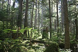
Forest management (redirect from Forest governance)
sequestration research, GIS applications, and long-term monitoring help assess and improve forest management, ensuring its effectiveness and success. The forest...
112 KB (22,464 words) - 22:46, 9 May 2025
Urban geography (section Environmental Impact)
and institutional activities, governance, decay and renewal, and notions of socio-spatial inclusions, exclusions, and everyday life. Urban geography...
25 KB (3,222 words) - 12:12, 19 October 2024

Western Ghats Ecology Expert Panel (category Environmental research)
Geo-spatial database based on environmental sensitivity (Note: The geospatial datasets restored by OSGEO, contain critical GIS datasets from the WGEEP panel...
11 KB (1,087 words) - 23:55, 21 October 2024
satisfaction, social connection and ethics. Crowdsourcing Neogeography Participatory 3D modelling (P3DM) Participatory GIS Public participation Public participation...
11 KB (1,241 words) - 19:35, 12 September 2024
Natural resource management (category Environmental social science)
various frameworks and computer models developed to assist natural resource management. Geographic Information Systems (GIS) GIS is a powerful analytical...
48 KB (5,330 words) - 06:08, 30 November 2024