
Maryland Route 2 (MD 2) is the longest state highway in the U.S. state of Maryland. The 79.24-mile (127.52 km) route runs from Solomons Island in Calvert...
77 KB (7,972 words) - 16:05, 15 May 2024
following is a list of state highways in Maryland shorter than one mile (1.6 km) in length with route numbers between 2 and 699. Most of these highways act...
89 KB (7,809 words) - 21:37, 4 May 2024
was transferred from state to municipal maintenance in 2005. Maryland Route 606 was the 2.27-mile-long (3.65 km) designation for Corsica Neck Road from...
71 KB (8,267 words) - 22:03, 30 October 2023
Maryland Route 503 was the designation for Olivet Road from the community of Olivet at the confluence of Mill Creek and St. John Creek north to MD 2 (now...
53 KB (5,661 words) - 04:31, 5 November 2023
was extended east to MD 212 in 1929. The route was removed from the state highway system in 1955. Maryland Route 205 was the designation for Edmonston Road...
104 KB (12,452 words) - 18:24, 21 August 2023
The following is a list of state highways in Maryland shorter than one mile (1.6 km) in length with route numbers between 900 and 999. Most of these highways...
97 KB (8,242 words) - 21:28, 4 May 2024
the state highway system in 1956. Maryland Route 416 was the designation for Southern Maryland Boulevard from MD 2 in Sunderland north to MD 4 at Waysons...
72 KB (8,399 words) - 01:10, 30 October 2023
The following is a list of state highways in Maryland shorter than one mile (1.6 km) in length with route numbers between 700 and 799. Most of these highways...
48 KB (3,564 words) - 02:44, 5 May 2024
from the state highway system in 1955. Maryland Route 164 was the designation for Carpenters Point Road, which ran 2.63 miles (4.23 km) from Carpenter Point...
86 KB (9,107 words) - 23:20, 15 May 2024
The following is a list of state highways in Maryland shorter than one mile (1.6 km) in length with route numbers between 800 and 899. Most of these highways...
96 KB (8,306 words) - 02:37, 5 May 2024
is a list and description of the local, express and commuter bus routes of the Maryland Transit Administration, which serve Baltimore and the surrounding...
42 KB (262 words) - 00:25, 2 May 2024
Roads Commission of Maryland (1943–1944 ed.). Baltimore: Maryland State Roads Commission. p. 77. Retrieved July 8, 2016. Maryland Route 714 was the designation...
54 KB (6,355 words) - 07:53, 22 June 2023

City, Maryland, on the Atlantic Ocean. In the U.S. state of Maryland, US 50 exists in two sections. The longer of these serves as a major route connecting...
88 KB (8,173 words) - 16:00, 22 May 2024
at the intersection of Pasadena Road and Governor Ritchie Highway (Maryland Route 2), is now assigned by the U.S. Census Bureau to the Severna Park census-designated...
10 KB (849 words) - 23:02, 18 May 2024
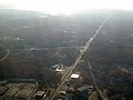
I-97 near Glen Burnie, the Baltimore–Washington Parkway (B–W Parkway; Maryland Route 295 [MD 295]) near Linthicum, I-70 near Woodlawn, I-795 near Pikesville...
60 KB (5,182 words) - 01:21, 27 May 2024
Sunderland, Route 4 meets Maryland Route 2 (traveling south as a two-lane road from Annapolis) and the two roads merge as Maryland Route 2–4. Route 2-4 continues...
50 KB (4,269 words) - 15:36, 25 April 2024

Maryland Route 3 (MD 3), part of the Robert Crain Highway, is the designation given to the former alignment of U.S. Route 301 (US 301) from Bowie, Maryland...
18 KB (1,910 words) - 19:36, 8 January 2024

Maryland Route 450 (MD 450) is a state highway in the U.S. state of Maryland. The state highway runs 30.19 miles (48.59 km) from U.S. Route 1 Alternate...
41 KB (4,760 words) - 06:46, 21 February 2024

Maryland Route 404 (MD 404) is a major highway on Maryland's Eastern Shore in the United States. Signed east-west, it runs 24.61 miles (39.61 km) from...
40 KB (3,934 words) - 14:33, 18 August 2023

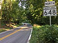
include Maryland Route 181, Maryland Route 387, Maryland Route 393, Maryland Route 435, Maryland Route 436, Maryland Route 450, Maryland Route 788 and...
91 KB (7,851 words) - 22:00, 26 May 2024
St. Paul and Calvert streets (redirect from Maryland Route 2 in Baltimore)
Downtown Baltimore and areas north. The streets, which are part of Maryland Route 2, are two of Baltimore's best-known streets in the downtown area. St...
9 KB (997 words) - 19:20, 26 December 2023
Edgewater Beach are some of the neighborhoods found in Edgewater. Maryland Route 2 (Solomons Island Road) is the main north–south road through the community...
6 KB (319 words) - 20:21, 22 September 2023

Harwood is a crossroads in Anne Arundel County, Maryland, United States, south of Annapolis on Maryland Route 2 (Solomons Island Road). Southern High School...
6 KB (271 words) - 22:20, 25 July 2023

Gambrills and Millersville. Severna Park is split by Ritchie Highway (Maryland Route 2), which runs between Baltimore and Annapolis and directly through Severna...
15 KB (1,353 words) - 16:38, 15 April 2024
106 at the 2010 census. Neighborhoods straddle College Parkway and Maryland Route 2 (Ritchie Highway). Arnold is located on the scenic Broadneck Peninsula...
16 KB (1,598 words) - 17:07, 21 August 2023

Maryland Route 5 (MD 5) is a 74.34-mile (119.64 km) long state highway that runs north–south in the U.S. state of Maryland. The highway runs from Point...
55 KB (5,610 words) - 02:08, 15 March 2024

Maryland Route 45 (MD 45) is a state highway in the U.S. state of Maryland. Known for most of its length as York Road, the state highway runs 30.06 miles...
35 KB (2,589 words) - 04:00, 7 May 2023

Maryland Route 200 (MD 200), also known as the Intercounty Connector or ICC, is an 18.8-mile (30.3 km) controlled-access toll road in the U.S. state of...
108 KB (10,773 words) - 12:10, 9 February 2024

Maryland Route 7 (MD 7) is a collection of state highways in the U.S. state of Maryland. Known for much of their length as Philadelphia Road, there are...
38 KB (4,314 words) - 01:25, 4 February 2024

U.S. Route 40 (US 40) in the U.S. state of Maryland runs from Garrett County in Western Maryland to Cecil County in the state's northeastern corner. With...
80 KB (7,537 words) - 19:24, 8 January 2024