New England Highway state-controlled roads in Queensland presents information about how the Queensland segment of the New England Highway is described...
12 KB (1,052 words) - 01:05, 22 January 2024
purposes by the Queensland Department of Transport and Main Roads, and about the state-controlled roads that intersect with it. The Bruce Highway runs from...
40 KB (3,348 words) - 15:45, 4 April 2024
purposes by the Queensland Department of Transport and Main Roads, and about the state-controlled roads that intersect with it. The Warrego Highway runs from...
23 KB (1,932 words) - 00:40, 22 January 2024
by the Queensland Department of Transport and Main Roads, and about the state-controlled roads that intersect with it. The Cunningham Highway runs from...
22 KB (1,802 words) - 22:38, 9 February 2024

route between Brisbane and Sydney. The Queensland segment of the New England Highway is a state-controlled road, subdivided into three sections for administrative...
41 KB (2,888 words) - 17:00, 20 May 2024
by the Queensland Department of Transport and Main Roads, and about the state-controlled roads that intersect with it. The Mount Lindesay Highway runs from...
6 KB (516 words) - 02:20, 5 March 2024

Inglewood to Goondiwindi State-controlled roads that intersect with the highway are listed in the main article. The highway is named in honour of the explorer...
20 KB (1,368 words) - 22:27, 27 January 2024

Lindesay Highway is an Australian national highway located in Queensland. The highway runs southwest from Brisbane, where it leaves Ipswich Road in the suburb...
26 KB (1,554 words) - 21:25, 7 March 2024

designated as a State Strategic Road (part of Australia’s Country Way) by the Queensland Government. Burnett Highway is a state-controlled regional road, most of...
15 KB (930 words) - 06:03, 27 April 2024

18G – Morven to Charleville State-controlled roads that intersect with the highway are listed in the main article. The highway commences at the end of the...
30 KB (2,105 words) - 12:42, 9 March 2024
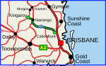
D'Aguilar Highway is a two-lane highway linking the Bruce Highway near Caboolture with the Bunya Highway in Kingaroy in the state of Queensland, Australia...
22 KB (1,114 words) - 05:42, 20 January 2024

Landsborough Highway in Kynuna, a distance of 112 kilometres (70 mi). It does not intersect with any other state-controlled roads. Australian Roads portal Highways...
19 KB (1,272 words) - 00:30, 5 May 2024

Leichhardt Highway, looking south from Guluguba Cafe, 2014 Australian Roads portal Queensland portal Highways in Australia List of highways in Queensland List...
9 KB (266 words) - 22:59, 27 May 2024

by slip roads (ramps), which allow for speed changes between the highway and arterials and collector roads. On the controlled-access highway, opposing...
232 KB (24,796 words) - 22:03, 15 May 2024

intersect with any state-controlled roads. Australian Roads portal Queensland portal Highways in Australia List of highways in Queensland Wikimedia Commons has...
8 KB (448 words) - 02:42, 15 January 2024

The Dawson Highway is a state highway in Queensland, Australia. It runs for 405 kilometres (252 mi) between Gladstone and Springsure where it terminates...
20 KB (1,305 words) - 02:29, 29 April 2024

Highways in Australia are generally high capacity roads managed by state and territory government agencies, though Australia's federal government contributes...
49 KB (4,929 words) - 12:39, 22 January 2024
Marlborough–Sarina Road is a state-controlled district road (number 512) rated as a local road of regional significance (LRRS). It runs from the Bruce Highway in Marlborough...
18 KB (1,471 words) - 05:56, 19 December 2023
Google Maps. Australian Roads portal Queensland portal List of road routes in Queensland List of numbered roads in Queensland Google (10 February 2022)...
14 KB (1,232 words) - 07:17, 23 December 2023

of the Queensland border near the Gold Coast. It is one of the busiest highways in Australia and was reconstructed as a controlled-access highway (motorway)...
138 KB (8,648 words) - 13:32, 25 April 2024

with any other state-controlled roads. Australian Roads portal Highways in Australia List of highways in Queensland "Queensland Government – Department...
18 KB (1,323 words) - 20:53, 18 May 2024

Developmental Road (State Route 87) is a sealed road in the Western Downs Region, Queensland, Australia. It is a state-controlled district road (numbers 86A...
11 KB (923 words) - 05:42, 9 January 2024
Wondai–Proston Road is a state-controlled district road (number 436) rated as a local road of regional significance (LRRS). It runs from the Bunya Highway in Wondai...
14 KB (1,151 words) - 23:27, 8 May 2024

Brisbane Valley Highway is a state highway in Queensland, Australia. It links the Warrego Highway near Ipswich and the D'Aguilar Highway about 4 km (2 mi)...
13 KB (784 words) - 05:57, 19 January 2024

Bay Highway is a short state highway of Queensland, Australia running between Goomeri on the Burnett Highway and a junction on the Bruce Highway. From...
8 KB (647 words) - 00:30, 21 January 2024
Can Bay Road is a continuous 56.1 kilometres (34.9 mi) road route in the Gympie region of Queensland, Australia. Part of it is signed as State Route 15...
14 KB (1,179 words) - 23:06, 28 March 2024
Greenmount–Hirstvale Road is a state-controlled road (number 3102) rated as a local road of regional significance (LRRS). It runs from the New England Highway in East...
13 KB (1,238 words) - 23:49, 1 January 2024
Kennedy Highway in Evelyn, a distance of 10.7 kilometres (6.6 mi). This road has no major intersections. Beatrice Way is a state-controlled district road (number...
10 KB (845 words) - 06:24, 9 January 2024
Roads ©State of Queensland [CC BY 4.0]. 2020. Retrieved 29 May 2023. "North Coast district map" (PDF). Department of Transport and Main Roads ©State of...
12 KB (1,026 words) - 23:20, 8 May 2024
Redcliffe Peninsula road network is a group of roads that provide access to the Redcliffe Peninsula in Queensland, Australia, and enable travel between...
12 KB (1,137 words) - 18:45, 23 April 2024