The Open Source Geospatial Foundation (OSGeo), is a non-profit non-governmental organization whose mission is to support and promote the collaborative...
10 KB (994 words) - 16:48, 22 April 2025
Geographic information system software (redirect from Open source GIS software)
191–198. ISBN 0-13-862145-4. "GRASS GIS history". GRASS GIS. Open Source Geospatial Foundation. Morehouse, Scott (1985). "ARC/INFO: A geo-relational model...
26 KB (2,782 words) - 17:47, 8 April 2025

GDAL (redirect from Geospatial Data Abstraction Library)
under the permissive X/MIT style free software license by the Open Source Geospatial Foundation. As a library, it presents a single abstract data model to...
15 KB (1,169 words) - 10:52, 16 November 2022
Open Source Geospatial Foundation (OSGeo) List of geographic information systems software Comparison of geographic information systems software OpenLayers...
14 KB (1,140 words) - 16:10, 13 April 2025
was introduced as open-source by Autodesk in November 2005, and the code was contributed to the Open Source Geospatial Foundation in March 2006 under...
4 KB (405 words) - 00:34, 15 March 2024
for physics Open Source Geospatial Foundation NASA Open Source Agreement (NOSA), an OSI-approved software license List of open-source software for mathematics...
106 KB (11,948 words) - 02:10, 19 June 2025
MapServer (section Open Source Geospatial Foundation)
Foundation were scrapped; Instead, the Open Source Geospatial Foundation (OSGeo) was established in 2006 to include MapServer and other open source GIS...
9 KB (906 words) - 09:00, 6 June 2025
States Geological Survey (USGS), but since 2019-11-26 is an Open Source Geospatial Foundation (OSGeo) project maintained by the PROJ Project Steering Committee...
7 KB (710 words) - 21:17, 9 April 2025
Mission to Nepal University of Minnesota UMN MapServer by the Open Source Geospatial Foundation Upper motor neuron Uspekhi Matematicheskikh Nauk (Russian:...
494 bytes (82 words) - 06:26, 18 March 2023
Computer Teachers Association (NCCCTA) Open Source Geospatial Foundation India (OSGEO India) Free Software Foundation of India – founded 2001 International...
16 KB (1,902 words) - 14:07, 5 November 2024
Web Map Service (category Open Geospatial Consortium)
specification by Open Source Geospatial Foundation (OSGeo) for tiled map layers Scharl, Arno; Klaus Tochtermann (2007). The Geospatial Web: How Geobrowsers...
8 KB (851 words) - 15:01, 23 April 2024

GRASS is one of the eight initial software projects of the Open Source Geospatial Foundation. GRASS supports raster and vector data in two and three dimensions...
12 KB (1,339 words) - 20:15, 6 June 2025
Provider for SDF". Open Source Geospatial Foundation. December 29, 2006. "FDO SDF Provider API Reference". Open Source Geospatial Foundation. "Autodesk MapGuide...
3 KB (330 words) - 07:21, 6 November 2022
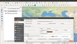
that is free and open-source. QGIS supports Windows, macOS, and Linux. It supports viewing, editing, printing, and analysis of geospatial data in a range...
10 KB (908 words) - 14:12, 27 March 2025
Open Source Geospatial Foundation Magnetotellurics "Release 33.1". 16 May 2025. Retrieved 25 May 2025. Garnett, Jody. "GeoTools User Guide". Open Source...
4 KB (440 words) - 20:42, 23 October 2023
Sector National Retail Federation National Wrestling Alliance Open Source Geospatial Foundation Software in the Public Interest UEFA Ulster Defence Association...
4 KB (386 words) - 06:17, 6 June 2025
Tile Map Service (category Open Geospatial Consortium)
is a specification for tiled web maps, developed by the Open Source Geospatial Foundation. The definition generally requires a URI structure which attempts...
3 KB (219 words) - 08:08, 27 May 2024

open-source mapping tools released by MetaCarta are FeatureServer and TileCache. Since November 2007, OpenLayers has been an Open Source Geospatial Foundation...
3 KB (207 words) - 07:53, 27 May 2025

Geographic information system (redirect from Geospatial Information System)
Integrated Geo Systems List of GIS data sources List of GIS software Map database management Open Source Geospatial Foundation Quantitative geography Technical...
103 KB (13,339 words) - 03:39, 19 June 2025
Open source intelligence (OSINT) is the collection and analysis of data gathered from open sources (overt sources and publicly available information)...
27 KB (2,716 words) - 15:45, 13 June 2025
GitHub. Esri. Retrieved 2025-05-25. "LIDAR Format Letter". Open Source Geospatial Foundation Wiki. Retrieved 2025-05-25. LASer (LAS) File Format Exchange...
10 KB (779 words) - 13:44, 16 June 2025
QGIS[citation needed] and MiraMon[citation needed]. According to the Open Source Geospatial Foundation (which releases GDAL), MrSID was developed "under the aegis...
9 KB (762 words) - 13:42, 29 December 2024
metadata and catalog standards. The software is part of the Open Source Geospatial Foundation's software stack. GeoCat Bridge allows users to edit, validate...
17 KB (2,003 words) - 07:56, 12 March 2025
Web Feature Service (category Open Geospatial Consortium)
registered clients. Open Source Geospatial Foundation Web Coverage Service (WCS) Web Coverage Processing Service (WCPS) Web Map Service (WMS) OpenGIS Web Feature...
7 KB (890 words) - 01:44, 3 February 2025
a list of free and open-source software (FOSS) packages, computer software licensed under free software licenses and open-source licenses. Software that...
75 KB (5,426 words) - 10:24, 19 June 2025

Geography of Taiwan (category CS1 Traditional Chinese-language sources (zh-hant))
Encyclopædia Britannica article "Formosa (China)". Taiwan datums, Open Source Geospatial Foundation Wiki National Parks of Taiwan, Construction and Planning Agency...
45 KB (4,625 words) - 09:57, 11 June 2025
GeoTIFF (category Public-domain software with source code)
in 2015. The pattern was developed into the COG within the Open Source Geospatial Foundation/GDAL project, starting in around 2016. The COG format can...
7 KB (764 words) - 09:22, 27 May 2025
Linux Foundation Mozilla Foundation Open Knowledge Foundation Open Source Geospatial Foundation Open Source Initiative Outercurve Foundation Software...
9 KB (691 words) - 12:28, 14 February 2024

system) SIGINT – signals intelligence USGIF – US Geospatial Intelligence Foundation OSINT - Open-sourced intelligence SOCMINT - Social media intelligence...
20 KB (2,162 words) - 17:23, 28 May 2025

Shapefile (category Open formats)
format is a geospatial vector data format for geographic information system (GIS) software. It is developed and regulated by Esri as a mostly open specification...
16 KB (1,626 words) - 14:25, 19 May 2025