
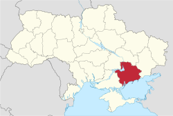
Azov Upland or Cisazov Upland is a plateau or range of hills in East Ukraine within the Donetsk and Zaporizhia oblasts. To the north it borders Dnieper...
1 KB (141 words) - 14:42, 20 February 2025

Central Russian Upland Donets-Azov Plateau Donets Upland Azov Upland Donets Ridge Black Sea-Azov Lowland Black Sea Lowland Crimean Lowland Azov Lowland Transcarpathian...
48 KB (2,524 words) - 19:41, 1 July 2025
Azov Upland. It extends to the east and to the territory of Donetsk Oblast, where it meets the Donetsk ridge. In the south, between the Azov Upland and...
27 KB (2,140 words) - 14:25, 26 April 2025
Volhynian-Podolian Upland Podolian Plateau Polesian Lowland Dnieper Lowland Dnieper Upland Kyiv Mountains Central Upland Black Sea Lowland Azov Upland / Donets...
7 KB (657 words) - 14:14, 11 February 2025

the Central Russian Upland over which runs the border with Russia. Near the Sea of Azov are the Donets Ridge and the Near Azov Upland. The snow melt from...
255 KB (22,958 words) - 17:55, 1 July 2025

composed out of several uplands such as Moldavian Plateau, Podillia Upland, Dnieper Upland, Zaporizhian Ridge, Azov Upland. Azov, Crimean, and Bugeac lowlands...
2 KB (214 words) - 19:55, 7 April 2025

has a drainage basin of 2,580 km2 (1,000 sq mi). It originates in the Azov Upland and flows into the Kakhovka Reservoir on the Dnieper. The cities of Polohy...
3 KB (231 words) - 21:18, 4 March 2025

Volnovakha, Velyka Novosilka Physical characteristics Source • location Azov Upland • coordinates 47°12′37″N 37°27′3″E / 47.21028°N 37.45083°E / 47.21028;...
6 KB (512 words) - 09:18, 6 May 2025

south. The change of river's direction is caused by its proximity to the Azov Upland located southeast of the city.[citation needed] One of the city's streets...
218 KB (19,235 words) - 15:35, 12 June 2025

Pryazovia (redirect from Azov Sea littoral)
Pryazovia. The natural Northern borders of Northwestern Pryazovia are the Azov Upland and the Donets Ridge. Major rivers include Kalmius and Mius. Largest...
9 KB (801 words) - 15:40, 2 July 2025
Upland Moldavian Plateau Roztocze Danubian Plain and Wallachian Plain Black Sea-Azov Lowland Black Sea Lowland Azov Lowland Donets-Azov Upland Azov Upland...
21 KB (155 words) - 09:31, 5 April 2025

rural hromada Polohy Raion is located on the Dnieper Lowland and the Azov Upland. The area of the district is 6 762.5 km2. Typical landscapes for Polohy...
9 KB (626 words) - 14:45, 1 July 2025
Berdyansk on the bank of Tokmak River in the geographic territory known as Azov Upland. The town is located in the middle of the Pontic steppe away from major...
3 KB (247 words) - 02:54, 6 June 2025

Azov. The population is 176,046 (2022 estimate). Berdyansk district is located on the Black Sea coast, on the Black Sea Lowland and the Azov Upland....
10 KB (675 words) - 15:07, 1 July 2025

rivers at points, including the Konka river. The raion was located in the Azov Uplands. The raion was established in March 1923 as Tsarekostiantynivka Raion...
9 KB (595 words) - 16:34, 30 October 2024

to south-east from the Slovechansk-Ovruch mountain range to the Near-Azov Upland. As the result of the denudation process only the base of those mountains...
6 KB (557 words) - 11:05, 20 June 2025
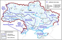
around 23,000 rivers, with most of the rivers draining into the Black Sea and Azov Sea and belonging to the larger Mediterranean basin. Those rivers mostly...
19 KB (651 words) - 11:22, 23 June 2025

south of the East European Plain. It originates in the Central Russian Upland, north of Belgorod, flows south-east through Ukraine (Kharkiv, Donetsk and...
36 KB (3,361 words) - 07:06, 4 May 2025

Central Russian Upland, on the right bank of Dnieper rises Dnieper Upland, which with Zaporizhia Ridge is connected with Donets-Azov Plateau. Geologically...
2 KB (185 words) - 20:56, 19 April 2025

stretches from southern areas of the Central Russian Upland to the northern shores of the Sea of Azov, from the eastern border with Russia to Black Sea and...
21 KB (1,841 words) - 10:44, 23 January 2025

However, by the mid-15th century, the Nogai (who lived north of the Sea of Azov) and the Crimean Khanate invaded these lands.[citation needed] The Grand...
50 KB (5,010 words) - 13:14, 2 July 2025

part of Belgorod Oblast, on the southeastern slopes of the Central Russian Upland. It flows in a northeasterly direction, and joins the Don some 15 kilometres...
2 KB (115 words) - 22:26, 6 November 2024

Peter the Great built a dockyard in Voronezh where the Azov Flotilla was constructed for the Azov campaigns in 1695 and 1696. This fleet, the first ever...
50 KB (4,603 words) - 00:09, 28 June 2025
following the Turkish Straits, the Black Sea, the Kerch Strait, the Sea of Azov and the Don (ancient Tanais). But maps produced during the 16th to 18th centuries...
241 KB (22,084 words) - 01:57, 3 July 2025

Governorate of Livonia (section Uplands)
cut by the river Emajõgi, to the south of which it is called the Otepää Upland. Near Arral, a plateau terrace of 100 feet (30 m) pushes out of itself in...
48 KB (5,246 words) - 13:56, 14 May 2025

Black Sea. To the south of the Middle European Plain stretch the central uplands and plateaus of Europe elevating to the peaks of the Alps, the Carpathian...
7 KB (748 words) - 20:35, 13 March 2025
Since then, a shallow sea has almost continuously existed between the uplands of the Fennoscandian Shield and the British Isles. This precursor of the...
137 KB (12,147 words) - 06:12, 3 July 2025

in Europe, originates in the Central Russian Upland south of Moscow and then flows into the Sea of Azov at Rostov-on-Don. The Volga, widely seen as Russia's...
52 KB (5,654 words) - 10:43, 26 June 2025

(790 sq mi). The Archeda begins in the southwestern part of the Volga Uplands. Most of its water comes from melting snow, and during periods of low water...
1 KB (93 words) - 07:17, 10 November 2024

1727, the territory of the modern Belgorod Oblast was part of the Kiev and Azov governorates. In 1727, Belgorod Governorate was established from parts of...
29 KB (3,220 words) - 08:33, 21 June 2025