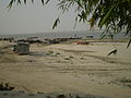
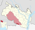
Chilmari (Bengali: চিলমারী) is an upazila of Kurigram District in the Division of Rangpur, Bangladesh. Chilmari was river port during the Pakistani and...
7 KB (572 words) - 17:07, 25 December 2023
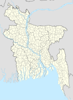
An upazila (Bengali: উপজেলা, romanized: upajēlā, lit. 'sub-district' pronounced: ['upɘdʒeːlaː]), formerly called thana, is an administrative division...
30 KB (746 words) - 17:03, 14 May 2024
are 18 villages and 08 mouzas in the union. "Chilmari Union". Bangladesh National Portal. "Bheramara Upazila". Banglapedia: National Encyclopedia of Bangladesh...
4 KB (71 words) - 15:08, 6 March 2022

as Tentulia, is the northernmost region of Bangladesh, constituting an upazila in Panchagarh District of Rangpur Division. Tetulia is geographically the...
6 KB (448 words) - 13:50, 3 February 2024

Haripur (Bengali: হরিপুর) is an 70205 code upazila of Thakurgaon District in the Division of Rangpur, Bangladesh. Haripur is located at 25°48′30″N 88°08′30″E...
6 KB (435 words) - 13:01, 22 February 2024

Jaldhaka (Bengali: জলঢাকা, Joldhaaka, means covered under water) is an upazila of Nilphamari District in the Division of Rangpur, Bangladesh. Jaldhaka...
5 KB (374 words) - 09:47, 26 April 2024

Palashbari (Bengali: পলাশবাড়ী) is an upazila of Gaibandha District in the Division of Rangpur, Bangladesh. Palashbari Upazila is located at 25°17′00″N 89°21′00″E...
6 KB (370 words) - 23:47, 20 April 2024

Taraganj Upazila, Rangpur Sadar Upazila and Saidpur Upazila on the north, Nawabganj Upazila on the south, Rangpur Sadar Upazila and Mithapukur Upazilas on the...
7 KB (564 words) - 05:51, 27 December 2023
Hakimpur is an upazila of Dinajpur District in the Division of Rangpur, Bangladesh. Hakimpur Upazila is located at 25°17′00″N 89°01′00″E / 25.2833°N...
7 KB (433 words) - 04:55, 30 May 2024

Phulchhari or Fulchhari (Bengali: ফুলছড়ি) is an upazila of Gaibandha District in the Division of Rangpur, Bangladesh. Phulchhari is located at 25°11′30″N...
4 KB (269 words) - 15:53, 24 December 2023

Gangachara (Bengali: গংগাচড়া, romanized: Gongachora) is the northernmost upazila of Bangladesh's Rangpur District, located in the Rangpur Division. There...
11 KB (1,246 words) - 17:29, 26 December 2023

flow through Ulipur. The Upazila is bounded by Chilmari and Raomari upazilas to the south, Kurigram Sadar and Rajarhat upazilas to its north, Assam state...
5 KB (379 words) - 17:13, 25 December 2023

the east, Char Rajibpur, Chilmari and Ulipur upazilas on the west. According to the 2011 Bangladesh census, Raomari Upazila had 46,871 households and...
5 KB (334 words) - 17:00, 25 December 2023

constituency by removing all portions of Chilmari Upazila, and adding the only missing union parishad of Ulipur Upazila: Saheber Alga. AKM Maidul Islam died...
23 KB (723 words) - 13:35, 24 May 2024

Upazila and part of Chilmari Upazila 28 Kurigram-4 Raomari Upazila, Char Rajibpur Upazila,part of Chilmari Upazila and part of Ulipur Upazila Gaibandha District...
28 KB (246 words) - 21:26, 10 January 2024

average of 32.4% literate. Daulatpur Upazila is divided into 14 union parishads: Adabaria, Ariaa, Boalia, Chilmari, Daulatpur, Hogalbaria, Khalishakundi...
6 KB (386 words) - 02:33, 25 April 2024

9800°N 89.7083°E / 25.9800; 89.7083 Nageshwari (Bengali: নাগেশ্বরী) is an upazila of Kurigram District in the Division of Rangpur, Bangladesh located at...
5 KB (318 words) - 17:33, 25 December 2023

Nawabganj (Bengali: নবাবগঞ্জ) is an upazila of Dinajpur District in the Division of Rangpur, Bangladesh. Nawabganj is located at 25°25′00″N 89°05′00″E...
6 KB (517 words) - 16:54, 27 December 2023

India. Char Rajibpur Upazila: island subdistrict in the south of Kurigram. Only accessible via water transport. Chilmari Upazila: subdistrict found on...
18 KB (1,289 words) - 18:06, 30 January 2024

into 82 mauzas and 103 villages. Adabaria Union Aria Union Boalia Union Chilmari Union Daulatpur Union Hogolbaria Union Khalishakundi Union Moricha Union...
5 KB (416 words) - 06:08, 14 January 2022
parliament for the Kurigram-4 constituency. Sarkar is the president of Chilmari Upazila BNP. He was elected to parliament from Kurigram-4 as a Bangladesh Nationalist...
3 KB (118 words) - 07:02, 23 August 2023

Rangpur, Bangladesh. Birampur is an important city near India Border. This upazila is 256 km away from Capital Dhaka and nearly 56 km away from Dinajpur City...
9 KB (825 words) - 16:40, 27 December 2023

Lalmonirhat Sadar (Bengali: লালমনিরহাট সদর) is an upazila of Lalmonirhat District in the Division of Rangpur, Bangladesh. Its headquarters are in Lalmonirhat...
5 KB (328 words) - 06:38, 27 December 2023

Ghoraghat (Bengali: ঘোড়াঘাট) is an upazila of Dinajpur District in the Division of Rangpur, Bangladesh. Ghoraghat was established in the time of Bakhtlar...
14 KB (1,483 words) - 12:18, 2 June 2024

Debiganj (Bengali: দেবীগঞ্জ) is an upazila of Panchagarh District in the Division of Rangpur, Bangladesh. Debiganj Upazila is located at 26°07′07″N 88°45′33″E...
6 KB (408 words) - 15:06, 28 December 2023

69 km2. Chirirbandar Upazila is bounded by Khansama Upazila on the north, Parbatipur Upazila in Dinajpur District and Saidpur Upazila in Nilphamari District...
6 KB (470 words) - 17:04, 27 December 2023

Fulbari Upazila is bounded by Parbatipur and Chirirbandar Upazilas on the north, Nawabganj and Birampur Upazilas on the east, Birampur Upazila on the south...
10 KB (807 words) - 16:46, 27 December 2023
Upazila is bounded by Bochaganj and Kaharole Upazilas on the north, Dinajpur Sadar Upazila and Punarbhaba River on the east, Dinajpur Sadar Upazila and...
6 KB (430 words) - 17:21, 27 December 2023

(Bengali: গোবিন্দগঞ্জ) is an Upazila of Gaibandha District and the Division of Rangpur. It is one of the largest upazila in Bangladesh including 17 unions...
7 KB (545 words) - 17:35, 23 April 2024

Birganj (Bengali: বীরগঞ্জ) is an upazila of Dinajpur District in the division of Rangpur, Bangladesh. Birganj is located "between 25°48' and 26°04' north...
7 KB (455 words) - 21:33, 25 March 2024