
The Cold Spring Canyon Arch Bridge in the Santa Ynez Mountains links Santa Barbara, California with Santa Ynez, California. The bridge is signed as part...
8 KB (684 words) - 05:52, 16 April 2025
California Cold Spring Canyon Arch Bridge, California Cold Spring, Kentucky Cold Spring, Minnesota Cold Spring, New Jersey Cold Spring Grange Hall, listed...
2 KB (315 words) - 00:01, 1 July 2024

Santa Barbara episode of the Cooking Channel's Man v. Food. Cold Spring Canyon Arch Bridge Santa Ynez Valley Meier, Marcia (November 14, 2010) "Keeping...
4 KB (322 words) - 00:37, 15 August 2024
Petersburg Times. "Cold Spring Bridge Site of 55th Suicide". Santa Barbara Independent. 2011-02-23. Retrieved 2011-02-23. "Cold Spring Canyon Bridge". California...
33 KB (3,125 words) - 05:01, 19 June 2025
Forest, and across the Cold Spring Canyon Arch Bridge, where Cold Spring Tavern is on Stagecoach Road which passes below the bridge. Nearby it crosses Camino...
9 KB (958 words) - 17:52, 13 June 2025

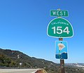
Barbara and Los Olivos is provided by SR 154 capped by the Cold Spring Canyon Arch Bridge near the summit of San Marcos Pass. SR 154 cuts directly between...
6 KB (648 words) - 16:41, 20 November 2024
battle. Road Trip with Huell Howser Episode 108 State Route 154 Cold Spring Canyon Arch Bridge Santa Ynez Valley Santa Ynez Mountains Santa Barbara, California...
6 KB (668 words) - 03:03, 27 March 2024
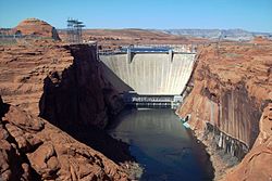
Glen Canyon Dam is a concrete arch-gravity dam in the southwestern United States, located on the Colorado River in northern Arizona, near the city of...
118 KB (14,230 words) - 02:30, 6 July 2025

Gorge Bridge—876' Foresthill Bridge—730' Glen Canyon Dam Bridge—700' Phil G. McDonald Bridge—700' Rio Grande Gorge Bridge—565' Perrine Bridge—486' Navajo...
37 KB (1,202 words) - 02:12, 3 July 2025

which runs California State Route 154 capped by the magnificent Cold Spring Canyon Arch Bridge near the summit. The highest point, an unnamed and unmarked...
13 KB (1,493 words) - 16:52, 25 May 2025
caption pages HAER No. UT-70-A, "Arches National Park Main Entrance Road, Moab Canyon Wash Culvert, Spanning Moab Canyon wash", 3 photos, 6 data pages,...
45 KB (4,002 words) - 22:11, 4 June 2025
States Arches National Park Dark Canyon Wilderness Glen Canyon National Recreation Area Manti-La Sal National Forest Muley Point Rainbow Bridge National...
16 KB (1,235 words) - 22:15, 6 June 2025
Grass Valley Carquinez Bridge, San Francisco Bay Area Cold Spring Canyon Arch Bridge, Santa Barbara County Confusion Hill Bridges, Mendocino County, crossing...
102 KB (9,331 words) - 02:12, 3 July 2025

Bridge Mountain (left) and The West Temple seen from the east Crawford Arch on Bridge Mountain Mountains portal Geology of the Zion and Kolob canyons...
5 KB (355 words) - 10:21, 5 January 2025

Hoover Dam (redirect from Boulder Canyon Project)
The Hoover Dam is a concrete arch-gravity dam in the Black Canyon of the Colorado River, on the border between the U.S. states of Nevada and Arizona. Constructed...
95 KB (10,824 words) - 05:47, 5 July 2025

to August can be foggy and cold, known locally as "June Gloom". The Pfeiffer family built the first home in Sycamore Canyon near the coast in the winter...
5 KB (447 words) - 15:13, 7 April 2024

Canyonlands National Park (redirect from Canyon Rims Recreation Area)
Arch in the Needles district Raft in the Big Drop Rapids, Cataract Canyon A view from Grand View Point Overlook toward Monument Basin Shafer Canyon and...
55 KB (4,674 words) - 05:15, 29 June 2025

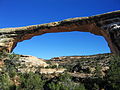
Devils Garden (Grand Staircase–Escalante National Monument) (category Natural arches of Utah)
based on the natural arch formation chapter in reference Barnes, F. A., Canyon Country Arches and Bridges". The Natural Arch and Bridge Society (NABS). Archived...
25 KB (2,065 words) - 09:21, 23 March 2025

The Grand Canyon is a steep-sided canyon carved by the Colorado River in Arizona, United States. The Grand Canyon is 277 miles (446 km) long, up to 18...
137 KB (14,012 words) - 05:16, 11 July 2025
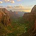
Zion National Park (redirect from Zion Canyon National Park)
Zion National Park includes mountains, canyons, buttes, mesas, monoliths, rivers, slot canyons, and natural arches. The lowest point in the park is 3,666 ft...
61 KB (5,680 words) - 11:32, 11 July 2025

natural bridge. Frying Pan Trail: an 8.8-mile (14.2 km) round trip that passes the Cassidy Arch, Grand Wash, and Cohab Canyon. Brimhall Natural Bridge: a popular...
42 KB (4,322 words) - 05:01, 3 June 2025
granary and pithouse can be seen on the canyon walls and along the trail. Mormons settled the valley near the bridge in the 1880s and established nearby Junction...
7 KB (705 words) - 15:44, 2 April 2024

permitted to climb up, walk and even drive on the bridges. Now the arch is closed to public access. Natural Bridges State Beach is home to a eucalyptus grove...
12 KB (1,101 words) - 08:40, 15 August 2024

Letchworth State Park (redirect from Grand Canyon of the East)
Middle Falls Genesee River Canyon downstream of the falls Genesee Arch Bridge and Upper Falls in July 2022 Genesee Arch Bridge and Upper Falls in late winter...
26 KB (2,832 words) - 01:19, 13 June 2025

Three Penguins (category Arches National Park)
located in a cold semi-arid climate zone with cold winters and hot summers. Spring and fall are the most favorable seasons to experience Arches National Park...
7 KB (576 words) - 05:34, 7 January 2025
Course of San Juan Creek (redirect from San Juan Canyon)
narrows again to a steep canyon, receiving Lion Canyon on the right bank. It is crossed by the first major bridge, a stone arch bridge carrying Ortega Highway...
13 KB (1,607 words) - 13:55, 7 May 2025
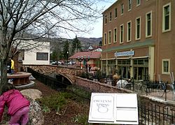
several steps between 1887 and 1934. The Iron Springs neighborhood is located in lower Englemann Canyon, along Ruxton Creek.: ix It is the site of trailheads...
24 KB (2,513 words) - 01:32, 24 January 2025

Colorado River (section Boulder Canyon Project)
Park, the Colorado enters Cataract Canyon, named for its dangerous rapids, and then Glen Canyon, known for its arches and erosion-sculpted Navajo sandstone...
247 KB (23,484 words) - 03:28, 6 July 2025
Savona, British Columbia (section Ferries and bridges)
northwest of Savona on the Deadman River. About 1858, during the Fraser Canyon Gold Rush, François Saveneux established a ferry across the fast current...
72 KB (5,552 words) - 23:41, 3 February 2025

Frank Church and the Hells Canyon Controversy." Montana: The Magazine of Western History 51 (Spring 2001): 36–51. "Hells Canyon National Recreation Area"...
9 KB (711 words) - 21:29, 28 June 2025