
ferry service flying from Valbiska port, accessed by the D104 road, thereby allowing the D104 traffic volume to be deduced. Substantial variations between...
5 KB (216 words) - 09:31, 2 February 2024

Great East Road links north to Lundazi (using the M12 road from Chipata), north-west to the South Luangwa National Park (using the D104 road from Chipata)...
15 KB (1,845 words) - 11:04, 23 May 2024

D104, D. 104, or D-104 may refer to: D104 road, a road in Croatia D-104 microphone, a microphone commonly used in broadcasting D. 104, The Symphony No...
234 bytes (66 words) - 00:42, 26 July 2021
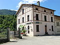
The D104 road also goes from the village over a tortuous mountain route to Arandas in the south-west. There are also many small mountain roads in the...
7 KB (503 words) - 15:10, 3 May 2024

residents are known as Yportais or Yportaises. Yport is located on the D104 road, about 19 miles (31 km) north of Le Havre, on the coast of the English...
5 KB (472 words) - 12:51, 22 May 2024

a commune in the Côte-d'Or department in eastern France. It is on the D104 road, 23 km north west of Beaune. The village is on the Lacanche river, and...
2 KB (96 words) - 18:41, 1 August 2023
Malinska and 9 km from Krk town. The village is located just off the D104 Road The emergence of Nenadic was associated with the migration of the Vlaška...
4 KB (410 words) - 14:38, 23 September 2023

Highways in Croatia (redirect from D401 road)
Avenue in Zagreb, designated as Ž1040, a county road. Other than the motorway routes, the national road classification includes the following enumerated...
61 KB (2,624 words) - 17:31, 13 May 2024

Vincly is located 21 miles (33 km) northeast of Montreuil-sur-Mer on the D104 road. The church of St.Thomas of Canterbury, dating from the sixteenth century...
2 KB (109 words) - 04:35, 24 April 2024

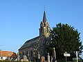
(16 km) northwest of Rouen at the junction of the D6015, D143 and the D104 roads. SNCF operates a TER rail service here. The church of St.Martin, dating...
4 KB (322 words) - 20:09, 26 March 2024
and about 10 km is the town of Krk. The village is located just off the D104 Road. In ancient times this area was inhabited by the Illyrians. In the Middle...
5 KB (546 words) - 14:56, 23 September 2023
List of highways numbered 104 (redirect from State Road 104)
List of A104 roads B104 road D104 road N104 (France) P104 R104 road (Ireland) R104 (South Africa) This article includes a list of roads, streets, highways...
6 KB (410 words) - 15:24, 9 April 2024

Joyeuse Juèsa (Occitan) Commune The railway station car park and the D104 road, with the chateau and the church beyond Coat of arms Location of Joyeuse...
5 KB (354 words) - 11:50, 20 April 2024

a state road connecting D100 state road to Merag ferry port, from where Jadrolinija ferries fly to Valbiska, Krk and D104 state road. The road is 10.9 km...
4 KB (186 words) - 01:41, 5 February 2023

village situated some 16 miles (26 km) east of Montreuil-sur-Mer on the D104 road. Communes of the Pas-de-Calais department "Répertoire national des élus:...
2 KB (101 words) - 06:33, 4 August 2023
immediately to the west of Bourges at the junction of the D104 with the D60 and the N76 with the D400 road. The church, dating from the eleventh century. The...
4 KB (298 words) - 16:36, 1 August 2023

village 20 miles (32 km) west of Arras at the junction of the D103 and D104 roads. The church of St.Martin, dating from the sixteenth century. Traces of...
2 KB (133 words) - 06:35, 4 August 2023

needed] Reclinghem lies about 12 miles (19 km) south of Saint-Omer, on the D104 road, by the banks of the river Lys. The eighteenth century church of St. Firmin...
3 KB (143 words) - 06:50, 4 August 2023

state road, D104 branches off to the southwest towards Valbiska ferry port. D102 bypasses the city of Krk, and proceeds southeast to Baška. The road, as...
9 KB (325 words) - 09:31, 2 February 2024

by the D35 road from Pont-de-Pany in the north-west passing through the north of the commune and continuing south-east to Urcy. The D104 road forms most...
8 KB (498 words) - 06:49, 5 January 2024

Séricourt lies 25 miles (40 km) west of Arras, at the junction of the D82 and D104 roads. The church of St.Martin, dating from the sixteenth century. A restored...
2 KB (120 words) - 06:53, 4 August 2023

state road and to Lopar ferry port from where Jadrolinija ferries fly to Valbiska, Krk and the D104. The road is 22.7 km (14.1 mi) long. The road, as well...
6 KB (231 words) - 09:31, 2 February 2024

of natural rainfall". Journal of Geophysical Research: Atmospheres. 107 (D104): ACH 9.1–ACH 9.6. Bibcode:2002JGRD..107.4198Z. doi:10.1029/2001JD001332...
5 KB (628 words) - 21:57, 16 February 2023

miles (43 km) west of Arras, at the junction of the D109, D111, D104 and D916 roads. The church of St.Michel, dating from the seventeenth century. Communes...
3 KB (119 words) - 06:48, 4 August 2023
30 miles (50 km) west-northwest of Arras at the junction of the D104 with the D99 road. The inhabitants are called Beauvoisains in French. The church of...
2 KB (133 words) - 07:55, 6 February 2024
located 24 miles (37 km) west of Arras at the junction of the D101 and D104 roads. The inhabitants are called Croisettois. The church of St. Martin, dating...
3 KB (145 words) - 06:34, 4 August 2023

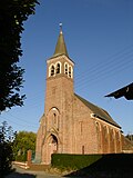
Senlis is located 15 miles (24 km) east of Montreuil-sur-Mer on the D104 road. The church of Notre-Dame, dating from the thirteenth century Communes...
2 KB (107 words) - 06:53, 4 August 2023

(14 km) northwest of Rouen, at the junction of the D6015, D47 and the D104 roads. The A151 autoroute passes through the commune's territory. The commune...
3 KB (160 words) - 11:44, 2 July 2023

(14 km) northeast of Rouen at the junction of the D6015, D47 and the D104 roads. The A151 autoroute passes through the commune's territory. The church...
3 KB (124 words) - 12:31, 23 September 2022