Eight Mile Creek is a rural locality in the Shire of Burdekin, Queensland, Australia. In the 2021 census, Eight Mile Creek had "no people or a very low...
4 KB (239 words) - 21:48, 25 May 2024

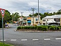
Eight Mile Plains is an outer southern suburb in the City of Brisbane, Queensland, Australia. In the 2021 census, Eight Mile Plains had a population of...
30 KB (2,970 words) - 20:53, 12 June 2024
Australia Eight Mile Creek, South Australia, a locality in the local government area of the District Council of Grant Eight Mile Plains, Queensland, a suburb...
1 KB (220 words) - 16:35, 8 May 2024
Eightmile Creek or Eight Mile Creek may refer to: in Australia Eight Mile Creek, Queensland, a rural locality in the Shire of Burdekin Eight Mile Creek (South...
942 bytes (163 words) - 15:54, 23 March 2021
Bald Hills Gateway Motorway between Bald Hills and Eight Mile Plains Pacific Motorway between Eight Mile Plains and Tugun The Pacific Motorway continues...
11 KB (843 words) - 13:49, 31 January 2024

preference to Eight Mile Plains or Spring Creek, the name then used to distinguish the area from Eight Mile Plains).[citation needed] The Spring Creek Township...
16 KB (1,714 words) - 08:58, 17 June 2024
"Six Mile Rocks – rock in City of Brisbane (entry 31014)". Queensland Place Names. Queensland Government. Retrieved 26 December 2020. "Toowong Creek – watercourse...
20 KB (2,147 words) - 21:00, 12 June 2024

business district to Eight Mile Plains in Queensland, Australia. The busway was completed to Woolloongabba in September 2000 and to Eight Mile Plains in April...
16 KB (1,264 words) - 09:39, 30 June 2023

Queensland Railways. Components of it include Stoney Creek Bridge, the Rail Bridge over Christmas Creek, Kuranda railway station, and Surprise Creek Rail...
69 KB (10,284 words) - 11:10, 22 December 2023

located in suburban Brisbane in the South East region of Queensland, Australia. The Bulimba Creek catchment has it sources in the low plateaus and marshy...
16 KB (1,390 words) - 05:26, 13 April 2024

17 May 2021. Retrieved 11 February 2022. "Oxley Creek (entry 25701)". Queensland Place Names. Queensland Government. Retrieved 7 April 2012. Fones 2006...
39 KB (3,833 words) - 20:52, 12 June 2024

coordinates) Seventeen Mile Rocks is a suburb in the City of Brisbane, Queensland, Australia. In the 2021 census, Seventeen Mile Rocks had a population...
14 KB (1,351 words) - 00:06, 13 June 2024
park-and-ride, or the nearby Garden City Interchange or Eight Mile Plains busway station. The nearest Queensland Rail suburban railway stations are Altandi, Sunnybank...
13 KB (1,172 words) - 03:37, 13 June 2024

Leichhardt Highway (redirect from A5 highway (Queensland))
(Map). Eight Mile Plains Queensland: Hema Maps. pp. 8/11. ISBN 978-1-86500-456-3. The State Road Network of Queensland (PDF) (Map). Queensland Government...
9 KB (266 words) - 22:59, 27 May 2024
hectares or 8.38% of Queensland's landmass was protected. Anderson Street Archer Point Baddow Island Baffle Creek Bakers Creek Baldwin Swamp Bare Hill...
125 KB (3,695 words) - 01:44, 31 May 2024

before which it was known as Four Mile Camp. The name Coorparoo is likely derived from an Aboriginal name for Norman Creek, probably recorded by early surveyors...
56 KB (5,740 words) - 21:06, 12 June 2024

Pacific Motorway (Brisbane–Brunswick Heads) (category Highways in Queensland)
May 2020. "Pacific Motorway Eight Mile Plains to Daisy Hill Upgrade (Sports Drive to Gateway Motorway upgrade)". Queensland Government. 15 July 2022. Retrieved...
52 KB (3,296 words) - 02:49, 11 January 2024
Road and 4WD Atlas (Map). Eight Mile Plains Queensland: Hema Maps. p. 95. ISBN 978-1-86500-456-3. Kakadu Highway, Pine Creek to Jabiru, ExplorOz. Retrieved...
2 KB (88 words) - 04:33, 15 April 2023
Teys Australia (category Articles incorporating text from the State Library of Queensland)
company headquartered at Building 3, Freeway Office Park, 2728 Logan Rd, Eight Mile Plains QLD 4113, Australia. In 2014, it was Australia's second-largest...
6 KB (542 words) - 18:39, 26 April 2024

Runcorn would have been in the territory of the Chepara clan of Eight Mile Plains, Queensland.[citation needed] Originally a part of Coopers Plains, the area...
20 KB (2,257 words) - 23:47, 12 June 2024

the project as the Eight Mile Camp. This first stage opened in November 1887 at which time the railway station at the Eight Mile Camp was named Redlynch...
18 KB (1,663 words) - 09:49, 6 June 2024

Albion, Queensland. "Albion". Queensland Places. Centre for the Government of Queensland, University of Queensland. "Breakfast Creek". Queensland Places...
35 KB (3,349 words) - 23:21, 12 June 2024

residents) is an inner suburb of the City of Brisbane, the state capital of Queensland, Australia. In the 2021 census, Fortitude Valley had a population of 9...
49 KB (5,073 words) - 21:03, 12 June 2024
in Queensland. It lists people who were executed by British (and from 1901, Australian) authorities within the modern-day boundaries of Queensland. For...
24 KB (2,891 words) - 22:27, 5 January 2023
Hills "Queensland Places – Kuraby". Centre for the Government of Queensland. Retrieved 19 February 2015. "EIGHT-MILE PLAINS". Logan Witness. Queensland, Australia...
5 KB (291 words) - 11:42, 17 February 2024

Woolloongabba (redirect from One Mile Swamp, Queensland)
(/wʊlənˈɡæbə/ wuu-lən-GAB-ə) is an inner southern suburb in the City of Brisbane, Queensland, Australia. In the 2021 census, Woolloongabba had a population of 8,687...
52 KB (5,302 words) - 20:45, 12 June 2024

Gregory Highway (redirect from A7 highway (Queensland))
2014. Hema, Maps (2007). Australia Road and 4WD Atlas (Map). Eight Mile Plains Queensland: Hema Maps. pp. 10&13. ISBN 978-1-86500-456-3. "Gregory Developmental...
14 KB (691 words) - 05:47, 20 January 2024

England Creek is a rural locality split between Somerset Region and City of Brisbane, Queensland, Australia. In the 2021 census, England Creek had a population...
5 KB (306 words) - 00:03, 13 June 2024
Queensland, Australia. In the 2021 census, Sharon had a population of 1,209 people. The locality is bounded to the north and east by Splitters Creek and...
13 KB (1,114 words) - 03:23, 30 May 2024
School opened on 7 March 1922. It closed in 1939. It was located at the Eight Mile Siding on the Japoon Tramline via Innisfail. In the 2016 census, Bombeeta...
3 KB (191 words) - 04:58, 22 May 2024