information system ArcGIS GIS and aquatic science Clark, Michael (May 1998). "Putting water in its place: a perspective on GIS in hydrology and water management"...
8 KB (896 words) - 06:30, 14 April 2025

processes and by the advent of computers and especially geographic information systems (GIS). (See also GIS and hydrology) The central theme of hydrology is...
41 KB (4,161 words) - 10:23, 25 May 2025

Geographic information system (redirect from GIS)
geographic information system (GIS) consists of integrated computer hardware and software that store, manage, analyze, edit, output, and visualize geographic data...
102 KB (13,199 words) - 20:26, 22 May 2025
Stream order (category Hydrology)
or waterbody order is a positive whole number used in geomorphology and hydrology to indicate the level of branching in a river system. There are various...
11 KB (1,553 words) - 15:16, 7 May 2025

geographic information systems (GIS). Internet GIS is an outgrowth of traditional GIS, and represents a shift from conducting GIS on an individual computer...
21 KB (2,233 words) - 13:52, 23 May 2025

European Plain (section Hydrology)
European Plain is a plain in Europe and is a major feature of one of four major topographical units of Europe – the Central and Interior Lowlands. It is the...
7 KB (748 words) - 20:35, 13 March 2025

Web GIS, also known as Web-based GIS, are Geographic Information Systems (GIS) that employ the World Wide Web (the Web) to facilitate the storage, visualization...
26 KB (2,931 words) - 15:11, 23 May 2025

teaching GIS and other geospatial technologies. This book is noted as having expanded the term "GIScience" to "GIScience and technology" (GIS&T). In 2009...
83 KB (8,593 words) - 16:57, 25 May 2025

Hydrological transport model (redirect from Hydrology transport model)
networks and system identification. These models are known as stochastic hydrology models. Data based models have been used within hydrology to simulate...
19 KB (2,361 words) - 11:26, 9 April 2025

Physical geography (section Journals and literature)
science. Hydrology is predominantly concerned with the amounts and quality of water moving and accumulating on the land surface and in the soils and rocks...
21 KB (2,619 words) - 17:53, 16 May 2025
geography Household electricity approach Human ecology Human settlement Hydrology Ice island Incorporation of nature within a city Indian subcontinent Indices...
4 KB (360 words) - 20:07, 24 November 2024
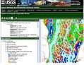
Geographic Information Systems (GIS) has become an integral part of aquatic science and limnology. Water by its very nature is dynamic. Features associated...
9 KB (1,012 words) - 00:58, 12 December 2023
Medieval Islamic geography and cartography refer to the study of geography and cartography in the Muslim world during the Islamic Golden Age (variously...
40 KB (4,688 words) - 15:41, 26 May 2025

Dirhami has a cargo and passenger port, a post office and the hydrology station of the Estonian Institute of Meteorology and Hydrology. There is also a bus...
2 KB (120 words) - 06:04, 25 January 2025
Flood Modeller (category Hydrology models)
perform rapid assessments of flooding. Hydrology Surface-water hydrology Hydrological transport model HEC-RAS SWMM GIS Computer simulation "Benchmarking the...
4 KB (363 words) - 09:21, 28 April 2025
Soil and Water Assessment Tool (SWAT) is a free and open source hydrology model and GIS computer simulation sponsored by the USDA. SWAT is a well known...
1 KB (107 words) - 20:19, 23 March 2022
Geography (section Origin and history)
assistance of some form of GIS software. The science of using GIS software and GIS techniques to represent, analyse, and predict the spatial relationships...
89 KB (9,101 words) - 03:26, 2 June 2025
Geographic information science (redirect from GIS&T)
systems (GIS), which are the actual repositories of geospatial data, the software tools for carrying out relevant tasks, and the profession of GIS users...
10 KB (992 words) - 08:59, 9 February 2025
list of GIS data sources (including some geoportals) that provide information sets that can be used in geographic information systems (GIS) and spatial...
44 KB (559 words) - 04:34, 1 June 2025
Dana Tomlin (section Contributions to GIS)
new maps. Tomlin's teaching and research focus on the development and application of geographic information systems (GIS). He is currently a professor...
6 KB (637 words) - 10:54, 27 May 2025
Geospatial metadata (redirect from GIS metadata)
metadata applicable to geographic data and information. Such objects may be stored in a geographic information system (GIS) or may simply be documents, data-sets...
17 KB (2,003 words) - 07:56, 12 March 2025

Geographer (section Institutions and societies)
human society and culture. Some geographers are practitioners of GIS (geographic information system) and are often employed by local, state, and federal government...
14 KB (1,304 words) - 10:55, 24 May 2025
UDig (category Free GIS software)
vector operations and also embeds JGRASS and specialized hydrology tools from the Horton Machine. It supports shapefiles, PostGIS, WMS, and many other data...
3 KB (169 words) - 23:36, 18 April 2024
Washington, D.C. 114 p. Rosenthal, W., R. Srinivasan, and J.G. Arnold. 1993. A GIS watershed hydrology model link to evaluate water resources of the Lower...
5 KB (598 words) - 18:53, 28 May 2025

K; Singh, Vijay P (2007). Hydrology and Water Resources of India. Springer. ISBN 9781402051807. Application Of GIUH And GIS Based Approach For Design...
4 KB (205 words) - 07:26, 27 April 2025
Arizona Geographic Information Council (category Geographic data and information organizations in the United States)
primary forum and oversight group for coordination efforts related to geographic information systems (GIS). AGIC identifies standards and implementation...
4 KB (368 words) - 17:16, 6 March 2024
used computer simulations and seismic data. The gravity anomaly, or "gravity hole", is centered southwest of Sri Lanka and Kanyakumari, the southernmost...
5 KB (607 words) - 23:39, 26 April 2025
ability of a system to meet the needs of a stakeholder or other user. Before GIS (a computerized method that helps to determine suitability analysis) was...
19 KB (2,583 words) - 02:55, 9 October 2024
Geostatistics Glaciology (Geology and Hydrology) Gravimetry (Geophysics) Historical geology Human geography Hydrogeology Hydrology Hydrometeorology Hydrosphere...
4 KB (310 words) - 03:35, 7 September 2024
traditions of geography. It focuses on the interaction of different cultural and natural geofactors in a specific land or landscape, while its counterpart...
5 KB (609 words) - 12:12, 19 October 2024