
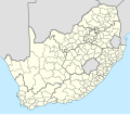
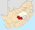
Gariep Local Municipality is a defunct local municipality in Joe Gqabi District Municipality, Eastern Cape. The municipality was merged with Maletswai...
8 KB (228 words) - 21:45, 6 April 2024

District Municipality, in the Eastern Cape province of South Africa. The municipality was formed by merging the Maletswai and Gariep local municipalities immediately...
7 KB (233 words) - 07:07, 7 April 2024
of the country is divided into district municipalities, each of which consists of several local municipalities. Since the boundary reform at the time of...
76 KB (229 words) - 17:32, 2 May 2024

Local Municipality was an administrative area in the Joe Gqabi District of the Eastern Cape in South Africa. The municipality was merged with Gariep Local...
9 KB (314 words) - 00:19, 19 September 2023

divided, for local government purposes, into two metropolitan municipalities (Buffalo City and Nelson Mandela Bay) and six district municipalities. The district...
13 KB (103 words) - 16:36, 15 January 2024

Venterstad (category Populated places in the Walter Sisulu Local Municipality)
is one of the smaller towns that currently forms part of the Gariep Local Municipality, with its seat in Burgersdorp. The town and its surrounding areas...
5 KB (169 words) - 12:42, 5 September 2022

abuts on the Gariep Local Municipality to the north, the Maletswai Local Municipality to the northeast, the Emalahleni Local Municipality to the east,...
10 KB (445 words) - 18:27, 15 January 2022

Local Municipalities such as in the Cacadu District Municipality, contain white percentages exceeding 10%, with the highest being the Kouga Local Municipality...
107 KB (2,349 words) - 09:45, 6 May 2024

Gariep Dam (Afrikaans: Gariepdam), founded as "Oranjekrag", is a settlement in Xhariep District Municipality in the Free State (province) of South Africa...
4 KB (129 words) - 04:45, 5 May 2024
Ethnic groups in South Africa by municipality details the ethnic composition of South Africa by municipality, according to the 2011 census. Demographics...
30 KB (39 words) - 04:05, 27 April 2022
municipality is the largest in the Free State geographically and is known for its vast land. It is home to the largest dam in the county, the Gariep Dam...
12 KB (267 words) - 22:02, 29 October 2023
The Gariep Arts Festival, also known as the Gariep Kunstefees, is an annual four-day Afrikaans local music event that happens in the city of Kimberly,...
4 KB (514 words) - 14:47, 13 February 2024

Steyn previously served as a municipal councillor of the former Gariep Local Municipality in the Eastern Cape, before her election to the National Assembly...
9 KB (540 words) - 21:19, 1 September 2023
Oviston (category Populated places in the Walter Sisulu Local Municipality)
Africa. Township 8 km north of Venterstad, on the southern bank of the Gariep Dam. It was established in 1964-65 to accommodate workers on the Orange-Fish...
4 KB (105 words) - 14:54, 24 January 2024
Matjhabeng Local Municipality 408,170 47,052 11.53% NW404: Maquassi Hills Local Municipality 69,034 7,678 11.12% EC105: Ndlambe Local Municipality 55,476...
19 KB (176 words) - 21:58, 26 May 2024

West Local Municipality, and was the largest party in the Cederberg Local Municipality but did not hold a majority there. Five local municipalities were...
49 KB (1,686 words) - 16:20, 5 September 2023

the Free State at Gariep Dam – Transfer Scheme (Additional Documentaries Resource), about 5 hours away at 462 km. The water from Gariep Dam is transferred...
90 KB (8,312 words) - 15:45, 29 May 2024

from an earlier Kora Khoekhoe or !Orakobab name, sometimes spelled as Tky-Gariep (in Khoekhoegowab orthography it is ǀHai!garib, drab river). Both Vaal and...
17 KB (1,740 words) - 09:07, 18 March 2024

Northern Cape (section Municipalities)
Western Cape – south and southwest The major river system is the Orange (or Gariep) River Basin, draining the interior of South Africa westwards into the Atlantic...
28 KB (2,550 words) - 10:01, 23 April 2024

Prieska (category Populated places in the Siyathemba Local Municipality)
only in the town but bordering district towns. A first in the history of Gariep High School which is a semi developed school. Gert Thys - marathon runner...
6 KB (260 words) - 14:33, 4 October 2022

Rouxville (category Populated places in the Mohokare Local Municipality)
locations - Zastron (30 km), Aliwal North (34 km), Smithfield (35 km), Gariep Dam (60 km) and Bethulie. Lady Grey, the Witteberg mountain range (with...
7 KB (477 words) - 14:14, 13 November 2022
De Aar (category Populated places in the Emthanjeni Local Municipality)
just as the sun sets to spend the night. Doornkloof Nature Reserve Karoo Gariep Conservancy Rolfontein Nature Reserve Hamilton Jansen Tourism Officer, General...
14 KB (1,004 words) - 13:51, 21 January 2024

country, dams and irrigation are extremely important: the largest dam is the Gariep on the Orange River. Like much of the African continent south of the Sahara...
50 KB (5,916 words) - 11:56, 26 May 2024

De Aar Wind Farm (category Pixley ka Seme District Municipality)
The De Aar Wind Energy Facility is a wind farm in the Emthanjeni Local Municipality, built on the Maanhaarberg near De Aar in the Northern Cape province...
3 KB (76 words) - 00:45, 26 May 2024

Khi Solar One (category Dawid Kruiper Local Municipality)
from South Country South Africa Location Upington (Dawid Kruiper Local Municipality) Coordinates 28°32′14″S 21°4′39″E / 28.53722°S 21.07750°E / -28...
7 KB (583 words) - 07:03, 8 May 2023
Gift van Staden (category People from Pixley ka Seme District Municipality)
Democratic Teachers Union (SADTU). He soon worked as a site steward at the Gariep High School in Prieska. He was elected to the Prieska transitional council...
6 KB (442 words) - 02:59, 27 April 2022
which is privately owned. Most other public airports are owned by local municipalities although there are also a significant number of privately owned airports...
45 KB (470 words) - 04:57, 11 November 2023
kilometres (12 mi), south of the Seriti Coal Mine in New Denmark, Lekwa Local Municipality, Gert Sibande District, Mpumalanga Province. New Denmark is located...
6 KB (528 words) - 12:51, 14 April 2024

Kouga Dam (category Kouga Local Municipality)
on the Kouga River about 21 km (13 mi) west of Patensie in Kouga Local Municipality, South Africa. It supplies irrigation water to the Kouga and Gamtoos...
4 KB (219 words) - 06:15, 27 April 2022
is located near the former mining town of Copperton, in Siyathemba Local Municipality, in the Karoo Region, in Northern Cape Province. This is approximately...
6 KB (504 words) - 04:26, 11 October 2023