The Ministry of Development Planning and Statistics (Arabic: وزارة التخطيط التنموي والإحصاء) is a governmental agency in the State of Qatar. It was established...
2 KB (131 words) - 23:18, 16 March 2025
The Ministry of Planning Development & Special Initiatives (Urdu: وزارت منصوبہ بندی ترقی و خصوصی امور , abbreviated as MoPD) is headed by the Minister...
8 KB (465 words) - 01:39, 15 March 2025

Al Rayyan (category Burial sites of the House of Thani)
Ministry of Development Planning and Statistics. Retrieved 9 July 2018. "Qatar Development Atlas - Part 1" (PDF). Ministry of Development Planning and...
49 KB (3,558 words) - 21:54, 21 May 2025

Al Daayen (category Municipalities of Qatar)
Ministry of Development Planning and Statistics. 2010. p. 215. Retrieved 11 July 2018. "Geo Statistics Application". Ministry of Development Planning...
33 KB (2,905 words) - 02:07, 5 May 2025

Al Khor (category Municipalities of Qatar)
statistics in State of Qatar" (PDF). Ministry of Development Planning and Statistics. 2015. p. 30. Retrieved 12 July 2018. "Environmental statistics in...
56 KB (4,441 words) - 04:32, 5 July 2025

Ministry of Development Planning and Statistics. Retrieved 27 August 2018. "Qatar in Figures" (PDF). Ministry of Development Planning and Statistics....
12 KB (946 words) - 04:39, 20 July 2025
Durham e-Thesis. p. 325. "Qatar Landmarks". Ministry of Development Planning and Statistics. Retrieved 7 January 2019. Louay Y. Bahry (Summer 2001)....
9 KB (659 words) - 04:45, 22 July 2025

Umm Salal (category Municipalities of Qatar)
Development Planning and Statistics. 2010. p. 183. Retrieved 12 July 2018. "Qatar Development Atlas - Part 2" (PDF). Ministry of Development Planning...
45 KB (3,627 words) - 22:00, 29 April 2025

Al Jemailiya (section Qatar National Master Plan)
Ministry of Development Planning and Statistics. Retrieved 15 February 2019. "2015 Population census" (PDF). Ministry of Development Planning and Statistics...
20 KB (1,692 words) - 04:46, 26 July 2025
Map". Ministry of Development Planning and Statistics. Retrieved 11 February 2019. "Qatar Development Atlas - Part 1" (PDF). Ministry of Development Planning...
14 KB (453 words) - 06:20, 27 July 2025
Gender, Municipality And Zone". Ministry of Development Planning and Statistics. March 2004. Retrieved 9 August 2017. "Law No. 12 of 2006 concerning the...
7 KB (470 words) - 18:34, 2 May 2025

green line of the metro. The following school is located in Al Mansoura: "District Area Map". Ministry of Development Planning and Statistics. Retrieved...
8 KB (507 words) - 20:36, 6 May 2025

Al Wakrah (municipality) (category Municipalities of Qatar)
statistics in State of Qatar" (PDF). Ministry of Development Planning and Statistics. 2015. p. 30. Retrieved 13 July 2018. "Environmental statistics in...
41 KB (2,785 words) - 04:59, 27 March 2025

Al-Shahaniya (category Municipalities of Qatar)
Ministry of Development Planning and Statistics. Retrieved 9 July 2018. "Qatar Development Atlas - Part 1" (PDF). Ministry of Development Planning and...
29 KB (2,372 words) - 08:39, 4 July 2025

completed, it will be part of Doha Metro's Gold Line. New Al Mirqab "District Area Map". Ministry of Development Planning and Statistics. Retrieved 11 February...
5 KB (301 words) - 01:07, 31 October 2024

buildings in Hamad Medical City "District Area Map". Ministry of Development Planning and Statistics. Retrieved 11 February 2019. "Hamad Medical City, Zone...
6 KB (353 words) - 09:16, 23 February 2025
Qatar National Vision 2030 (category Environment of Qatar)
Government of the State of Qatar. Retrieved 2 October 2015. "Pillars of Qatar National Vision 2030". Ministry of Development Planning and Statistics. Archived...
13 KB (1,256 words) - 06:57, 17 July 2025

Zone 18, Qatar (category Zones of Qatar)
21 February 2019. "2015 Population census" (PDF). Ministry of Development Planning and Statistics. April 2015. Archived from the original (PDF) on 17...
6 KB (180 words) - 04:46, 27 July 2025

socioeconomic planning and statistics management. 1. Planning Division Bangladesh Institute of Development Studies Planning Commission 2. Statistics and Informatics...
3 KB (84 words) - 12:47, 13 April 2025
Al Karaana (section Qatar National Master Plan)
centre and youth centre. The following schools are located in Al Karaana: "District Area Map". Ministry of Development Planning and Statistics. Retrieved...
19 KB (1,655 words) - 06:39, 23 July 2025
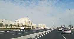
Doha Port (section Development history)
Doha Port (2012) View of boats docked at Doha Port (2013) "District Area Map". Ministry of Development Planning and Statistics. Retrieved 11 February...
6 KB (376 words) - 08:14, 31 October 2024
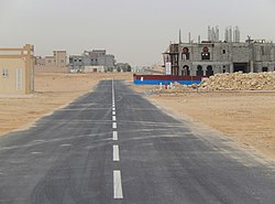
Umm Qarn (section Developments)
"District Area Map". Ministry of Development Planning and Statistics. Retrieved 12 March 2019. "2010 population census" (PDF). Qatar Statistics Authority. Retrieved...
11 KB (841 words) - 02:37, 30 June 2025

Umm Salal Ali (section Development)
Ministry of Development Planning and Statistics. Retrieved 8 August 2017. "Qatar in Figures" (PDF). Ministry of Development Planning and Statistics....
16 KB (1,320 words) - 21:03, 29 June 2025

The Ministry of Finance, Planning and Economic Development (MoFPED) is a cabinet-level government ministry of Uganda. Its mandate is to formulate sound...
15 KB (1,324 words) - 20:10, 20 April 2025
Zone 56, Qatar (category Zones of Qatar)
(PDF) on 1 July 2015. "Physiography - Land use 2015". Ministry of Development Planning and Statistics. 15 January 2018. Retrieved 13 February 2019. v t e...
6 KB (210 words) - 05:07, 27 July 2025

from other parts of the country due to its relatively low prices. "District Area Map". Ministry of Development Planning and Statistics. Retrieved 12 March...
5 KB (336 words) - 05:20, 20 July 2025
Zone 71, Qatar (category Zones of Qatar)
(PDF) on 1 July 2015. "Physiography - Land use 2015". Ministry of Development Planning and Statistics. 15 January 2018. Retrieved 14 February 2019. v t e...
7 KB (237 words) - 05:11, 27 July 2025
Zone 91, Qatar (category Zones of Qatar)
(PDF) on 1 July 2015. "Physiography - Land use 2015". Ministry of Development Planning and Statistics. 15 January 2018. Retrieved 13 February 2019. v t e...
6 KB (209 words) - 05:17, 27 July 2025

Al Rayyan (city) (section Twin towns and sister cities)
Mogilev, Belarus (since 2010) "District Area Map". Ministry of Development Planning and Statistics. Retrieved 12 February 2019. "New Al Rayyan, Zone 53...
19 KB (1,569 words) - 11:53, 2 March 2025

Ain Khaled (section Development)
part of Doha Metro's Gold Line. The following schools are located in Ain Khaled: "District Area Map". Ministry of Development Planning and Statistics. Retrieved...
10 KB (512 words) - 17:35, 22 June 2025