
Canadian province of Newfoundland and Labrador. It connects the town of Westport, along with the community of Purbeck's Cove, with Route 410 (Dorset Trail)...
3 KB (169 words) - 01:45, 16 July 2024
This is a list of highways in Newfoundland and Labrador. Newfoundland and Labrador is unusual among jurisdictions in Canada in that it exclusively uses...
39 KB (2,795 words) - 03:06, 2 March 2024

The Trans-Labrador Highway (TLH) is the primary public road in Labrador, the mainland portion of the province of Newfoundland and Labrador, Canada. The...
25 KB (1,536 words) - 11:01, 17 February 2025

Newfoundland and Labrador. It leads from Sheppardville, at Route 1 (Trans-Canada Highway), to a dead end in Fleur de Lys, Newfoundland and Labrador....
5 KB (314 words) - 03:31, 24 May 2025
Route 1 is a highway in the Canada province of Newfoundland and Labrador, and is the easternmost stretch of the Trans-Canada Highway. Route 1 is the primary...
32 KB (1,175 words) - 00:58, 24 December 2024

Route 403 is a minor highway in the western region of Newfoundland in the Canadian province of Newfoundland and Labrador. The highway begins at a junction...
2 KB (134 words) - 01:45, 16 July 2024

Newfoundland and Labrador is the easternmost province of Canada, in the country's Atlantic region. The province comprises the island of Newfoundland and...
200 KB (18,976 words) - 06:52, 23 May 2025

Route 360, also known as Bay d'Espoir Highway, is a provincial highway in Newfoundland and Labrador. It runs from the Bishop's Falls area to Bay d'Espoir...
7 KB (426 words) - 01:44, 16 July 2024

in the Canadian province of Newfoundland and Labrador. It connects the town of Burgeo with the Trans-Canada Highway (Route 1). The highway is a winding...
4 KB (286 words) - 16:35, 18 April 2023
Route 411 or Highway 411 may refer to: Manitoba Provincial Road 411 Newfoundland and Labrador Route 411 National Route 411 San Jose–Tapaste Road (2–411)...
2 KB (131 words) - 01:11, 5 August 2024

Canadian province of Newfoundland and Labrador. The route begins at the intersection of Route 1 (The Trans Canada Highway) in Deer Lake and ends in St. Anthony...
14 KB (825 words) - 18:21, 5 April 2024
Route 450A, also known as Lewin Parkway, is an alternate route of Route 450 in the city of Corner Brook, Newfoundland and Labrador. The route runs from...
3 KB (172 words) - 23:55, 10 May 2023

Route 20 is a 30.2-kilometre-long (18.8 mi) provincial highway in Newfoundland and Labrador, extending from St. John's to the towns of Torbay, Flatrock...
6 KB (302 words) - 21:23, 31 January 2025

Route 239 is a highway in the Trinity Bight portion of Newfoundland in the Canadian province of Newfoundland and Labrador. It is a short route, running...
3 KB (216 words) - 15:16, 22 October 2022
island of Newfoundland. It connects the Creston neighbourhood of town with the downtown area. Route 220A also represents the former alignment of Route 220 prior...
3 KB (159 words) - 15:11, 22 October 2022

the Canadian province of Newfoundland and Labrador. The highway begins at a junction with Route 1 (Trans-Canada Highway) and continues to its west terminus...
3 KB (186 words) - 15:42, 22 October 2022

province of Newfoundland and Labrador. It straddles the line between the provinces two largest cities, the capital city of St. John's and the city Mount...
7 KB (610 words) - 21:57, 8 March 2025

Route 201 (known as the Osprey Trail) is a provincial road in the Canadian province of Newfoundland and Labrador. It is one of only three loop roads designated...
4 KB (288 words) - 01:44, 16 July 2024

of Newfoundland and Labrador. Its eastern terminus is the intersection at the Trans-Canada Highway (Route 1) in the Town of Badger, and the route ends...
4 KB (312 words) - 01:44, 16 July 2024

from Goobies to Grand Bank, Newfoundland and Labrador. The maximum speed limit is 90 km/h except through communities and settlements where the speed limit...
15 KB (719 words) - 15:08, 22 October 2022

Newfoundland in the Canadian province of Newfoundland and Labrador. It begins at a junction of Route 430 in Wiltondale and terminates at Trout River. It serves...
4 KB (244 words) - 18:21, 5 April 2024

Route 100 (also known as The Cape Shore Highway and Argentia Access Road) is a major highway in Newfoundland and Labrador. The highway begins at its northern...
8 KB (472 words) - 23:31, 14 February 2024

the Canadian province of Newfoundland and Labrador. The highway begins at a junction with the Trans-Canada Highway (Route 1) and continues to its southern...
2 KB (102 words) - 01:45, 16 July 2024

Route 402, also known as Gallants Road, is a minor highway in the Canadian province of Newfoundland and Labrador. The highway is located about 40 kilometres...
2 KB (121 words) - 01:45, 16 July 2024

Cove-St. Philips in Newfoundland and Labrador, Canada. Route 40 also serves as the primary access to St. John's International Airport and the Bell Island...
4 KB (271 words) - 21:09, 30 August 2024

island of Newfoundland in the Canadian province of Newfoundland and Labrador. It is a relatively short highway with no other towns on the route other than...
2 KB (100 words) - 01:44, 16 July 2024

example of a road concurrency in the entire province of Newfoundland and Labrador. Route 461/Route 490 now cross a bridge over an inlet to enter Stephenville...
4 KB (234 words) - 15:38, 15 July 2024
in the province of Newfoundland and Labrador. It serves as the only road connection to the town of Terra Nova, connecting with Route 1 (Trans-Canada Highway)...
3 KB (173 words) - 13:17, 5 March 2025
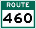
Route 460 is an 87.5-kilometre-long (54.4 mi) east-west Canadian provincial highway in Newfoundland and Labrador. It is located on the west coast of the...
9 KB (612 words) - 15:35, 15 July 2024
of Newfoundland. It is located entirely with the town of St. Jacques-Coomb's Cove, connecting the communities on the western half of town with Route 362...
3 KB (166 words) - 14:20, 27 April 2024