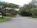
Pikes Creek is a rural locality in the Southern Downs Region, Queensland, Australia. In the 2021 census, Pikes Creek had a population of 19 people. The...
5 KB (386 words) - 07:10, 29 May 2024
Missouri Pike Creek (Queensland), a river in southern Queensland, Australia Pike Creek Bypass, a road in Essex County, Ontario, Canada Pikes Creek, Pennsylvania...
753 bytes (113 words) - 15:41, 1 March 2020
Murray–Darling basin, is located in the Darling Downs region of Queensland, Australia Pike Creek rises on the western slopes of the Great Dividing Range below...
3 KB (130 words) - 09:51, 17 January 2023
It is also known as the Pike Creek Reservoir. The Stanthorpe – Texas Road runs through the locality from north (Pikes Creek) to west (Silver Spur). There...
9 KB (749 words) - 11:07, 26 May 2024

Glenlyon Dam (redirect from Pike Creek Reservoir)
Glenlyon Dam, also known as Pike Creek Reservoir, is an earth and rockfill dam in Queensland near the border with New South Wales, roughly between Stanthorpe...
4 KB (377 words) - 23:12, 27 December 2023

Brisbane (redirect from Brisbane, Queensland)
(/ˈbrɪzbən/ BRIZ-bən, Turrbal: Meaanjin) is the capital of the state of Queensland and the third-most populous city in Australia and Oceania, with a population...
204 KB (17,552 words) - 00:28, 17 June 2024

Victoria, the Australian Capital Territory, and parts of the states of Queensland (the lower third) and South Australia (the southeastern corner). The Basin...
54 KB (3,945 words) - 02:10, 11 June 2024
Stanthorpe–Texas–Inglewood Road (category Roads in Queensland)
pastoral runs in Queensland was made available for closer settlement. These included modern-day Nundubbermere and what is now Pikes Creek. As land was cleared...
15 KB (1,313 words) - 20:05, 10 March 2024

Australian gold rushes (redirect from Gold rushes in Queensland)
Castlemaine (then known as Forest Creek and the Mount Alexander Goldfield) and the goldfield at Bendigo (then known as Bendigo Creek) in November 1851. Gold, just...
177 KB (20,136 words) - 06:02, 20 May 2024

Granite Belt (redirect from Granite Belt, Queensland)
is an area of the Great Dividing Range in the Darling Downs region of Queensland and the New England region of New South Wales, Australia. The Granite...
14 KB (1,510 words) - 14:54, 5 March 2024

of Queensland. The locality is bounded to the north-west, north, and north-east by Moreton Bay and to the east and south-east by Hilliards Creek. The...
29 KB (2,948 words) - 03:15, 31 May 2024

Shire of Cook, Queensland, Australia. Cooktown is at the mouth of the Endeavour River, on Cape York Peninsula in Far North Queensland where James Cook...
55 KB (5,989 words) - 03:25, 16 June 2024

23622)". Queensland Place Names. Queensland Government. Retrieved 25 November 2020. "Mount Pike – mountain in Cook Shire (entry 26722)". Queensland Place...
31 KB (3,274 words) - 03:44, 14 June 2024

List of rivers of Australia (redirect from List of rivers of Queensland)
states and territories. Where a river has a name that includes the word creek, it has been officially designated as a river. Rivers of the Australian...
55 KB (2,240 words) - 00:29, 3 January 2024

River and the creek banks the golden penda Xanthostemon chrysanthus. Environment portal Queensland portal Protected areas of Queensland Australian Bureau...
23 KB (2,625 words) - 00:33, 29 May 2024

Dumaresq River (category Rivers of Queensland)
Stanthorpe, Queensland. The Dumaresq River flows generally southwest and northwest, joined by fourteen tributaries, including the Mole River, Pike Creek, Beardy...
7 KB (442 words) - 05:20, 13 March 2024

Cape York Peninsula (category Articles incorporating text from the State Library of Queensland)
Cape York Peninsula is a peninsula located in Far North Queensland, Australia. It is the largest wilderness in northern Australia. The land is mostly flat...
51 KB (5,517 words) - 06:12, 7 June 2024
Stanthorpe Inglewood Road which exits the locality to the north west. Pike Creek flows from the north-west to the south-west of the locality, becoming...
12 KB (1,122 words) - 01:11, 10 June 2024

Shire of Stanthorpe (category Former local government areas of Queensland)
Aplin Greenlands Kyoomba Lyra Messines Mingoola Passchendaele Pikedale Pikes Creek Pozieres Severnlea Somme The Summit Thorndale Wallangarra Wyberba * -...
5 KB (340 words) - 02:37, 20 October 2021
The principal topographic feature of Queensland is the series of low highlands and plateaus called the Great Dividing Range, which extend from north to...
10 KB (200 words) - 14:22, 9 February 2024
Retrieved 28 May 2022. "Hilliards Creek – watercourse in City of Redland (entry 15897)". Queensland Place Names. Queensland Government. Retrieved 7 March...
17 KB (1,494 words) - 06:28, 29 May 2024
owns and operates a number of mines in Queensland and New South Wales. Callide mine: is a leading Queensland domestic coal producer providing low-sulphur...
55 KB (6,685 words) - 04:07, 10 June 2024

British Columbia (1858–61) Rock Creek Gold Rush, British Columbia (1859–60s)[clarification needed] Pike's Peak Gold Rush, Pikes Peak, Kansas Territory (present-day...
32 KB (3,625 words) - 05:02, 12 June 2024

University of Queensland Football Club. Kenmore is dissected by Moggill Creek. The Moggill Creek Catchment Group organises working bees to rid the creek area of...
25 KB (2,386 words) - 22:27, 12 June 2024
South Wales – Chris Minns Opposition Leader – Mark Speakman Premier of Queensland – Steven Miles Opposition Leader – David Crisafulli Premier of South Australia...
455 KB (37,632 words) - 13:26, 17 June 2024

Yowie (section Queensland)
Outback. The creature has its roots in Aboriginal oral history. In parts of Queensland, they are known as quinkin (or as a type of quinkin), and as joogabinna...
31 KB (3,269 words) - 11:33, 18 April 2024

Southern Downs Region (category Local government areas of Queensland)
Kyoomba Lyra Messines Mingoola Nundubbermere Passchendaele Pikedale Pikes Creek Pozieres Severnlea Somme The Summit Thorndale Wallangarra Wyberba Named...
13 KB (869 words) - 21:43, 2 June 2024

located in Queensland. These facilities represent a total capacity of 13,389 gigalitres (2,945×10^9 imp gal; 3,537×10^9 US gal) for Queensland. This does...
76 KB (509 words) - 20:29, 25 September 2023

Gayndah (redirect from Gayndah, Queensland)
Gayndah (/ɡeɪndə/) is a town and locality in the North Burnett Region, Queensland, Australia. It is the administrative centre for the North Burnett Region...
38 KB (3,395 words) - 22:17, 13 June 2024
Edmund Kennedy (category Explorers of Queensland)
explored the interior of Queensland and northern New South Wales, including the Thomson River, the Barcoo River, Cooper Creek, and Cape York Peninsula...
22 KB (2,558 words) - 01:05, 20 March 2024