
A nautical chart or hydrographic chart is a graphic representation of a sea region or water body and adjacent coasts or banks. Depending on the scale of...
18 KB (2,301 words) - 00:26, 14 June 2025
Raster Navigational Charts (RNC's) are created by the National Oceanic and Atmospheric Administration (NOAA) of the United States Government. Each original...
2 KB (166 words) - 18:33, 14 August 2023

- informational significance, are portrayed through Raster facsimiles of traditional paper charts; or more commonly through vector images, which are able...
15 KB (1,604 words) - 04:17, 5 May 2025
for Relax NG files in compact syntax Raster Navigational Charts (NOAA), a raster file format for nautical charts RNC, a randomized computational complexity...
1 KB (209 words) - 23:48, 21 March 2025

Admiralty charts are nautical charts issued by the United Kingdom Hydrographic Office (UKHO) and subject to Crown Copyright. Over 3,500 Standard Nautical Charts...
27 KB (3,140 words) - 06:38, 31 May 2025
1996, the UKHO developed ADMIRALTY Raster Chart Service, a raster navigational chart service for Electronic Chart Display and Information System. This...
21 KB (2,086 words) - 14:28, 16 June 2025

Fathom (category Nautical terminology)
needed] Most modern nautical charts indicate depth in metres. However, the U.S. Hydrographic Office uses feet and fathoms. A nautical chart will always explicitly...
18 KB (1,948 words) - 06:37, 31 May 2025

Topographic map (redirect from Topographic chart)
Aeronautical chart Bathymetric chart Cadastral map Thematic map Hypsometric tints International Map of the World (List of) national mapping agencies Nautical chart...
20 KB (2,055 words) - 15:28, 25 May 2025
were the conduction of hydrographic surveys and the publication of nautical charts. In many countries, various navigation-related services are now concentrated...
17 KB (2,147 words) - 20:59, 17 May 2025

a subset of navigational maps, which also include aeronautical and nautical charts, railroad network maps, and hiking and bicycling maps. In terms of...
36 KB (4,374 words) - 22:52, 19 June 2025
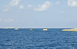
Chart #11013, Atlantic Coast: Straits of Florida and Approaches. 48th Edition, corrected though Feb-12. Available as a NOAA Raster Navigational Chart...
8 KB (833 words) - 04:17, 30 October 2024
Chart Division, responsible for processing nautical data, producing raster, paper, and electronic charts, and making critical corrections to charts....
12 KB (1,377 words) - 01:02, 5 February 2024
parcel, street, nautical, and aeronautical maps. The NGA uses GIS products to create digital nautical, aeronautical, and topographic charts and maps, to...
22 KB (2,582 words) - 16:38, 1 April 2025
interface, AIS, nautical charts, instrument panels, track recording. glgrib This application displays GRIB2 fields with OpenGL. Raster, contour, vector...
14 KB (1,654 words) - 01:43, 5 December 2024
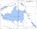
Chart #11013, Atlantic Coast: Straits of Florida and Approaches. 48th Edition, corrected though Feb-12. Available as a NOAA Raster Navigational Chart...
15 KB (1,985 words) - 15:29, 8 May 2025
including vector & raster data, digital elevation models (DEM), satellite & aerial imagery, topographic maps, nautical & aeronautical charts, geological maps...
4 KB (413 words) - 03:27, 6 March 2023

Geography Markup Language (category GIS raster file formats)
support of particular application domains such as commercial aviation, nautical charting or resource exploitation. The GML Specification (Since GML v3.) contains...
32 KB (4,027 words) - 08:57, 6 June 2025

signed Portuguese nautical chart. 1492: Cartographer Jorge de Aguiar made the oldest known signed and dated Portuguese nautical chart. 1537: Much of Portuguese...
143 KB (17,675 words) - 23:22, 23 June 2025

Navigational Chart #12343, Hudson River to Wappinger Creek. 19th Edition, corrected though Oct-05. Available as a NOAA Raster Navigational Chart at the NOAA...
12 KB (1,181 words) - 05:14, 4 February 2025
portions near their mouth, where channels tend to be deeper and wider. raster A representation of spatial data within a two-dimensional image that defines...
210 KB (20,033 words) - 05:05, 29 May 2025

the first attempt to systematically codify nautical maps. This chart-book combined an atlas of nautical charts and sailing directions with instructions...
156 KB (19,000 words) - 21:21, 10 June 2025

the sense of including all revision levels. Maps portal Admiralty chart – Nautical chart Alastair Macdonald (surveyor) – Deputy Director of the Directorate...
84 KB (8,802 words) - 07:59, 23 June 2025
Mexico and the southwestern United States. chart A special-purpose map designed for navigation, especially nautical and aeronautical navigation, or to present...
276 KB (28,404 words) - 21:41, 11 June 2025
world's railway infrastructure based on OSM data. OpenSeaMap is a world nautical chart built as a mashup of OpenStreetMap, crowdsourced water depth tracks...
111 KB (10,651 words) - 17:25, 14 June 2025

new industries to explore and exploit these potentials. See also digital raster graphic. In the early years of the new millennium, three key technological...
65 KB (7,642 words) - 00:10, 16 June 2025

Retrieved 18 September 2024. "Portland Harbor and Casco Bay, Maine, 1781 (Raster Image)". Web Map Service. Harvard University. Retrieved 19 September 2024...
201 KB (20,231 words) - 09:48, 22 June 2025