
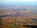
The Shire of Moorabool is a local government area in Victoria, Australia, located in the western part of the state. It covers an area of 2,111 square kilometres...
11 KB (462 words) - 17:43, 10 February 2024

largest urban area in the Shire of Moorabool local government area. Traditionally a market garden area producing a large amount of the region's fruits and...
26 KB (2,770 words) - 06:15, 5 January 2024

Little River (Cocoroc Rivulet, Rothwell) • Mannerim • Marcus Hill • Moorabool • Ocean Grove (Collendina) • Point Wilson • Portarlington (Port Arlington)...
135 KB (12,134 words) - 13:07, 30 November 2023

Central Highlands (Victoria) (redirect from Central highlands of victoria)
Shire of Hepburn, Shire of Moorabool, Shire of Pyrenees. The term is mainly used in a geological context to describe that part of the Great Dividing...
6 KB (412 words) - 04:27, 7 May 2024
of the state capital, Melbourne, within the Wombat State Forest. Blackwood is in the Shire of Moorabool local government area and had a population of...
11 KB (1,228 words) - 11:53, 12 May 2024

town in the Shire of Hepburn and Shire of Moorabool local government area, Victoria, Australia. At the 2016 census, Trentham had a population of 1,180, with...
12 KB (697 words) - 10:56, 24 May 2024

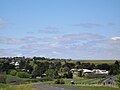
Ballan had a population of 3,392. It is the second largest administrative centre, behind Bacchus Marsh, in the Shire of Moorabool local government area...
15 KB (1,433 words) - 11:43, 12 May 2024
Westmelton Mount Cottrell 3024 (shared with City of Wyndham) Chartwell Parwan 3340 (shared with Shire of Moorabool) Plumpton 3335 Sydenham West Ravenhall 3023...
48 KB (3,640 words) - 15:29, 25 May 2024

the Shire of Moorabool, 61 kilometres (38 mi) west north west of the state capital, Melbourne. At the 2021 census, Maddingley had a population of 5,491...
2 KB (124 words) - 02:04, 14 March 2023

The town is located in the Shire of Moorabool and on the Geelong-Ballarat railway line, 108 kilometres (67 mi) west of the state capital, Melbourne...
4 KB (306 words) - 09:59, 7 May 2023
suburb of Sydney Clarendon, Queensland, a rural locality in the Somerset Region Clarendon, South Australia Clarendon, Victoria, in the Shire of Moorabool Clarendon...
3 KB (396 words) - 13:58, 21 December 2022

Geelong. Its local government areas are the Shire of Moorabool and the City of Ballarat. Located at the foot of Mount Buninyong, it was named after the Scott...
4 KB (358 words) - 08:49, 5 April 2024
the mountain by the same name in the Shire of Moorabool local government area, 97 kilometres (60 mi) north west of the state capital, Melbourne. At the...
10 KB (1,044 words) - 11:51, 12 May 2024

a shire and is governed by a shire council. Local councils have the same administrative functions and similar political structures, regardless of their...
39 KB (321 words) - 22:13, 11 May 2024

Geelong, in the local government area of the Golden Plains Shire. At the 2016 census, Meredith had a population of 788. The town was surveyed in 1851–52...
5 KB (389 words) - 14:42, 31 March 2024

central Victoria, Australia. The locality is in the Shire of Moorabool, 63 kilometres (39 mi) west of the state capital, Melbourne. The town name comes...
2 KB (85 words) - 11:58, 29 November 2023

Western Highway (Victoria) (category Shire of Moorabool)
part of the principal route linking the Australian cities of Melbourne and Adelaide, with a length of approximately 258 kilometres (160 mi) of single...
40 KB (3,346 words) - 02:19, 10 April 2024
Parwan, Victoria (category City of Melton)
Australia, 45 km (28 mi) west of Melbourne's Central Business District, located within the City of Melton and the Shire of Moorabool local government areas....
4 KB (303 words) - 12:03, 12 May 2024

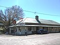
town in Victoria, Australia in the Shire of Moorabool local government area, 99 kilometres (62 mi) north-west of the state capital, Melbourne. The township...
4 KB (117 words) - 10:17, 7 May 2023

Shire of Moorabool local government area, 95 kilometres (59 mi) west of the state capital, Melbourne. At the 2021 census, Gordon had a population of 1...
13 KB (1,170 words) - 11:45, 12 May 2024

central Victoria, Australia in the Shire of Moorabool local government area, 81 kilometres (50 mi) west north west of the state capital, Melbourne. At the...
3 KB (177 words) - 09:53, 7 May 2023

Buninyong. It also covers large parts of the Golden Plains Shire and Moorabool Shire areas, including the towns of Ballan, Bacchus Marsh, Meredith, Lethbridge...
3 KB (205 words) - 08:32, 6 May 2024

district of Macedon is an electoral district of the Victorian Legislative Assembly. It was created in 2002, replacing the abolished electorate of Gisborne...
3 KB (131 words) - 11:11, 30 December 2023

The electoral district of Melton is an electoral district of the Victorian Legislative Assembly. It contains the towns of Aintree, Bacchus Marsh, Balliang...
3 KB (116 words) - 09:13, 7 May 2023

The Division of Hawke is an Australian electoral division in the state of Victoria, which was contested for the first time at the 2022 Australian federal...
5 KB (321 words) - 13:16, 26 April 2024

Balliang, Victoria (category Suburbs of Geelong)
Australia. It is divided between the Shire of Moorabool and City of Greater Geelong local government areas. It lies north of Geelong and 54 kilometres (34 mi)...
4 KB (303 words) - 05:42, 11 May 2023
Retrieved 5 October 2019. "Windfarms in Moorabool". Shire of Moorabool. Retrieved 5 October 2019. "Moorabool Wind Farm turbine installations complete"...
2 KB (221 words) - 10:40, 22 April 2024
Melton, Victoria (category Suburbs of the City of Melton)
Melton shares one local newspaper with the neighbouring Shire of Moorabool, the Melton & Moorabool Star Weekly. Melton has one local radio station, 979fm...
26 KB (2,336 words) - 14:52, 4 June 2024
the state government's Centenary of Women's Suffrage funds and the Shire of Moorabool council to re-develop the memorial. A rotunda, featuring information...
3 KB (350 words) - 21:54, 6 May 2023
the 2016 census, Myrniong had a population of 404. The town is in the eastern area of Shire of Moorabool local government area. Myrniong was named for...
4 KB (271 words) - 01:17, 2 March 2024