In navigation, a state vector is a set of data describing exactly where an object is located in space, and how it is moving. A state vector typically will...
1 KB (245 words) - 22:58, 27 July 2022

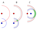
astrodynamics and celestial dynamics, the orbital state vectors (sometimes state vectors) of an orbit are Cartesian vectors of position ( r {\displaystyle \mathbf...
6 KB (833 words) - 11:13, 26 March 2025
Look up vector or vectorial in Wiktionary, the free dictionary. Vector most often refers to: Disease vector, an agent that carries and transmits an infectious...
6 KB (733 words) - 03:12, 26 June 2025

Azimuth (category Navigation)
There are exceptions: some navigation systems use south as the reference vector. Any direction can be the reference vector, as long as it is clearly defined...
14 KB (1,768 words) - 08:17, 23 June 2025

Wind triangle (category Air navigation)
used extensively in dead reckoning navigation. The wind triangle is a vector diagram, with three vectors. The air vector represents the motion of the aircraft...
4 KB (515 words) - 02:02, 7 January 2024

link][dead link] Navigation refers to the determination, at a given time, of the vehicle's location and velocity (the "state vector") as well as its attitude...
13 KB (1,522 words) - 14:40, 17 June 2025

monochromatic vector mapping displays used by predecessors. 1990: Mazda Eunos Cosmo became the first production car with built-in GPS-navigation system 1991:...
21 KB (2,335 words) - 07:37, 25 June 2025

The field of navigation includes four general categories: land navigation, marine navigation, aeronautic navigation, and space navigation. It is also the...
84 KB (9,533 words) - 02:28, 24 June 2025

Area navigation (RNAV, usually pronounced as /ˈɑːrnæv/) is a method of instrument flight rules (IFR) navigation that allows aircraft to fly along a desired...
11 KB (1,326 words) - 09:50, 14 February 2025

An inertial navigation system (INS; also inertial guidance system, inertial instrument) is a navigation device that uses motion sensors (accelerometers)...
47 KB (5,956 words) - 10:04, 19 June 2025

Rhumb line (category Navigation)
In navigation, a rhumb line, rhumb (/rʌm/), or loxodrome is an arc crossing all meridians of longitude at the same angle, that is, a path with constant...
21 KB (2,873 words) - 15:27, 8 June 2025

Dead reckoning (category Navigation)
In navigation, dead reckoning is the process of calculating the current position of a moving object by using a previously determined position, or fix,...
27 KB (3,631 words) - 13:33, 29 May 2025
guidance, navigation, and control of the U.S. Navy's Transit satellite system at Johns Hopkins Applied Physics Laboratories. TRIAD represented the state of practice...
8 KB (963 words) - 20:16, 27 April 2025
users of the Loran-C navigation system. The idea of geometric DOP is to state how errors in the measurement will affect the final state estimation. This can...
16 KB (2,224 words) - 18:22, 1 July 2024

and ENCs are the primary means of electronic navigation on cargo ships. Charts can be used in navigation to provide an indication of location once a position...
15 KB (1,604 words) - 04:17, 5 May 2025
Guidance system (redirect from Guidance (navigation))
about the object's state of motion. A guidance system is usually part of a Guidance, navigation and control system, whereas navigation refers to the systems...
15 KB (1,923 words) - 09:54, 15 February 2025
shapes in a vector graphics editor. Image maps which do not make their clickable areas obvious risk subjecting the user to mystery meat navigation. Even when...
9 KB (898 words) - 12:44, 3 May 2025

pilot-nav SIDs, radar vector SIDs, and hybrid SIDs. A pilot-nav SID is a SID where the pilot is primarily responsible for navigation along the SID route...
9 KB (1,230 words) - 05:40, 19 January 2025
database is the United States Defense Mapping Agency's (DMA) operational navigation chart (ONC) 1:1,000,000 scale paper map series produced by the US, Australia...
2 KB (253 words) - 10:02, 10 February 2021

cases where the dimension of the observation vector y is bigger than the dimension of the state space vector x, the information filter can avoid the inversion...
127 KB (20,447 words) - 05:33, 8 June 2025
characters. Unit vector In mathematics, a unit vector in a normed vector space is a vector (often a spatial vector) of length 1. A unit vector is often denoted...
251 KB (31,179 words) - 19:07, 15 June 2025

Magnetic field (redirect from Magnetic field vector)
is important in navigation using a compass. The force on an electric charge depends on its location, speed, and direction; two vector fields are used...
105 KB (12,969 words) - 07:57, 9 June 2025
from MT Vector. Don Claudio serviced the Manila - Iloilo City route until the 1990s when it was put in service for Roxas City as Negros Navigation acquired...
6 KB (547 words) - 22:53, 28 April 2025

Polarization (waves) (redirect from State of polarization)
the same state of polarization. The physical electric field, as the real part of the Jones vector, would be altered but the polarization state itself is...
74 KB (9,420 words) - 14:38, 20 June 2025
sequence of vectors using self-supervised learning. It uses the encoder-only transformer architecture. BERT dramatically improved the state-of-the-art...
31 KB (3,569 words) - 11:09, 2 July 2025

The Vector Map (VMAP), also called Vector Smart Map, is a vector-based collection of geographic information system (GIS) data about Earth at various levels...
11 KB (1,176 words) - 10:51, 27 May 2023
Etak (redirect from Etak (automotive navigation systems))
Etak, Inc. was an independent US-based vendor of automotive navigation system equipment, digital maps, and mapping software. It was founded in 1983. Competitor...
17 KB (1,836 words) - 00:52, 17 June 2025

Euclidean space (redirect from Euclidean vector space)
of navigation. More generally, the spaces of non-Euclidean geometries can be realized as Riemannian manifolds. An inner product of a real vector space...
47 KB (6,967 words) - 08:16, 28 June 2025

Angular momentum (redirect from Orbital angular momentum vector)
the cross product of the particle's position vector r (relative to some origin) and its momentum vector; the latter is p = mv in Newtonian mechanics....
93 KB (13,485 words) - 16:23, 13 June 2025

Required navigation performance (RNP) is a type of performance-based navigation (PBN) that allows an aircraft to fly a specific path between two 3D-defined...
27 KB (3,644 words) - 03:29, 24 February 2025