
Interstate 8 (I-8) is an Interstate Highway in the southwestern United States. It runs from the southern edge of Mission Bay at Sunset Cliffs Boulevard...
113 KB (12,119 words) - 02:25, 7 June 2025
Interstate 8 is the second EP by alternative rock band Modest Mouse, released on Up Records in 1996. It contains the band's original demo, Live in Sunburst...
5 KB (262 words) - 01:57, 5 June 2025

Arizona, United States. It is located near the junction of Interstate 8 and Interstate 10 at the midpoint between Phoenix and Tucson, approximately...
26 KB (2,567 words) - 18:38, 6 May 2025

At the Jack Schrade Interchange, Interstate 805 crosses Mission Valley and connects with Interstate 8. Interstate 15 and State Route 163 also cross Mission...
13 KB (1,100 words) - 21:37, 6 June 2025

business routes of Interstate 8 (I-8). The portions of the I-8 business routes through California are mostly unsigned. All Interstate business routes in...
15 KB (923 words) - 02:55, 13 May 2025
The Interstate 8 Athletic Conference is an athletic conference for high schools in Michigan formed in 2014 with eight schools in south central Michigan...
10 KB (251 words) - 02:35, 22 January 2025

California. It contains 230 acres (93 ha) and is bounded by Interstate 8 on the north, Interstate 5 on the west, Mission Hills on the east and south. It is...
11 KB (1,269 words) - 15:26, 10 June 2025

Department of Transportation (FDOT) designation of State Road 8 (SR 8). The Interstate runs roughly parallel to US Highway 90 (US 90) (which intersects...
30 KB (1,358 words) - 12:37, 10 June 2025
Interstate 840 (I-840), formerly State Route 840 (SR 840), is a freeway that serves as an outer bypass route around Nashville, Tennessee. Built by the...
41 KB (3,435 words) - 02:51, 22 April 2025

Alabama. I-459 lies entirely within Jefferson County. This Interstate Highway is about 32.8 miles (52.8 km) long, and its construction was completed in 1984...
10 KB (742 words) - 00:38, 27 January 2025
Telegraph Pass (Arizona) (category Interstate 8)
Telegraph Pass is a highway pass on Interstate 8 through the Gila Mountains in Yuma County, Arizona, about 19 miles (30 km) east of Yuma in the northwest...
3 KB (433 words) - 23:11, 16 August 2024

town has a total area of 28.88 square miles (74.8 km2), all land. Wellton is located along Interstate 8 and the former route of U.S. Route 80. The town...
8 KB (703 words) - 23:34, 5 June 2025

A8 motorway (Greece) (redirect from Greece Interstate 8)
A8 motorway Αυτοκινητόδρομος 8 Route information Part of E94 and E65 Maintained by Olympia Odos S.A. Length 135 mi (217 km) History 1962–1973: Constructed...
12 KB (586 words) - 00:35, 24 May 2025

from Casa Grande is Interstate 8, which goes via Yuma into California, crossing the Colorado River. Finally, the short Interstate 19 runs south from Tucson...
7 KB (871 words) - 00:33, 4 June 2025

The Interstate Highway System of the United States, in addition to being a network of freeways, also includes a number of business routes assigned by the...
44 KB (3,234 words) - 09:23, 27 May 2025
Retrieved 15 November 2012. "Album Reissues « News « Interstate-8 : A Modest Mouse Fan Collaborative". www.interstate-8.com. Retrieved November 5, 2019. v t e...
4 KB (392 words) - 04:59, 5 June 2025
Interstate 380 may refer to: Interstate 380 (California), a spur from Interstate 280 to U.S. Route 101 and the San Francisco International Airport Interstate...
787 bytes (138 words) - 22:29, 15 January 2025

the border with Mexico east of Calexico north to its terminus at Interstate 8 (I-8), where Orchard Road continues the route north towards Holtville....
9 KB (1,065 words) - 02:02, 27 May 2025

census. It is part of the El Centro, CA Metropolitan Area. North of Interstate 8 and bordering Yuma, Arizona, the town is partly in the Fort Yuma Indian...
14 KB (1,013 words) - 23:19, 8 June 2025

National System of Interstate and Defense Highways, commonly known as the Interstate Highway System, or the Eisenhower Interstate System, is a network...
132 KB (13,087 words) - 00:56, 9 June 2025

heavily used area begins at Highway 78 and continues south just past Interstate 8. The expansive dune formations offer picturesque scenery, a chance to...
80 KB (5,926 words) - 05:01, 11 June 2025

U.S. Route 80 (category Interstate 8)
creation of the Interstate and Defense Highway System in 1957. Four Interstates were slated to replace US 80 as a major highway: Interstate 8 between San...
70 KB (8,194 words) - 07:06, 3 June 2025
College Area, San Diego (section K through 8)
which overlooks Interstate 8. The neighborhood's borders are defined by Montezuma Road/Collwood Boulevard to the southwest, Interstate 8 to the north, 73rd...
11 KB (855 words) - 05:38, 17 April 2025
Interstate 384 (I-384) is an auxiliary Interstate Highway located entirely within the state of Connecticut. It runs 8.2 miles (13.2 km) east to west,...
10 KB (917 words) - 01:40, 23 April 2025
between Interstate 8 and the Mexico–United States border east of Otay Mountain and west of Imperial County. Communities located just north of Interstate 8, such...
5 KB (485 words) - 22:28, 16 October 2024

Gila Mountains (Yuma County) (section Interstate 8)
Interstate Highway System in the US goes through a two-tiered highway section through Telegraph Pass at the north end of the range. The Interstate 8 roadcuts...
7 KB (527 words) - 21:53, 25 October 2021
and 1998, composing of A and B sides from singles, three tracks from Interstate 8, and one song from the vinyl version of The Lonesome Crowded West. The...
6 KB (462 words) - 15:48, 2 January 2025

acres and lies at an elevation of 285 feet (87 m). It is accessible from Interstate 8 in the far southeast of the state, just west of Yuma, Arizona. The Quechan...
5 KB (366 words) - 18:56, 21 May 2025

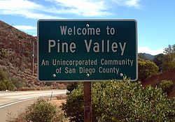
Pine Valley Creek Bridge (category Interstate 8)
town of Pine Valley. The bridge was built in 1974 as part of the Interstate 8 (I-8) freeway system. At the time of its construction, it was the first...
6 KB (371 words) - 23:12, 8 March 2025