
Irish Transverse Mercator (ITM) is the geographic coordinate system for Ireland. It was implemented jointly by the Ordnance Survey Ireland (OSi) and the...
7 KB (698 words) - 03:33, 9 March 2025

the Ordnance Survey of Northern Ireland for the island of Ireland. The Irish Transverse Mercator (ITM) coordinate reference system was adopted in 2001 and...
19 KB (2,175 words) - 10:16, 2 May 2025
Transverse Mercator projection has many implementations. Louis Krüger in 1912 developed one of his two implementations that expressed as a power series...
25 KB (4,902 words) - 15:08, 22 November 2024
Irish grid reference system, Ireland Irish Transverse Mercator, Ireland SWEREF 99 (sv), Sweden United States National Grid, US Universal Transverse Mercator...
15 KB (1,570 words) - 12:19, 7 May 2025
Castletown Geoghegan, County Westmeath. The exact location lies at the Irish Transverse Mercator (ITM) coordinates 633015.166477, 744493.046768, and at Latitude:...
3 KB (360 words) - 09:04, 26 May 2024
Survey of Ireland and the Ordnance Survey of Northern Ireland jointly implemented a new coordinate system for Ireland called Irish Transverse Mercator, or ITM...
7 KB (754 words) - 22:01, 25 March 2025
locating points on Earth. The MGRS is derived from the Universal Transverse Mercator (UTM) grid system and the Universal Polar Stereographic (UPS) grid...
15 KB (2,136 words) - 19:17, 1 June 2025

projection. Each projected coordinate system, such as "Universal Transverse Mercator WGS 84 Zone 26N," is defined by a choice of map projection (with...
21 KB (2,805 words) - 00:44, 11 June 2025
accuracy use of the GPS system. Irish grid reference system, the old coordinate system for Ireland. Irish Transverse Mercator, the new coordinate system....
5 KB (667 words) - 20:07, 12 August 2023

The French datum RGF93 The Great Britain datum OSGB36. For Ireland, the Irish Transverse Mercator. The Swedish datum RT90. The Switzerland datum CH1903....
8 KB (923 words) - 15:13, 6 February 2025
Irish grid reference system Irish Transverse Mercator State Agencies of the Republic of Ireland Ordnance Survey Ireland Act 2001 (Establishment Day)...
14 KB (1,460 words) - 12:14, 13 June 2025
International Trade Mart Irish Transverse Mercator, new geographic coordinate system of Ireland Israeli Transverse Mercator, new geographic coordinate...
2 KB (220 words) - 22:11, 28 April 2025
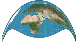
(ellipsoidal) transverse Mercator Cylindrical Conformal Carl Friedrich Gauss Johann Heinrich Louis Krüger This transverse, ellipsoidal form of the Mercator is finite...
32 KB (772 words) - 04:49, 5 May 2025

country (projected to the Airy ellipsoid then flattened using the Transverse Mercator projection), or as the point farthest from the boundary of the country...
13 KB (1,218 words) - 17:37, 7 October 2024
Retrieved 28 April 2022. "NSGI". Retrieved 2021-05-03. "New Zealand Transverse Mercator". Land Information New Zealand. Retrieved 23 October 2018. "A Guide...
6 KB (274 words) - 14:42, 6 March 2025
Geodetic datum KMZ file, a zipped KML file Latitude Longitude Universal Transverse Mercator coordinate system (UTM) GPS and Positioning Services FAQ, Q1 Archived...
6 KB (651 words) - 16:06, 24 June 2025

the mapping, with the existing Cassini projection replaced by the Transverse Mercator. This was preferred by the Ordnance Survey because the use of the...
25 KB (3,016 words) - 19:05, 22 May 2025
3409 [cs.CR]. "Journal of the Royal Asiatic Society of Great Britain and Ireland". 1907. "The_Aryabhatiya_of_Aryabhata_Clark_1930". Mercier, Raymond (1992)...
21 KB (2,443 words) - 15:24, 12 June 2025

Knocknahila, County Kerry (category Lime kilns in Ireland)
and an enclosure which will require further research (Universal Transverse Mercator grid references, 29U 489599 621959 and 29U 489776 621791 respectively)...
6 KB (371 words) - 22:18, 2 December 2024
transformation coupled with a standard parameterised map projection (such as Transverse Mercator); this is increasing in popularity due to better compatibility with...
9 KB (796 words) - 15:41, 27 March 2025

ISBN 9780784475706. "Making maps compatible with GPS". Government of Ireland 1999. Archived from the original on 21 July 2011. Retrieved 15 April 2008...
23 KB (2,540 words) - 22:18, 14 May 2025
The Craig retroazimuthal map projection was created by James Ireland Craig in 1909. It is a modified cylindrical projection. As a retroazimuthal projection...
3 KB (321 words) - 13:04, 28 March 2023

Knockbrack East, County Kerry (category Articles containing Irish-language text)
ringforts, that are recognised as National Monuments: (Universal Transverse Mercator grid references): (29U 489356 621719 (marked as a circular enclosure...
7 KB (438 words) - 07:02, 6 November 2024
Grid) Irish national grid reference system Spatial Reference System List of National Coordinate Reference Systems Universal Transverse Mercator coordinate...
54 KB (6,263 words) - 07:04, 3 June 2025

Glanballyma, County Kerry (category Articles containing Irish-language text)
recognised as National Monuments: three are enclosures (Universal Transverse Mercator grid references): (29U 489880 623939, 29U 490676 624328, 29U 490996...
7 KB (546 words) - 21:41, 5 December 2024

Tooreen, County Kerry (category Articles containing Irish-language text)
found in Tooreen, namely a fulacht fiadh (burnt mound) (Universal Transverse Mercator grid reference: 29U 489859 620331). This site will require further...
7 KB (421 words) - 20:31, 5 November 2024
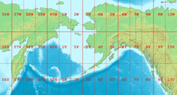
the Bering Sea with latitude and longitude zones of the Universal Transverse Mercator coordinate system Bering Sea Coordinates 58°0′N 178°0′W / 58.000°N...
24 KB (2,344 words) - 05:51, 15 June 2025

Ballyconnell, County Kerry (category Articles containing Irish-language text)
National Monuments: four are locations of ancient ringforts (Universal Transverse Mercator coordinate system (UTM) grid references: 29U 457409 5800207, 29U...
6 KB (413 words) - 09:18, 6 November 2024

Castletown, County Kerry (category Articles containing Irish-language text)
National Monuments: five are locations of ancient ring forts (Universal Transverse Mercator (UTM) grid references: 29U 489007 624035, 29U 489078 623865, 29U...
6 KB (418 words) - 03:21, 6 November 2024

Gortclohy, County Kerry (category Articles containing Irish-language text)
charcoal of hazel, oak and alder (approximate location using Universal Transverse Mercator coordinate system, 29U 491373 623604). A fragment of alder charcoal...
9 KB (700 words) - 12:33, 6 November 2024