island of Newfoundland. It connects the Creston neighbourhood of town with the downtown area. Route 220A also represents the former alignment of Route 220 prior...
3 KB (159 words) - 15:11, 22 October 2022
This is a list of highways in Newfoundland and Labrador. Newfoundland and Labrador is unusual among jurisdictions in Canada in that it exclusively uses...
39 KB (2,795 words) - 03:06, 2 March 2024

The Trans-Labrador Highway (TLH) is the primary public road in Labrador, the mainland portion of the province of Newfoundland and Labrador, Canada. The...
25 KB (1,536 words) - 11:01, 17 February 2025

Route 61, a.k.a. Foxtrap Access Road, is a short access road which connects the Trans-Canada Highway with Foxtrap, part of the town of Conception Bay...
2 KB (116 words) - 18:39, 18 May 2025

province of Newfoundland and Labrador. It straddles the line between the provinces two largest cities, the capital city of St. John's and the city Mount...
7 KB (610 words) - 21:57, 8 March 2025

from Goobies to Grand Bank, Newfoundland and Labrador. The maximum speed limit is 90 km/h except through communities and settlements where the speed limit...
15 KB (719 words) - 15:08, 22 October 2022

of Newfoundland and Labrador. Its eastern terminus is the intersection at the Trans-Canada Highway (Route 1) in the Town of Badger, and the route ends...
4 KB (312 words) - 01:44, 16 July 2024
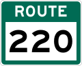
Route 220 is the southern portion of the Heritage Run in the Canadian province of Newfoundland and Labrador, running along the southern and western coastlines...
9 KB (517 words) - 06:11, 1 September 2024

two being where Route 320 transitions to Route 330 (Road to the Shore/Gander Bay Road). List of Newfoundland and Labrador highways "Route 320" (Map). Google...
4 KB (210 words) - 15:29, 15 July 2024
Route 1 is a highway in the Canada province of Newfoundland and Labrador, and is the easternmost stretch of the Trans-Canada Highway. Route 1 is the primary...
32 KB (1,175 words) - 01:00, 1 July 2025

province of Newfoundland and Labrador. The road provides a direct link from the Trans-Canada Highway (TCH) to downtown St. John's, Newfoundland, which was...
10 KB (653 words) - 22:11, 30 August 2024

Route 360, also known as Bay d'Espoir Highway, is a provincial highway in Newfoundland and Labrador. It runs from the Bishop's Falls area to Bay d'Espoir...
7 KB (459 words) - 21:24, 29 June 2025

Route 201 (known as the Osprey Trail) is a provincial road in the Canadian province of Newfoundland and Labrador. It is one of only three loop roads designated...
4 KB (288 words) - 01:44, 16 July 2024

Avalon Peninsula of Newfoundland in the Canadian province of Newfoundland and Labrador. Its southern terminus is at Route 10 in Goulds and its northern terminus...
4 KB (295 words) - 01:44, 16 July 2024
turn and coming to an end shortly thereafter at another intersection with Route 235 (Church Street). As with most highways in Newfoundland and Labrador, the...
12 KB (593 words) - 01:43, 16 July 2024

Newfoundland and Labrador. Its southern terminus is at Route 90 in St. Vincent's-St. Stephen's-Peter's River, and its northern terminus is at Route 2...
7 KB (338 words) - 23:27, 14 February 2024
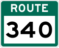
Route 340, also known as Road to the Isles, is a road in the Canadian province of Newfoundland and Labrador passing through the towns of Lewisporte, Summerford...
14 KB (699 words) - 01:31, 8 November 2024

Route 30 is a 12.0-kilometre-long (7.5 mi) north-south provincial highway in Newfoundland and Labrador, extending from St. John's through Logy Bay-Middle...
3 KB (180 words) - 23:28, 14 February 2024

Newfoundland and Labrador. It leads from Sheppardville, at Route 1 (Trans-Canada Highway), to a dead end in Fleur de Lys, Newfoundland and Labrador....
5 KB (314 words) - 03:31, 24 May 2025

Route 422, also known as Cormack Road, is a relatively short highway on western Newfoundland in the Canadian province of Newfoundland and Labrador. The...
3 KB (199 words) - 12:46, 29 June 2025

Cove-St. Philips in Newfoundland and Labrador, Canada. Route 40 also serves as the primary access to St. John's International Airport and the Bell Island...
4 KB (271 words) - 21:09, 30 August 2024
Avalon Peninsula in the Canadian province of Newfoundland and Labrador. The highway starts at a junction at Route 90, traveling through the town of Colinet...
4 KB (174 words) - 01:44, 16 July 2024

Route 380 (also known as the Beothuck Trail) is a highway in Newfoundland and Labrador. There are five communities along the route, beginning with South...
5 KB (294 words) - 01:44, 16 July 2024

highway on the Avalon Peninsula of Newfoundland. It runs between the town of Cupids and the city of St. John's. Route 60 begins as Topsail Road at the west...
8 KB (342 words) - 08:54, 1 July 2025

Newfoundland in the province of Newfoundland and Labrador. It connects the communities of Monkstown and Davis Cove with Route 210 (Heritage Run/Burin Peninsula...
2 KB (134 words) - 15:10, 22 October 2022

in the Canadian province of Newfoundland and Labrador. It connects the town of Burgeo with the Trans-Canada Highway (Route 1). The highway is a winding...
4 KB (286 words) - 16:35, 18 April 2023

the Canadian province of Newfoundland and Labrador. The highway begins at a junction with Route 1 (Trans-Canada Highway) and continues to its west terminus...
3 KB (186 words) - 15:42, 22 October 2022

Canadian province of Newfoundland and Labrador. It connects the towns of Charlottetown and Pinsent's Arm with the Trans-Labrador Highway (Route 510). The road...
3 KB (171 words) - 19:16, 27 April 2025

intersection between Route 320 (Road to the Shore) and a local road to Wesleyville. List of Newfoundland and Labrador highways "Route 330" (Map). Google...
7 KB (355 words) - 21:46, 21 May 2024
Route 460 is an 87.5-kilometre-long (54.4 mi) east-west Canadian provincial highway in Newfoundland and Labrador. It is located on the west coast of the...
9 KB (612 words) - 15:35, 15 July 2024