
Canadian province of Newfoundland and Labrador. It connects the communities on the northwestern tip of the peninsula (Cape Norman) with Route 430 (Viking Trail/Great...
3 KB (193 words) - 18:20, 5 April 2024
This is a list of highways in Newfoundland and Labrador. Newfoundland and Labrador is unusual among jurisdictions in Canada in that it exclusively uses...
39 KB (2,795 words) - 03:06, 2 March 2024

The Trans-Labrador Highway (TLH) is the primary public road in Labrador, the mainland portion of the province of Newfoundland and Labrador, Canada. The...
25 KB (1,536 words) - 11:01, 17 February 2025

Canadian province of Newfoundland and Labrador. The route begins at the intersection of Route 1 (The Trans Canada Highway) in Deer Lake and ends in St. Anthony...
14 KB (825 words) - 18:21, 5 April 2024

Route 20 is a 30.2-kilometre-long (18.8 mi) provincial highway in Newfoundland and Labrador, extending from St. John's to the towns of Torbay, Flatrock...
6 KB (302 words) - 21:23, 31 January 2025

Newfoundland in the Canadian province of Newfoundland and Labrador. It begins at a junction of Route 430 in Wiltondale and terminates at Trout River. It serves...
4 KB (244 words) - 18:21, 5 April 2024

example of a road concurrency in the entire province of Newfoundland and Labrador. Route 461/Route 490 now cross a bridge over an inlet to enter Stephenville...
4 KB (234 words) - 15:38, 15 July 2024

in the Canadian province of Newfoundland and Labrador. It connects the town of Burgeo with the Trans-Canada Highway (Route 1). The highway is a winding...
4 KB (286 words) - 16:35, 18 April 2023

Avalon Peninsula of Newfoundland in the Canadian province of Newfoundland and Labrador. Its southern terminus is at Route 10 in Goulds and its northern terminus...
4 KB (295 words) - 01:44, 16 July 2024

the Canadian province of Newfoundland and Labrador. The highway begins at a junction with Route 1 (Trans-Canada Highway) and continues to its west terminus...
3 KB (186 words) - 15:42, 22 October 2022
Route 1 is a highway in the Canada province of Newfoundland and Labrador, and is the easternmost stretch of the Trans-Canada Highway. Route 1 is the primary...
32 KB (1,175 words) - 00:58, 24 December 2024

Census population 6,540) is a town in Newfoundland and Labrador, Canada, on the west coast of the island of Newfoundland. The town functions as a local service...
36 KB (2,742 words) - 15:30, 28 May 2025

Route 201 (known as the Osprey Trail) is a provincial road in the Canadian province of Newfoundland and Labrador. It is one of only three loop roads designated...
4 KB (288 words) - 01:44, 16 July 2024

about five kilometres (3.1 mi) and is one of two provincial routes designated as an access to Holyrood (the other being Route 90). Before 2018, it was called...
3 KB (163 words) - 18:39, 18 May 2025

Newfoundland and Labrador. Its southern terminus is at Route 90 in St. Vincent's-St. Stephen's-Peter's River, and its northern terminus is at Route 2...
7 KB (338 words) - 23:27, 14 February 2024

Route 408, also known as Cape Ray Road, is a highway on the west coast of Newfoundland in the Canadian province of Newfoundland and Labrador. The intersection...
3 KB (177 words) - 00:41, 22 March 2023

Route 213 is a highway on the Burin Peninsula of the island of Newfoundland in the Canadian province of Newfoundland and Labrador. It is one of a small...
3 KB (189 words) - 15:10, 22 October 2022

Route 75, also known as Veterans Memorial Highway, is a two-lane expressway on the Avalon Peninsula of Newfoundland. The route begins at a trumpet interchange...
7 KB (386 words) - 01:44, 16 July 2024

Route 30 is a 12.0-kilometre-long (7.5 mi) north-south provincial highway in Newfoundland and Labrador, extending from St. John's through Logy Bay-Middle...
3 KB (180 words) - 23:28, 14 February 2024

Route 450 (also known as Captain Cook's Trail) is a highway in the Canadian province of Newfoundland and Labrador. The highway starts at an interchange...
6 KB (416 words) - 15:45, 22 October 2022

province of Newfoundland and Labrador. It straddles the line between the provinces two largest cities, the capital city of St. John's and the city Mount...
7 KB (610 words) - 21:57, 8 March 2025

of Newfoundland and Labrador. Its eastern terminus is the intersection at the Trans-Canada Highway (Route 1) in the Town of Badger, and the route ends...
4 KB (312 words) - 01:44, 16 July 2024
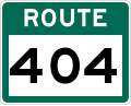
Route 404 is a short provincial highway on the west coast of Newfoundland in the Canadian province of Newfoundland and Labrador. It is one of four provincial...
4 KB (213 words) - 01:44, 16 July 2024

Route 403 is a minor highway in the western region of Newfoundland in the Canadian province of Newfoundland and Labrador. The highway begins at a junction...
2 KB (134 words) - 01:45, 16 July 2024

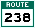
Route 239 is a highway in the Trinity Bight portion of Newfoundland in the Canadian province of Newfoundland and Labrador. It is a short route, running...
3 KB (216 words) - 15:16, 22 October 2022
island of Newfoundland. It is one of very few highways in Newfoundland and Labrador that both begin and end at the same highway, this one being Route 230 (Bonavista...
4 KB (357 words) - 21:38, 11 November 2022

Route 342 in Newfoundland and Labrador leads from Route 341 in Lewisporte to Embree and then to Little Burnt Bay, all on the island of Newfoundland. The...
3 KB (141 words) - 01:45, 16 July 2024

two being where Route 320 transitions to Route 330 (Road to the Shore/Gander Bay Road). List of Newfoundland and Labrador highways "Route 320" (Map). Google...
4 KB (210 words) - 15:29, 15 July 2024

Newfoundland in the province of Newfoundland and Labrador. It connects the towns of Boat Harbour, Brookside, and Petit Forte with Route 210 (Heritage Run/Burin...
4 KB (246 words) - 15:11, 22 October 2022

dead end near the western tip of the island. List of Newfoundland and Labrador highways "Route 350" (Map). Google Maps. Retrieved February 21, 2020....
5 KB (356 words) - 15:28, 22 October 2022