
Route 440 (also known as Admiral Palliser's Trail) is a relatively short highway in the Canadian province of Newfoundland and Labrador, on the West Coast...
4 KB (342 words) - 01:44, 16 July 2024

The Trans-Labrador Highway (TLH) is the primary public road in Labrador, the mainland portion of the province of Newfoundland and Labrador, Canada. The...
25 KB (1,536 words) - 11:01, 17 February 2025
This is a list of highways in Newfoundland and Labrador. Newfoundland and Labrador is unusual among jurisdictions in Canada in that it exclusively uses...
39 KB (2,795 words) - 03:06, 2 March 2024

of Newfoundland and Labrador. Its eastern terminus is the intersection at the Trans-Canada Highway (Route 1) in the Town of Badger, and the route ends...
4 KB (312 words) - 01:44, 16 July 2024

Route 406, also known as Codroy Road, is a highway on the western portion of Newfoundland in the Canadian province of Newfoundland and Labrador. It is...
4 KB (217 words) - 01:44, 16 July 2024

Newfoundland and Labrador is the easternmost province of Canada, in the country's Atlantic region. The province comprises the island of Newfoundland and...
200 KB (19,036 words) - 22:03, 19 June 2025

kind in the entire province of Newfoundland and Labrador. Route 520 begins at an intersection with Route 500 (Trans Labrador Highway) at the western edge...
4 KB (225 words) - 23:55, 10 May 2023

Route 470, also known as La Poile Highway, is a highway on the West Coast of the Canadian province of Newfoundland and Labrador. It is the last provincial...
5 KB (368 words) - 01:44, 16 July 2024

Canadian province of Newfoundland and Labrador. The route begins at the intersection of Route 1 (The Trans Canada Highway) in Deer Lake and ends in St. Anthony...
14 KB (825 words) - 18:21, 5 April 2024

in the Canadian province of Newfoundland and Labrador. It connects the town of Burgeo with the Trans-Canada Highway (Route 1). The highway is a winding...
4 KB (286 words) - 16:35, 18 April 2023

Route 201 (known as the Osprey Trail) is a provincial road in the Canadian province of Newfoundland and Labrador. It is one of only three loop roads designated...
4 KB (288 words) - 01:44, 16 July 2024

Newfoundland in the Canadian province of Newfoundland and Labrador. It begins at a junction of Route 430 in Wiltondale and terminates at Trout River. It serves...
4 KB (244 words) - 18:21, 5 April 2024

the Canadian province of Newfoundland and Labrador. The highway begins at a junction with Route 1 (Trans-Canada Highway) and continues to its west terminus...
3 KB (186 words) - 15:42, 22 October 2022
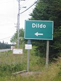
local service district and designated place in the Canadian province of Newfoundland and Labrador on the island of Newfoundland. It is located on the southeastern...
12 KB (1,054 words) - 22:18, 27 February 2025

Route 390, also known as Springdale Road, is a highway in the central portion of Newfoundland in the Canadian province of Newfoundland and Labrador. It...
3 KB (194 words) - 01:44, 16 July 2024

Newfoundland and Labrador. It leads from Sheppardville, at Route 1 (Trans-Canada Highway), to a dead end in Fleur de Lys, Newfoundland and Labrador....
5 KB (314 words) - 03:31, 24 May 2025

province of Newfoundland and Labrador. It straddles the line between the provinces two largest cities, the capital city of St. John's and the city Mount...
7 KB (610 words) - 21:57, 8 March 2025

province of Newfoundland and Labrador. It connects the towns of Englee, Bide Arm, Roddickton, as well as Conche via Route 434 (Conche Road), with Route 432 (Main...
3 KB (163 words) - 18:21, 5 April 2024

Route 342 in Newfoundland and Labrador leads from Route 341 in Lewisporte to Embree and then to Little Burnt Bay, all on the island of Newfoundland. The...
3 KB (141 words) - 01:45, 16 July 2024

Route 30 is a 12.0-kilometre-long (7.5 mi) north-south provincial highway in Newfoundland and Labrador, extending from St. John's through Logy Bay-Middle...
3 KB (180 words) - 23:28, 14 February 2024

Route 75, also known as Veterans Memorial Highway, is a two-lane expressway on the Avalon Peninsula of Newfoundland. The route begins at a trumpet interchange...
7 KB (386 words) - 01:44, 16 July 2024

two being where Route 320 transitions to Route 330 (Road to the Shore/Gander Bay Road). List of Newfoundland and Labrador highways "Route 320" (Map). Google...
4 KB (210 words) - 15:29, 15 July 2024
Route 1 is a highway in the Canada province of Newfoundland and Labrador, and is the easternmost stretch of the Trans-Canada Highway. Route 1 is the primary...
32 KB (1,175 words) - 00:58, 24 December 2024
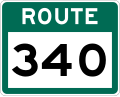
Route 340, also known as Road to the Isles, is a road in the Canadian province of Newfoundland and Labrador passing through the towns of Lewisporte, Summerford...
14 KB (699 words) - 01:31, 8 November 2024
Route 450A, also known as Lewin Parkway, is an alternate route of Route 450 in the city of Corner Brook, Newfoundland and Labrador. The route runs from...
3 KB (172 words) - 23:55, 10 May 2023

Route 213 is a highway on the Burin Peninsula of the island of Newfoundland in the Canadian province of Newfoundland and Labrador. It is one of a small...
3 KB (189 words) - 15:10, 22 October 2022

passengers last year". CBC. 2020-05-15. Retrieved 2020-12-17. "Newfoundland and Labrador Route 364" (Map). Google Maps. Retrieved February 26, 2020....
5 KB (270 words) - 14:19, 27 April 2024

Peninsula of Newfoundland in the Canadian province of Newfoundland and Labrador. It extends from the city of St. John's west to Paradise. Route 50 begins...
4 KB (256 words) - 23:29, 14 February 2024

Route 239 is a highway in the Trinity Bight portion of Newfoundland in the Canadian province of Newfoundland and Labrador. It is a short route, running...
3 KB (216 words) - 15:16, 22 October 2022

Route 403 is a minor highway in the western region of Newfoundland in the Canadian province of Newfoundland and Labrador. The highway begins at a junction...
2 KB (134 words) - 01:45, 16 July 2024