
Route 450 (also known as Captain Cook's Trail) is a highway in the Canadian province of Newfoundland and Labrador. The highway starts at an interchange...
6 KB (416 words) - 15:45, 22 October 2022
This is a list of highways in Newfoundland and Labrador. Newfoundland and Labrador is unusual among jurisdictions in Canada in that it exclusively uses...
39 KB (2,795 words) - 03:06, 2 March 2024

The Trans-Labrador Highway (TLH) is the primary public road in Labrador, the mainland portion of the province of Newfoundland and Labrador, Canada. The...
25 KB (1,536 words) - 11:01, 17 February 2025
Route 450A, also known as Lewin Parkway, is an alternate route of Route 450 in the city of Corner Brook, Newfoundland and Labrador. The route runs from...
3 KB (172 words) - 23:55, 10 May 2023

Route 30 is a 12.0-kilometre-long (7.5 mi) north-south provincial highway in Newfoundland and Labrador, extending from St. John's through Logy Bay-Middle...
3 KB (180 words) - 23:28, 14 February 2024

Route 20 is a 30.2-kilometre-long (18.8 mi) provincial highway in Newfoundland and Labrador, extending from St. John's to the towns of Torbay, Flatrock...
6 KB (302 words) - 21:23, 31 January 2025

in the Canadian province of Newfoundland and Labrador. It connects the town of Burgeo with the Trans-Canada Highway (Route 1). The highway is a winding...
4 KB (286 words) - 16:35, 18 April 2023
are numbered 450: Manitoba Provincial Road 450 New Brunswick Route 450 Newfoundland and Labrador Route 450 Route 450 (Japan) U.S. Route 450 (former) Florida...
1 KB (100 words) - 23:02, 23 August 2024
Route 1 is a highway in the Canada province of Newfoundland and Labrador, and is the easternmost stretch of the Trans-Canada Highway. Route 1 is the primary...
32 KB (1,175 words) - 00:58, 24 December 2024

Route 100 (also known as The Cape Shore Highway and Argentia Access Road) is a major highway in Newfoundland and Labrador. The highway begins at its northern...
8 KB (472 words) - 23:31, 14 February 2024

Canadian province of Newfoundland and Labrador. The route begins at the intersection of Route 1 (The Trans Canada Highway) in Deer Lake and ends in St. Anthony...
14 KB (825 words) - 18:21, 5 April 2024

Newfoundland in the Canadian province of Newfoundland and Labrador. It begins at a junction of Route 430 in Wiltondale and terminates at Trout River. It serves...
4 KB (244 words) - 18:21, 5 April 2024

Cove-St. Philips in Newfoundland and Labrador, Canada. Route 40 also serves as the primary access to St. John's International Airport and the Bell Island...
4 KB (271 words) - 21:09, 30 August 2024

Avalon Peninsula of Newfoundland in the Canadian province of Newfoundland and Labrador. Its southern terminus is at Route 10 in Goulds and its northern terminus...
4 KB (295 words) - 01:44, 16 July 2024

Route 470, also known as La Poile Highway, is a highway on the West Coast of the Canadian province of Newfoundland and Labrador. It is the last provincial...
5 KB (368 words) - 01:44, 16 July 2024

province of Newfoundland and Labrador. It straddles the line between the provinces two largest cities, the capital city of St. John's and the city Mount...
7 KB (610 words) - 21:57, 8 March 2025

Newfoundland and Labrador. Its southern terminus is at Route 90 in St. Vincent's-St. Stephen's-Peter's River, and its northern terminus is at Route 2...
7 KB (338 words) - 23:27, 14 February 2024

Route 335, also known as Farewell Road, is a highway in the northern portion of Newfoundland in the Canadian province of Newfoundland and Labrador. The...
3 KB (176 words) - 15:22, 22 October 2022

Route 403 is a minor highway in the western region of Newfoundland in the Canadian province of Newfoundland and Labrador. The highway begins at a junction...
2 KB (134 words) - 01:45, 16 July 2024

the Canadian province of Newfoundland and Labrador. The highway begins at a junction with the Trans-Canada Highway (Route 1) and continues to its southern...
2 KB (137 words) - 22:51, 24 May 2025

of Newfoundland and Labrador. Its eastern terminus is the intersection at the Trans-Canada Highway (Route 1) in the Town of Badger, and the route ends...
4 KB (312 words) - 01:44, 16 July 2024
and designated place in the Canadian province of Newfoundland and Labrador. It is on the east shore of Trinity Bay, along Provincial Route 80. Route 80's...
10 KB (834 words) - 15:28, 6 July 2024
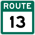
Route 13, also known as Witless Bay Line, is a 20.9-kilometre (13.0 mi), uncontrolled-access highway in Newfoundland and Labrador. Its western terminus...
2 KB (122 words) - 13:01, 5 March 2025

Newfoundland and Labrador. It leads from Sheppardville, at Route 1 (Trans-Canada Highway), to a dead end in Fleur de Lys, Newfoundland and Labrador....
5 KB (314 words) - 03:31, 24 May 2025

Route 239 is a highway in the Trinity Bight portion of Newfoundland in the Canadian province of Newfoundland and Labrador. It is a short route, running...
3 KB (216 words) - 15:16, 22 October 2022

Route 75, also known as Veterans Memorial Highway, is a two-lane expressway on the Avalon Peninsula of Newfoundland. The route begins at a trumpet interchange...
7 KB (386 words) - 01:44, 16 July 2024

island of Newfoundland in the Canadian province of Newfoundland and Labrador. It is a relatively short highway with no other towns on the route other than...
2 KB (100 words) - 01:44, 16 July 2024

highway on the Avalon Peninsula of Newfoundland. It runs between the town of Cupids and the city of St. John's. Route 60 begins as Topsail Road at the west...
8 KB (342 words) - 06:57, 16 January 2023

Route 213 is a highway on the Burin Peninsula of the island of Newfoundland in the Canadian province of Newfoundland and Labrador. It is one of a small...
3 KB (189 words) - 15:10, 22 October 2022

kind in the entire province of Newfoundland and Labrador. Route 520 begins at an intersection with Route 500 (Trans Labrador Highway) at the western edge...
4 KB (225 words) - 23:55, 10 May 2023