
Canadian province of Newfoundland and Labrador. Its northern terminus is an intersection at Route 91, near the town of Colinet, and its southern terminus...
3 KB (207 words) - 01:45, 16 July 2024
This is a list of highways in Newfoundland and Labrador. Newfoundland and Labrador is unusual among jurisdictions in Canada in that it exclusively uses...
39 KB (2,795 words) - 03:06, 2 March 2024

The Trans-Labrador Highway (TLH) is the primary public road in Labrador, the mainland portion of the province of Newfoundland and Labrador, Canada. The...
25 KB (1,536 words) - 11:01, 17 February 2025

town and designated place in the Canadian province of Newfoundland and Labrador. Located in the northeastern portion of the island of Newfoundland on Freshwater...
7 KB (427 words) - 19:33, 16 February 2025

Trinity is a small town located on Trinity Bay in Newfoundland and Labrador. The town contains a number of buildings recognized as Registered Heritage...
14 KB (1,068 words) - 07:02, 1 March 2025

of Newfoundland and Labrador. Its eastern terminus is the intersection at the Trans-Canada Highway (Route 1) in the Town of Badger, and the route ends...
4 KB (312 words) - 01:44, 16 July 2024

Canadian province of Newfoundland and Labrador. The route begins at the intersection of Route 1 (The Trans Canada Highway) in Deer Lake and ends in St. Anthony...
14 KB (825 words) - 12:46, 29 June 2025
Victoria is a landlocked town on the Avalon Peninsula in Newfoundland and Labrador, Canada, located approximately midway on the Bay de Verde Peninsula...
9 KB (541 words) - 19:01, 5 July 2024

Route 30 is a 12.0-kilometre-long (7.5 mi) north-south provincial highway in Newfoundland and Labrador, extending from St. John's through Logy Bay-Middle...
3 KB (180 words) - 23:28, 14 February 2024
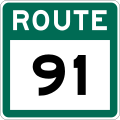
Avalon Peninsula in the Canadian province of Newfoundland and Labrador. The highway starts at a junction at Route 90, traveling through the town of Colinet...
4 KB (174 words) - 01:44, 16 July 2024
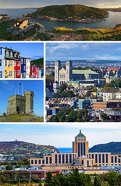
St. John's is the capital and largest city of the Canadian province of Newfoundland and Labrador. It is located on the eastern tip of the Avalon Peninsula...
160 KB (13,416 words) - 06:02, 30 June 2025

in the Canadian province of Newfoundland and Labrador. It connects the town of Burgeo with the Trans-Canada Highway (Route 1). The highway is a winding...
4 KB (286 words) - 16:35, 18 April 2023

be accessed via Route 100 or Route 92. Nearby communities include Point Lance and St. Bride's, Newfoundland and Labrador. The first settler of Branch...
6 KB (292 words) - 15:54, 4 June 2025

Newfoundland in the Canadian province of Newfoundland and Labrador. It begins at a junction of Route 430 in Wiltondale and terminates at Trout River. It serves...
4 KB (244 words) - 18:21, 5 April 2024

Route 422, also known as Cormack Road, is a relatively short highway on western Newfoundland in the Canadian province of Newfoundland and Labrador. The...
3 KB (199 words) - 12:46, 29 June 2025
Route 1 is a highway in the Canada province of Newfoundland and Labrador, and is the easternmost stretch of the Trans-Canada Highway. Route 1 is the primary...
32 KB (1,175 words) - 01:00, 1 July 2025

Newfoundland and Labrador. It leads from Sheppardville, at Route 1 (Trans-Canada Highway), to a dead end in Fleur de Lys, Newfoundland and Labrador....
5 KB (314 words) - 03:31, 24 May 2025

Route 20 is a 30.2-kilometre-long (18.8 mi) provincial highway in Newfoundland and Labrador, extending from St. John's to the towns of Torbay, Flatrock...
6 KB (302 words) - 21:23, 31 January 2025

Route 470, also known as La Poile Highway, is a highway on the West Coast of the Canadian province of Newfoundland and Labrador. It is the last provincial...
5 KB (368 words) - 01:44, 16 July 2024

northernmost permanent settlement in the Canadian province of Newfoundland and Labrador, within the Nunatsiavut region, located about 370 km (230 mi)...
34 KB (1,981 words) - 20:40, 19 June 2025
Party of Newfoundland and Labrador is a provincial political party in Newfoundland and Labrador, Canada. The party was founded in 1949 and most recently...
100 KB (9,730 words) - 22:48, 23 June 2025

the Canadian province of Newfoundland and Labrador. The highway begins at a junction with Route 1 (Trans-Canada Highway) and continues to its west terminus...
3 KB (186 words) - 15:42, 22 October 2022

from Goobies to Grand Bank, Newfoundland and Labrador. The maximum speed limit is 90 km/h except through communities and settlements where the speed limit...
15 KB (719 words) - 15:08, 22 October 2022
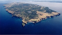
Bell Island is an island that is part of Newfoundland and Labrador, Canada's easternmost province. With an area of 34 square kilometres (13 sq mi), it...
127 KB (15,376 words) - 00:59, 1 July 2025

Route 406, also known as Codroy Road, is a highway on the western portion of Newfoundland in the Canadian province of Newfoundland and Labrador. It is...
4 KB (217 words) - 01:44, 16 July 2024
in the northeastern part of the island of Newfoundland in the Canadian province of Newfoundland and Labrador, approximately 40 km (25 mi) south of Gander...
36 KB (2,692 words) - 23:27, 22 June 2025
community in the province of Newfoundland and Labrador, Canada. It is home to the Churchill Falls Generating Station and is a company town. John McLean...
13 KB (569 words) - 10:48, 27 May 2025

kind in the entire province of Newfoundland and Labrador. Route 520 begins at an intersection with Route 500 (Trans Labrador Highway) at the western edge...
4 KB (225 words) - 12:56, 29 June 2025

Newfoundland Railway Company had built 92 km (57 mi) west to Whitbourne before going into receivership. The bondholders of the bankrupt Newfoundland Railway...
28 KB (2,379 words) - 03:24, 9 March 2025

Route 201 (known as the Osprey Trail) is a provincial road in the Canadian province of Newfoundland and Labrador. It is one of only three loop roads designated...
4 KB (288 words) - 01:44, 16 July 2024