
Swift River Valley region, a reference to the Swift River, which was dammed to form the reservoir. At its most restrictive, the Quabbin–Swift River Valley...
5 KB (318 words) - 13:35, 28 July 2024

an area of 38.6 square miles (100 km2). Quabbin Reservoir is formed by the flooding of the Swift River Valley behind Winsor Dam and Goodnough Dike. The...
24 KB (2,812 words) - 00:22, 17 July 2025

branch. It is a tributary of the Ware River. Part of it is dammed in the Swift River Valley to form the Quabbin Reservoir serving Boston and Eastern Massachusetts...
2 KB (192 words) - 14:11, 12 May 2024

May 9, 2015. "Chasing loons: Banding the elusive birds at night on the Quabbin Reservoir". masslive.com. July 28, 2014. Retrieved April 23, 2015. "Coastal...
256 KB (22,331 words) - 05:01, 21 July 2025
Massachusetts The Berkshires (shown in map) Housatonic Valley Pioneer Valley Quabbin-Swift River Valley Regions of Michigan include: Northern Michigan Traverse...
54 KB (3,843 words) - 22:01, 17 July 2025

flooding. The creation of the Quabbin Reservoir in the 1930s diverted the Swift River, which feeds the Chicopee River, a tributary of the Connecticut...
75 KB (7,177 words) - 18:00, 14 July 2025

Secretary of the Commonwealth of Massachusetts. Retrieved 8 May 2013. "'Swift-footed lizard' is named the Massachusetts state dinosaur". NPR. 2022-10-19...
9 KB (207 words) - 00:26, 8 June 2025
in this valley before it was flooded for the reservoir. Greenwich was disincorporated on April 28, 1938, as part of the creation of the Quabbin Reservoir...
7 KB (437 words) - 09:34, 25 June 2025
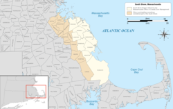
Shore Western Massachusetts The Berkshires Housatonic Valley Pioneer Valley Quabbin-Swift River Valley Counties Barnstable Berkshire Bristol Dukes Essex Franklin...
13 KB (630 words) - 01:49, 1 February 2025
Shore Western Massachusetts The Berkshires Housatonic Valley Pioneer Valley Quabbin-Swift River Valley Counties Barnstable Berkshire Bristol Dukes Essex Franklin...
15 KB (1,721 words) - 20:55, 7 July 2025
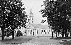
style of a European castle turret in Scituate Center, Massachusetts. North River Wildlife Sanctuary, a wildlife sanctuary owned by the Massachusetts Audubon...
24 KB (844 words) - 17:07, 30 July 2024

Ware River, then continues through the Quabbin Valley to New Braintree and Barre roughly following the Ware River northeast. All improved sections are a...
109 KB (10,990 words) - 05:24, 19 July 2025

Prescott, Massachusetts (section Other Quabbin towns)
not allowed on the peninsula except for an annual tour given by the Swift River Valley Historical Society, or for hikes conducted by the Society. None of...
8 KB (585 words) - 09:48, 25 June 2025
first State normal school in America; the journals of Cyrus Peirce and Mary Swift (Harvard UP, 1926) pp xiii to lvi. online Normal Schools – History of American...
31 KB (3,606 words) - 12:57, 21 July 2025
construction of the Quabbin Reservoir was located in the former town hall and was the last building razed in the Swift River Valley, in 1940. The majority...
8 KB (582 words) - 08:45, 25 June 2025
expanded greatly by the building of the Quabbin Reservoir in 1938. When the towns of the Swift River Valley were disincorporated, Petersham and neighboring...
16 KB (1,860 words) - 02:43, 29 June 2025

again, however, when the Quabbin Reservoir was formed along the branches of the Swift River. The reservoir filled along the river, and protected lands along...
13 KB (1,617 words) - 02:40, 29 June 2025

the construction of the Quabbin Reservoir. The reservoir dammed the Swift River in the former town of Enfield, flooding the valley. Four towns—Enfield, Greenwich...
19 KB (2,068 words) - 02:30, 1 July 2025

Shore Western Massachusetts The Berkshires Housatonic Valley Pioneer Valley Quabbin-Swift River Valley Counties Barnstable Berkshire Bristol Dukes Essex Franklin...
13 KB (299 words) - 01:54, 17 July 2025
Massachusetts List of Registered Historic Places in Massachusetts List of rivers of Massachusetts List of school districts in Massachusetts List of state...
21 KB (1,751 words) - 21:35, 9 March 2024

eastern part of the area, the Quabbin region is a place of outdoor recreation. Archeological efforts in the Connecticut River Valley have revealed traces of...
49 KB (5,208 words) - 01:48, 12 January 2025

generally difficult economic times. When four Swift River Valley towns were flooded to create the Quabbin Reservoir, the Springfield railroad route had...
39 KB (4,501 words) - 05:44, 17 July 2025

Shore Western Massachusetts The Berkshires Housatonic Valley Pioneer Valley Quabbin-Swift River Valley Counties Barnstable Berkshire Bristol Dukes Essex Franklin...
16 KB (1,848 words) - 13:04, 9 December 2023
Shore Western Massachusetts The Berkshires Housatonic Valley Pioneer Valley Quabbin-Swift River Valley Counties Barnstable Berkshire Bristol Dukes Essex Franklin...
49 KB (840 words) - 01:56, 29 April 2025
on May 13, 1956, as WCAT, operating on 1390 AM. Original owner Miller's River Broadcasting sold the station to Tri-State Radio in 1960, who in turn sold...
17 KB (1,523 words) - 08:29, 20 July 2025

by the former West and Middle Branches of the Swift River, which are now submerged as part of the Quabbin Reservoir. The land of the two forks of the reservoir...
15 KB (1,803 words) - 00:43, 29 June 2025

Connecticut River. The Chicopee River Watershed includes all or part of 32 cities and towns. Upstream of the Chicopee River on the Swift River, the Quabbin Reservoir...
8 KB (822 words) - 23:41, 29 March 2025

Chicopee River Watershed. The Goodnough Dike is not as large as the Winsor Dam, but it is equally important as they both trap the waters of the Quabbin Reservoir...
4 KB (415 words) - 05:23, 16 July 2025
Park Quabbin Reservoir Robert Frost Hiking Trail Scarborough Conservation Area Shelton Brothers Importers Skettersville Pond Stone House Museum Swift River...
40 KB (4,943 words) - 13:28, 22 July 2025

the building of the Quabbin Reservoir. The reservoir's waters extend into the town along the former East Branch of the Swift River, which once ran through...
15 KB (1,697 words) - 11:16, 28 June 2025