Radar calibration satellites are orbital satellites used to calibrate ground-based space surveillance radars. There are two types: active and passive....
4 KB (410 words) - 00:36, 15 April 2025
Pennsylvania State University. Retrieved 21 August 2019. "radar calibration via satellites". National Astronomy and Ionosphere Center. Acreibo Observatory...
6 KB (538 words) - 16:58, 27 February 2025
RADCAL (category Radar calibration satellites)
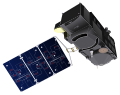
RADCAL (short for RADar CALibration Satellite) was a radar calibration satellite launched and operated by the United States Air Force. It was active from...
6 KB (459 words) - 03:38, 28 May 2025

reflector for NISAR.It will play a key role in calibration and course correction of the Nisar satellite's radar during the in-orbit checkout phase. ISRO's...
15 KB (1,272 words) - 06:40, 8 June 2025
SURCAL (category Radar calibration satellites)
The Surveillance Calibration (or SURCAL) satellites were a series of radar calibration satellites for the Naval Space Surveillance radar system. They were...
7 KB (391 words) - 15:31, 4 February 2024
ODERACS 2 (category Radar calibration satellites)
ODERACS-2 (Orbital Debris Radar Calibration Sphere 2) was a series of six spheres deployed from the shuttle mission STS-63, ODERACS-2A through -2. The...
2 KB (138 words) - 11:06, 31 October 2023

determine the geocentric position of an Earth satellite, allowing for the precise calibration of radar altimeters and separation of long-term instrumentation...
21 KB (2,338 words) - 10:15, 25 November 2024
RADCAT (category Radar calibration satellites)
RADCAT (RADar CAlibration Target) were a pair of passive radar calibration satellites operated by the United States. They were cylinders with a radar cross...
895 bytes (72 words) - 17:31, 19 November 2023
machine learning system Lincoln Calibration Sphere 1, first of a series of inert globes used as radar calibration satellites Liquid cooling system Locally...
3 KB (436 words) - 12:05, 26 November 2024

instrument aboard Biomass is a synthetic aperture radar (SAR) operating at 435 MHz. The satellite measures 10 x 12 x 20 m, weighs around 1.2 tonnes and...
25 KB (2,156 words) - 10:28, 1 June 2025

Synthetic-aperture radar (SAR) is a form of radar that is used to create two-dimensional images or three-dimensional reconstructions of objects, such as...
79 KB (11,260 words) - 07:13, 27 May 2025

Surface Water and Ocean Topography (redirect from Ka-band Radar Interferometer)
approximately an order of magnitude finer than current satellites. It does this using synthetic aperture radar interferometry. Because it uses wide-swath altimetry...
16 KB (1,695 words) - 00:06, 8 May 2025

A weather radar, also called weather surveillance radar (WSR) and Doppler weather radar, is a type of radar used to locate precipitation, calculate its...
106 KB (12,857 words) - 16:10, 31 May 2025
Radiolocation (redirect from Radiolocation-satellite service)
radiolocation-satellite service "ORS-2" space-based radar "NRO Lacrosse" radar satellite "ROSAR" radar satellite The allocation of radio frequencies is provided...
19 KB (2,111 words) - 10:35, 25 May 2025
determine the geocentric position of an Earth satellite, allowing for the precise calibration of radar altimeters and separation of long-term instrumentation...
20 KB (2,022 words) - 22:40, 22 May 2025
shut down.[citation needed] An attempted launch of a military radar calibration satellite on 25 January 1983 suffered another first stage failure about...
9 KB (690 words) - 16:47, 4 December 2024
Scatterometer (redirect from Radar scatterometer)
is a scientific instrument to measure the return of a beam of light or radar waves scattered by diffusion in a medium such as air. Diffusionmeters using...
12 KB (1,457 words) - 21:33, 24 May 2025
Sentinel-3 (category Earth satellite radar altimeters)
real aperture radar) and 17.8 kHz (synthetic aperture radar - SAR). DORIS (Doppler Orbitography and Radiopositioning Integrated by Satellite) is a receiver...
22 KB (1,995 words) - 07:23, 6 April 2025
of Soviet satellites developed by the Yuzhnoye Design Office, for use in calibrating the Dnestr space surveillance and early-warning radar system. Between...
2 KB (179 words) - 15:49, 8 September 2024

Altimeter (section Radar altimeter)
(Jason-2) are satellite missions that use altimeters to measure sea surface height Level sensor Lidar Pressure sensor Primary flight display Radar altimeter...
6 KB (732 words) - 10:07, 21 May 2025

Earth's precipitation patterns and provides a new calibration standard for the rest of the satellite constellation. The GPM Core Observatory was assembled...
16 KB (1,352 words) - 04:39, 23 March 2025

Soil Moisture Active Passive (redirect from SMAP (satellite))
2015, scientists completed their initial calibration of the two instruments on board, however, SMAP's radar stopped transmitting 7 July due to an anomaly...
21 KB (1,894 words) - 18:24, 23 May 2025
Kosmos 725 (category Kosmos satellites)
which was built by the Yuzhnoye Design Bureau, and was used as a radar calibration target for anti-ballistic missile tests. A Kosmos-2I 63SM carrier...
4 KB (306 words) - 12:02, 24 October 2024

TerraSAR-X (category Synthetic aperture radar satellites)
TerraSAR-X is an imaging radar Earth observation satellite, a joint venture being carried out under a public-private-partnership between the German Aerospace...
14 KB (1,457 words) - 02:29, 4 June 2025

Jason-1 (category Earth satellite radar altimeters)
orbit to TOPEX/Poseidon, which allowed for cross calibration. At the end of this period, the older satellite was moved to a new orbit midway between each...
21 KB (2,271 words) - 11:09, 12 February 2025
Radar MASINT is a subdiscipline of measurement and signature intelligence (MASINT) and refers to intelligence gathering activities that bring together...
43 KB (5,274 words) - 22:39, 16 April 2025

"Characterization of the Advanced Satellite for Cosmology and Astrophysics X-ray telescope: Preflight calibration and ray tracing". Applied Optics. 34...
9 KB (745 words) - 17:46, 2 October 2024

Eglin AFB Site C-6 (category Strategic Air Command radar stations)
Operations Center satellite catalogue. With a peak radiated power of 32 megawatts the Space Force claims it is the most powerful radar in the world, and...
46 KB (4,799 words) - 13:57, 26 May 2025

Remote sensing (redirect from Remote sensing satellites)
areas. For a summary of major remote sensing satellite systems see the overview table. Conventional radar is mostly associated with aerial traffic control...
60 KB (7,328 words) - 00:05, 9 June 2025

GEOS-3 (category Earth satellite radar altimeters)
measurements. The system also supported the altimeter and C-band calibration. Satellite-to-Satellite Tracking (SST) – The SST experiment consisted of the ground-based...
7 KB (643 words) - 16:25, 22 January 2024