
The Shire of Strathbogie is a local government area in the Hume region of Victoria, Australia, located in the north-east part of the state. It covers an...
10 KB (512 words) - 05:24, 25 May 2025
home ground of association football club Huntly F.C. Strathbogie, Victoria, Australia Shire of Strathbogie, Victoria, Australia Strathbogie Ranges, Victoria...
522 bytes (100 words) - 02:49, 18 July 2015

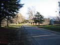
Strathbogie is a town in central Victoria, Australia. It is in the Shire of Strathbogie local government area. At the 2016 census, Strathbogie and the...
11 KB (831 words) - 05:13, 11 May 2025

South (1902–1969) • Creek Junction (1885–1969 Too-Rour, Strathbogie North, Watson's (Strathbogie North)) • Creightons Creek (1902–1937 Creighton Creek...
134 KB (12,146 words) - 22:54, 19 January 2025

Rural City of Benalla, the Shire of Baw Baw, the Shire of Murrindindi, the Shire of Yarra Ranges, the Shire of Strathbogie and the Shire of Wellington...
8 KB (493 words) - 05:23, 25 May 2025

Nagambie (category Shire of Strathbogie)
Goulburn Valley region of Victoria, Australia. The city is on the Goulburn Valley Freeway north of Seymour and in the Shire of Strathbogie. In the 2021 census...
11 KB (1,170 words) - 08:21, 2 May 2025

Hume (region) (category Regions of Victoria (state))
of Alpine Shire, Rural City of Benalla, City of Wodonga, City of Greater Shepparton, Shire of Indigo, Shire of Mansfield, Shire of Strathbogie, Shire...
17 KB (1,264 words) - 06:19, 4 October 2024

Euroa (category Shire of Strathbogie)
Euroa is a town in the Shire of Strathbogie in the north-east of Victoria, Australia. At the 2021 census, Euroa's population was 3,116. The name Euroa...
13 KB (824 words) - 11:46, 5 April 2025

Avenel, Victoria (category Shire of Strathbogie)
Avenel is a town in the Shire of Strathbogie, Victoria, Australia. At the 2021 census, Avenel had a population of 1,112, up from 1048 at the 2016 census...
6 KB (530 words) - 13:11, 16 January 2025

Mangalore, Victoria (category Shire of Strathbogie)
locality in the state of Victoria, Australia. The town is the Shire of Strathbogie local government area, and is 12km north of Seymour and two hours from...
7 KB (297 words) - 17:59, 13 March 2025

Greater Shepparton, Shire of Mitchell, Shire of Moira, Shire of Murrindindi, Shire of Strathbogie Victoria, Regional Development (17 May 2018). "Hume's Goulburn...
1 KB (49 words) - 04:31, 7 May 2024

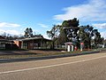
Violet Town (category Shire of Strathbogie)
Victoria, Australia. The town is in the Shire of Strathbogie local government area, 174 kilometres (108 mi) northeast of the state capital, Melbourne on the...
11 KB (1,256 words) - 11:35, 5 April 2025
Ruffy, Victoria (category Shire of Strathbogie)
Australia. It straddles the border of the Shire of Strathbogie and the Shire of Murrindindi, 175 kilometres (109 mi) north of the state capital, Melbourne....
3 KB (133 words) - 10:32, 16 July 2024
Whroo (category Shire of Strathbogie)
Whroo is a locality in the Shire of Strathbogie and Shire of Campaspe, Victoria, Australia. The locality includes the Whroo Historical Area state reserve...
4 KB (330 words) - 09:44, 6 May 2024

City of Greater Bendigo, which was created earlier in April 1994. The Graytown district was transferred into the newly created Shire of Strathbogie, while...
4 KB (316 words) - 06:52, 25 May 2025

Longwood, Victoria (category Shire of Strathbogie)
town in northern Victoria, Australia. The town is located in the Shire of Strathbogie local government area, 149 kilometres (93 mi) from the state capital...
5 KB (483 words) - 19:18, 21 December 2024

Campaspe, Strathbogie, Benalla and Mitchell local government areas. After its formation, Euroa was classed as a safe Nationals seat, with a margin of 13.6%...
5 KB (244 words) - 11:14, 30 December 2023

a shire and is governed by a shire council. Local councils have the same administrative functions and similar political structures, regardless of their...
38 KB (325 words) - 03:42, 25 May 2025

merged into the newly created Shire of Strathbogie. The Arcadia and Karramomus districts were transferred to newly created City of Greater Shepparton, whilst...
4 KB (319 words) - 06:50, 25 May 2025
Mitchell Shire and the Strathbogie Shire, in the state of Victoria. This is the area north of the Great Divide. The southern half of the shire is served...
7 KB (879 words) - 06:24, 13 January 2024
Tahbilk (category Shire of Strathbogie)
located 120 km (75 miles) north of Melbourne between the townships of Seymour and Nagambie in the Nagambie Lakes a sub region of Goulburn Valley Wine Region...
15 KB (1,565 words) - 20:35, 6 January 2025

This is a list of places on the Victorian Heritage Register in the Shire of Strathbogie in Victoria, Australia. The Victorian Heritage Register is maintained...
5 KB (63 words) - 19:34, 12 March 2022

the Shires of Euroa and Violet Town, and some neighbouring districts, was merged into the newly created Shire of Strathbogie. The Shire of Goulburn was...
4 KB (243 words) - 06:51, 25 May 2025
Baddaginnie, Victoria (category Shire of Strathbogie)
Football Association 1925 - Baddaginnie: 6.16 - 52 d Strathbogie: 6.9 - 45 Australian Bureau of Statistics (28 June 2022). "Baddaginnie (suburb and locality)"...
4 KB (340 words) - 00:28, 17 May 2025
Tabilk (category Shire of Strathbogie)
Tabilk is a locality located in the Shire of Strathbogie. The 2016 census recorded that 131 people lived in the area. The closest major towns are Nagambie...
3 KB (266 words) - 07:41, 19 April 2025

Wahring, Victoria (category Shire of Strathbogie)
Australia. The locality is in the Shire of Strathbogie local government area, 149 kilometres (93 mi) north east of the state capital, Melbourne. Millicent...
2 KB (106 words) - 10:43, 18 September 2023
II Strathbogie (died 28 December 1326) was Earl of Atholl, Constable of Scotland, and Chief Warden of Northumberland. The eldest son and heir of John...
3 KB (435 words) - 11:48, 1 January 2024
Upotipotpon, Victoria (category Shire of Strathbogie)
Australia, 208 kilometres (129 mi) north-east of the state capital, Melbourne, and 27 kilometres (17 mi) km north of Violet Town. The name may derive from the...
3 KB (198 words) - 00:46, 16 April 2025

Locksley, Victoria (category Shire of Strathbogie)
located on the Longwood - Avenel Road (former Hume Highway in the Shire of Strathbogie local government area, 152 kilometres (94 mi) from the state capital...
6 KB (502 words) - 01:06, 8 August 2023

Constituting the Shires of Towong, Indigo, Milawa, Delatite, Strathbogie, Murrindindi, Mitchell, Moira and (etc.) – Part 6: Alpine Shire". Victoria Government...
11 KB (584 words) - 05:21, 25 May 2025