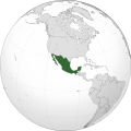
Land, and Atmosphere Long-term Observational and Collaborative Network (TLALOCNet) is a network of continuous Global Positioning System (GPS) and meteorology...
4 KB (427 words) - 11:18, 20 February 2025
continuous GPS meteorology or cGPS/Met sites. Along with the NSF-funded TLALOCNet GPS network in Mexico, the two networks of cGPS-Met instrumentation were...
10 KB (1,040 words) - 03:37, 11 December 2024

broader Network of the Americas (NOTA), along with networks in Mexico (TLALOCNet) and the Caribbean (COCONet), as part of the NSF's Geodetic Facility for...
5 KB (668 words) - 01:39, 19 October 2024
Observatory (PBO), which spans Alaska, the continental US, and Puerto Rico. TLALOCNet, which consists of 40 stations in Mexico. COCONet, which consists of 85...
4 KB (374 words) - 20:14, 2 December 2024
(which spans a range including Alaska, Continental U.S., and Puerto Rico), TLALOCNet (Mexico), and COCONet (Caribbean and the neighboring area). Data from...
15 KB (1,365 words) - 22:53, 19 June 2025
Citizen) 2011 Robert B. Smith of the University of Utah 2016 John Galetzka, TLALOCNet Project Manager of UNAVCO List of geology awards Recipients of the 2006...
10 KB (1,123 words) - 04:25, 22 July 2025