
Brooloo is a rural town and locality in the Gympie Region, Queensland, Australia. In the 2016 census, the locality of Brooloo had a population of 348...
6 KB (448 words) - 20:26, 27 March 2023
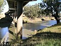
Gympie–Brooloo–Kenilworth Road is a continuous 51.6 kilometres (32.1 mi) road route in the Gympie and Sunshine Coast regions of Queensland, Australia...
11 KB (980 words) - 06:12, 9 January 2024

now closed. A branch line was opened from Monkland (south of Gympie) to Brooloo in 1915. A line was opened from the first South Brisbane station at Stanley...
55 KB (3,762 words) - 10:52, 10 May 2024
Warrego Highway state-controlled roads (redirect from River Road (Queensland))
Warrego Highway is described for administrative and funding purposes by the Queensland Department of Transport and Main Roads, and about the state-controlled...
23 KB (1,932 words) - 00:40, 22 January 2024
Queensland State Archives. Retrieved 6 May 2021. Imbil School centenary, 1897-1997 : incorporating Bella Junction, Bollier, Borumba Dam & Brooloo Schools...
6 KB (608 words) - 22:11, 26 May 2024

Bruce Highway (redirect from A1 highway (Queensland))
The Bruce Highway is a major highway in Queensland, Australia. Commencing in the state capital, Brisbane, it passes through areas close to the eastern...
101 KB (5,398 words) - 13:50, 10 May 2024

Kenilworth is a rural town and locality in the Sunshine Coast Region, Queensland, Australia. In the 2016 census, the locality of Kenilworth had a population...
15 KB (1,532 words) - 12:49, 11 February 2024

In Queensland, Highway 1 is a 2,964-kilometre (1,842 mi) long route that crosses the state, from the Northern Territory (NT) border near Wollogorang to...
9 KB (592 words) - 04:05, 16 May 2024
Road routes in Queensland assist drivers navigating roads throughout the state, by identifying important through-routes. Queensland is in the process of...
81 KB (670 words) - 20:26, 24 January 2024

centenary, 1897-1997 : incorporating Bella Junction, Bollier, Borumba Dam & Brooloo Schools, The Centenary Committee, 1997, pp. map, 5–9, ISBN 978-0-646-33095-2...
4 KB (337 words) - 01:27, 22 May 2024
railway line, Queensland#Branch lines Broadmount - North Coast railway line, Queensland#Branch lines Brooloo - North Coast railway line, Queensland#Branch lines...
3 KB (280 words) - 11:58, 3 July 2023

Brisbane to Lota, Kuraby and Corinda, Shorncliffe, Dayboro, Pinkenba, Kilcoy, Brooloo, Byellee (near Gladstone) to Monto and Selene, Bajool to Pt Alma, Rockhampton...
8 KB (648 words) - 01:57, 9 January 2024

Gregory Highway (redirect from A7 highway (Queensland))
Gregory Highway is a state highway in Queensland, Australia that serves the major coal-mining centres of Central Queensland. The highway was named after Augustus...
14 KB (691 words) - 05:47, 20 January 2024
Cairns road network (redirect from Anderson Street (Queensland))
a group of roads that provide access to the urban areas of Cairns in Queensland, Australia, and enable travel between the communities. Most of the roads...
6 KB (528 words) - 21:15, 5 April 2024

6845°E / -26.2110; 152.6845 (Monkland railway station)) and continued to Brooloo in the upper Mary Valley. It was constructed between 1911 and April 1915...
19 KB (1,687 words) - 23:52, 27 May 2024

2003. One of the Shay locomotives is preserved at Nambour. Monkland - Brooloo 44 km opened between 1914 and 1915, the Mary Valley Railway branched off...
59 KB (7,352 words) - 03:37, 10 May 2024

Amamoor (redirect from Amamoor, Queensland)
6741 (Amamoor railway station)) serving the locality. The second stage to Brooloo was completed in April 1915. The final stage to Kenilworth was to be built...
13 KB (1,268 words) - 18:36, 14 October 2023

Pacific Motorway (Brisbane–Brunswick Heads) (category Highways in Queensland)
in Australia between Brisbane, Queensland, and Brunswick Heads, New South Wales, through the New South Wales–Queensland border at Tweed Heads. The motorway...
52 KB (3,296 words) - 02:49, 11 January 2024
Castlereagh Highway (redirect from A55 road (Queensland))
located in New South Wales and Queensland, Australia. From north to south the highway traverses South West Queensland and the North West Slopes, Orana...
21 KB (1,617 words) - 20:23, 18 May 2024

Gympie Region (category Articles incorporating text from the State Library of Queensland)
Gympie Region is a local government area in the Wide Bay–Burnett region of Queensland, Australia, about 170 kilometres (110 mi) north of Brisbane, the state...
15 KB (1,037 words) - 10:13, 23 April 2024
Cunningham Highway state-controlled roads (category Roads in Queensland)
Cunningham Highway is described for administrative and funding purposes by the Queensland Department of Transport and Main Roads, and about the state-controlled...
22 KB (1,802 words) - 22:38, 9 February 2024

The Flinders Highway is a highway that crosses Queensland east to west, from Townsville on the Pacific coast to Cloncurry. The road continues as the Barkly...
19 KB (1,272 words) - 00:30, 5 May 2024
Moy Pocket is a rural locality in the Gympie Region, Queensland, Australia. In the 2021 census, Moy Pocket had a population of 120 people. In the 2016...
2 KB (102 words) - 06:22, 28 May 2024

Leichhardt Highway (redirect from A5 highway (Queensland))
The Leichhardt Highway is a major transport route in Queensland, Australia. It is a continuation northward from Goondiwindi of the Newell Highway, via...
9 KB (266 words) - 22:59, 27 May 2024
Roma–Condamine Road (category Roads in Queensland)
road route in the Maranoa and Western Downs local government areas of Queensland, Australia. It is a state-controlled regional road (number 344), rated...
12 KB (1,042 words) - 21:17, 6 March 2024
Dam & Brooloo Schools, The Centenary Committee, 1997, pp. map, 10–17, ISBN 978-0-646-33095-2 Queensland Family History Society (2010), Queensland schools...
8 KB (763 words) - 04:46, 22 May 2024

New England Highway (category Highways in Queensland)
long highway in Australia running from Yarraman, north of Toowoomba, Queensland, at its northern end to Hexham at Newcastle, New South Wales, at its southern...
41 KB (2,888 words) - 17:00, 20 May 2024
approved 1914 Glenmorgan – Surat, approved 1914 Lawgi – Monto, approved 1920 Brooloo – Kenilworth, approved 1920 Dobbyn – 80 km towards Burketown, approved...
4 KB (268 words) - 09:55, 7 November 2023
Eumundi–Noosa Road (category Roads in Queensland)
state-controlled roads; Kenilworth–Skyring Creek Road, Obi Obi Road, and Kenilworth–Brooloo Road. It also has an exit to the Bruce Highway in Eerwah Vale. Emu Mountain...
12 KB (1,026 words) - 23:20, 8 May 2024
Atherton–Malanda–Millaa Millaa Road (category Roads in Queensland)
0-kilometre (24.2 mi) road route in the Tablelands local government area of Queensland, Australia. It has two official names, Malanda–Atherton Road and Millaa...
10 KB (845 words) - 06:24, 9 January 2024