
meteorology, a competing display system is the CAPPI (Constant Altitude Plan Position Indicator) when a multi-angle scan is available. Using computers...
6 KB (815 words) - 22:41, 13 February 2025

The constant altitude plan position indicator, better known as CAPPI, is a radar display which gives a horizontal cross-section of data at constant altitude...
4 KB (549 words) - 05:10, 9 December 2023

on the cloud. To avoid some of the PPI problems, the constant-altitude plan position indicator (CAPPI) has been developed by Canadian researchers. It...
106 KB (12,857 words) - 02:51, 9 July 2025

it is a constant independent of weight, bank angle, temperature, density altitude, and the center of gravity of an aircraft. An AOA indicator provides...
11 KB (1,097 words) - 08:46, 27 January 2025

airspeed indicators on aircraft instrument panels have been configured to read in knots, kilometers per hour, miles per hour. In high altitude flight,...
14 KB (1,896 words) - 23:32, 21 February 2025
Plan Position Indicator. Users have a pointing device with several buttons that provides access to the track file through the Plan Position Indicator...
18 KB (2,505 words) - 23:28, 28 December 2024

The complex electromechanical attitude director indicator (ADI) and horizontal situation indicator (HSI) were the first candidates for replacement by...
15 KB (1,922 words) - 20:50, 13 December 2024

autopilot is a system used to control the path of a vehicle without requiring constant manual control by a human operator. Autopilots do not replace human operators...
21 KB (2,771 words) - 09:26, 11 June 2025
Nozzle Control (CENC) – Convertiplane – Cowling – Crab landing – Crash position indicator – Cross control – CTAF – Cyclic Deep stall – Delta wing – Dihedral...
16 KB (1,411 words) - 08:17, 12 July 2025

VHF omnidirectional range (section Constants)
course on a Radio Magnetic Indicator, or setting it on a course deviation indicator (CDI) or a horizontal situation indicator (HSI, a more sophisticated...
53 KB (6,920 words) - 08:34, 12 July 2025
operating minima AOP Airport operating plan AP Autopilot A/P Airplane (US), Aeroplane (ICAO) APARS Automatic pressure altitude reporting system APC Auto pilot...
72 KB (315 words) - 16:12, 29 June 2025

Decompression sickness (redirect from Altitude-induced decompression sickness)
decompression from saturation, flying in an unpressurised aircraft at high altitude, and extravehicular activity from spacecraft. DCS and arterial gas embolism...
131 KB (14,382 words) - 10:44, 30 June 2025

special drift-and-speed indicator for the flight around the world in which only one known factor was required, namely, the altitude above the object sighted...
17 KB (2,183 words) - 22:55, 5 May 2025
Air navigation (redirect from Altitude navigation)
collisions with obstructions are usually fatal. Therefore, constant awareness of position is critical for aircraft pilots. The techniques used for navigation...
21 KB (3,087 words) - 22:23, 29 March 2025
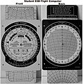
calculators or calculators containing flight planning software are permitted to be used. Many airspeed indicator (ASI) instruments have a movable ring built...
15 KB (2,241 words) - 01:28, 23 June 2025

Flight management system (category Flight planning)
cruise altitude. For aircraft that do not have a GPS, the initial position is also required. The pilot uses the FMS to modify the flight plan in flight...
14 KB (1,963 words) - 15:59, 23 May 2025

the PAR derived guidance information displayed on a special PPI (Plan Position Indicator) via VHF- or UHF-voice-communication. PAR GCA requires no equipment...
59 KB (7,071 words) - 06:44, 25 June 2025

Instrument approach (redirect from Decision altitude)
shows both the decision altitude (DA) and decision height (DH). Finally, the chart depicts the missed approach procedures in plan and profile view, besides...
38 KB (4,760 words) - 10:47, 23 May 2025

Terrain-following radar designed to allow the aircraft to fly at a constant altitude, which would, in theory, produce better reconnaissance photos. Unfortunately...
69 KB (9,101 words) - 17:53, 5 July 2025

based upon the assumption that target speed, direction, and altitude would remain constant during the prediction cycle, which consisted of the time to...
35 KB (4,621 words) - 14:58, 2 June 2025

position of the control surface on its axis will change until the torques from the control surface and the trim surface balance each other. Planing boats...
12 KB (1,577 words) - 04:19, 18 March 2025
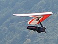
then pilots have been able to soar for hours, gain thousands of meters of altitude in thermal updrafts, perform aerobatics, and glide cross-country for hundreds...
41 KB (5,290 words) - 18:23, 22 May 2025

in the latter position until the end of the flight.[citation needed] At 02:11:10 UTC, the aircraft had climbed to its maximum altitude around 38,000 feet...
227 KB (20,460 words) - 14:48, 14 July 2025

bomb wing's flying operations. The mission plan for the flight called for a demanding series of low-altitude passes, 60° banked turns, a steep climb, and...
30 KB (3,648 words) - 21:03, 6 July 2025

Navigation (redirect from Estimated position)
latitude, and altitude) within a few meters using time signals transmitted along a line of sight by radio from satellites. Positions derived can then...
84 KB (9,533 words) - 14:19, 9 July 2025
be a sensitive indicator of low risk decompression, therefore the quantitative detection of VGE is thought to be useful as an indicator of decompression...
33 KB (3,622 words) - 22:55, 16 April 2025

F-14s flew combat air patrols at high altitude, pairs of F-5Es or F-4 Phantoms were positioned at low altitude in order to prevent Iraqi fighters from...
144 KB (18,733 words) - 21:38, 23 June 2025
a mirror tilted according to the magnitude of the data to be recorded (altitude, speed, etc.). A pre-production run of 25 "HB" recorders was ordered in...
74 KB (7,417 words) - 21:07, 11 July 2025

features promised unprecedented accuracy for daytime bombing from high altitudes. During prewar testing the Norden demonstrated a 150 feet (46 m) circular...
68 KB (9,879 words) - 03:28, 16 April 2025
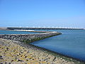
Coastal management (section Shoreline indicator)
of shoreline indicators to represent the true shoreline position. The choice of shoreline indicator is a primary consideration. Indicators must be easily...
56 KB (6,742 words) - 07:54, 25 May 2025