
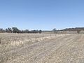
(secondary coordinates) Felton is a rural locality in the Toowoomba Region, Queensland, Australia. In the 2021 census, Felton had a population of 267...
9 KB (754 words) - 22:18, 25 May 2024
Felton may refer to: in Australia Felton, Queensland in Canada Felton, Ontario Felton River, in Estrie, Quebec in Cuba Felton, Mayarí in the United Kingdom...
672 bytes (97 words) - 12:38, 28 December 2020
Felton South is a rural locality in the Toowoomba Region, Queensland, Australia. In the 2021 census, Felton South had a population of 78 people. The locality...
7 KB (606 words) - 23:57, 7 September 2023
Toowoomba–Karara Road (redirect from Pittsworth–Felton Road)
through Felton, Felton South, and Ellangowan before reaching Leyburn. In Felton it passes exits to Felton-Clifton Road and Pittsworth-Felton Road. In...
14 KB (1,232 words) - 07:17, 23 December 2023
Gatton–Clifton Road (redirect from Felton–Clifton Road)
before reaching an intersection with King Street. The road ends here, with Felton–Clifton Road running north as King Street. In Fordsdale the road crosses...
13 KB (1,238 words) - 23:49, 1 January 2024

and closed on 1959. It was on Ted Mengel Road, now within the locality of Felton (27°50′41″S 151°49′45″E / 27.8446°S 151.8292°E / -27.8446; 151.8292...
18 KB (1,759 words) - 22:23, 29 March 2024

Cunnamulla (redirect from Cunnamulla, Queensland, Australia)
2011. Retrieved 7 February 2012. Felton-Taylor, Arlie; Phillips, Amy (23 February 2012). "Recovering from Queensland's 2012 flood". ABC Rural. Australian...
37 KB (3,189 words) - 14:18, 9 April 2024

Darling Downs (redirect from Darling Downs, Queensland)
Range in southern Queensland, Australia. The Downs are to the west of South East Queensland and are one of the major regions of Queensland. The name was generally...
35 KB (3,199 words) - 18:08, 28 March 2024

Bruce Highway (redirect from A1 highway (Queensland))
The Bruce Highway is a major highway in Queensland, Australia. Commencing in the state capital, Brisbane, it passes through areas close to the eastern...
101 KB (5,398 words) - 13:50, 10 May 2024
New England Highway state-controlled roads in Queensland presents information about how the Queensland segment of the New England Highway is described...
12 KB (1,052 words) - 01:05, 22 January 2024
Warrego Highway state-controlled roads (redirect from River Road (Queensland))
Warrego Highway is described for administrative and funding purposes by the Queensland Department of Transport and Main Roads, and about the state-controlled...
23 KB (1,932 words) - 00:40, 22 January 2024
Cairns road network (redirect from Anderson Street (Queensland))
a group of roads that provide access to the urban areas of Cairns in Queensland, Australia, and enable travel between the communities. Most of the roads...
6 KB (528 words) - 21:15, 5 April 2024

December 2023 – via National Library of Australia. "Parish of Felton" (Map). Queensland Government. 1946. Archived from the original on 21 April 2021...
9 KB (819 words) - 18:03, 23 December 2023
became Broxburn State School. It closed in 1959. It was on the Pittsworth Felton Road (27°43′56″S 151°40′29″E / 27.7323°S 151.6746°E / -27.7323; 151.6746...
7 KB (718 words) - 06:13, 22 May 2024

Toowoomba Region (redirect from Toowoomba City Council, Queensland)
Region is a local government area located in the Darling Downs part of Queensland, Australia. Established in 2008, it was preceded by several previous local...
22 KB (1,133 words) - 07:49, 4 May 2024
Alfred D Felton (1889-1951) was the first Australian after World War I to win the professional World Sculling Championship. Before the war seven other...
13 KB (2,103 words) - 09:22, 1 April 2024
Kim Felton (born 27 March 1975) is an Australian professional golfer. As an amateur, Felton won the Australian Amateur in 1997 and was the low individual...
8 KB (211 words) - 07:31, 23 May 2024
through the locality where it forms part of its northern boundary with Felton South. The land use is a mixture of crop growing (particularly in areas...
7 KB (515 words) - 21:57, 25 May 2024
Bruce Highway state-controlled roads (category Roads in Queensland)
Bruce Highway is described for administrative and funding purposes by the Queensland Department of Transport and Main Roads, and about the state-controlled...
40 KB (3,348 words) - 15:45, 4 April 2024

In Queensland, Highway 1 is a 2,964-kilometre (1,842 mi) long route that crosses the state, from the Northern Territory (NT) border near Wollogorang to...
9 KB (592 words) - 04:05, 16 May 2024

Gregory Highway (redirect from A7 highway (Queensland))
Gregory Highway is a state highway in Queensland, Australia that serves the major coal-mining centres of Central Queensland. The highway was named after Augustus...
14 KB (691 words) - 05:47, 20 January 2024
Ambre Energy (section Felton Clean Coal Project)
operate a clean coal gasification plant at Felton Valley, 30 kilometres (19 mi) south west of Toowoomba, Queensland. The plan includes construction of an open-pit...
12 KB (1,314 words) - 14:45, 30 June 2023

Condamine River (category Rivers of Queensland)
southern Queensland, Australia. The river is approximately 500 kilometres (310 mi) long and rises on Mount Superbus, South East Queensland's highest peak...
21 KB (1,859 words) - 04:54, 19 May 2024

The Flinders Highway is a highway that crosses Queensland east to west, from Townsville on the Pacific coast to Cloncurry. The road continues as the Barkly...
19 KB (1,272 words) - 00:30, 5 May 2024

Leichhardt Highway (redirect from A5 highway (Queensland))
The Leichhardt Highway is a major transport route in Queensland, Australia. It is a continuation northward from Goondiwindi of the Newell Highway, via...
9 KB (266 words) - 22:59, 27 May 2024
Atlas Aguilar, first comprehensive world atlas of Spanish origin Aguilar v. Felton, 473 U.S. 402 (1985), United States Supreme Court decision interpreting...
2 KB (257 words) - 10:07, 27 December 2020

James Tyson (category Members of the Queensland Legislative Council)
Carnarvon, Tully, Wyobie, Felton, and Mount Russell in Queensland. It is on record that on one occasion he offered the Queensland government a loan of £500...
14 KB (1,391 words) - 10:30, 14 January 2024
Cunningham Highway state-controlled roads (category Roads in Queensland)
Cunningham Highway is described for administrative and funding purposes by the Queensland Department of Transport and Main Roads, and about the state-controlled...
22 KB (1,802 words) - 22:38, 9 February 2024
coordinates) Back Plains is a rural locality in the Toowoomba Region, Queensland, Australia. In the 2021 census, Back Plains had a population of 104 people...
9 KB (657 words) - 03:01, 19 May 2024

Capricorn Highway (redirect from A4 highway (Queensland))
Capricorn Highway is located in Central Queensland, Australia, and links the city of Rockhampton with western Queensland. The highway is 575 kilometres (357 mi)...
18 KB (1,323 words) - 20:53, 18 May 2024