
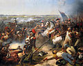
The Ferraris map or map of the Austrian Netherlands is a historical map created between 1770 and 1778 by Count Joseph de Ferraris and includes 275 sheets...
2 KB (265 words) - 19:38, 10 July 2024

ISBN 978-0-7481-3412-0 Wikimedia Commons has media related to Joseph de Ferraris. The Austrian Netherlands maps by de Ferraris (online ed.), Belgian national library...
5 KB (607 words) - 23:09, 23 January 2025
1907, pp. 303–305. KBR: The Royal Library of Belgium (1770–1778). "The Ferraris Map". p. 81: Charleroi. Archived from the original on 30 May 2019. Retrieved...
55 KB (7,136 words) - 13:30, 13 February 2025

Ghent (category Pages using infobox settlement with image map1 but not image map)
system, Ghent has a marine west coast climate, abbreviated "Cfb" on climate maps. Ghent is home to many people of foreign origin and immigrants. The 2020...
54 KB (4,953 words) - 22:32, 25 May 2025

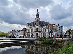
Bruges (category Pages using infobox settlement with image map1 but not image map)
Bruges on the Ferraris map, c. 1775...
53 KB (5,033 words) - 08:37, 16 June 2025
Lokeren (category Pages using infobox settlement with image map1 but not image map)
Durme was cut off near the Buylaers. The muted meander is visible on the Ferraris map. In 1725 the Church of Saint Laurence was built on the Markt. In December...
18 KB (2,209 words) - 18:02, 19 March 2025

with only one mayor remaining, Tony Vermeire (CD&V). Waarschoot on the Ferraris map (around 1775) Church of Saint Ghislenus in Waarschot. Tower and ruins...
5 KB (163 words) - 21:32, 24 August 2024

Sint Anna ter Muiden and Sluis on the Ferraris map (around 1775)...
10 KB (634 words) - 21:07, 14 January 2025

Leuven (category Pages using infobox settlement with image map1 but not image map)
for Leuven. Official website Detailed map of Leuven Archived 30 November 2005 at the Wayback Machine (detailed map of Leuven by the KUL) Streets worldwide...
46 KB (4,832 words) - 11:28, 7 June 2025

Mechelen (category Pages using infobox settlement with image map1 but not image map)
en Zuid: Maendschrift voor Kunsten, letteren en wetenschappen, Volume 2 "Map created c.1781 to depict which strategical defence structures had to be broken...
37 KB (3,776 words) - 07:45, 16 June 2025

Chapelot et Cie. KBR: The Royal Library of Belgium (1770–1778). "The Ferraris Map". p. #82: Thuin. Archived from the original on 30 May 2019. Retrieved...
24 KB (2,938 words) - 23:42, 14 April 2025

Eeklo (category Pages using infobox settlement with image map1 but not image map)
Eeklo on the Ferraris map (around 1775)...
6 KB (602 words) - 13:35, 14 October 2024

extensively documented, including an anonymous plan from 1760–1770, the Ferraris map (1770-1778), the pen drawings N. De Sparr (1753) and the descriptions...
20 KB (2,134 words) - 16:06, 9 June 2025

Damme (category Pages using infobox settlement with image map1 but not image map)
boat takes. Damme on the Deventer map (around 1558) Damme on the Atlas van Loon (around 1649) Damme on the Ferraris map (around 1775) "Wettelijke Bevolking...
5 KB (491 words) - 18:55, 22 April 2025

Veurne (category Pages using infobox settlement with image map1 but not image map)
Veurne on the Ferraris map (around 1775)...
12 KB (1,010 words) - 13:15, 22 April 2025
Uccle (category Pages using infobox settlement with image map1 but not image map)
The village of Uccle marked on the 18th-century Ferraris map...
15 KB (1,655 words) - 19:38, 12 March 2025

Schoten, as can be seen on, for example, the Ferraris map, made by the Austrian general Joseph de Ferraris on the orders of emperor Joseph II. With the...
5 KB (363 words) - 10:39, 23 May 2023

Kaprijke (category Pages using infobox settlement with image map1 but not image map)
Kaprijke on the Ferraris map (around 1775)...
4 KB (312 words) - 10:33, 4 May 2025

Laeken) between 1782 and 1784, and the Belvédère Castle in 1788. The Ferraris map of 1777 does not show these first two castles but indicates the Osseghem...
23 KB (2,490 words) - 18:39, 28 May 2025

Ixelles (category Pages using infobox settlement with image map1 but not image map)
The village of Ixelles marked on the 18th-century Ferraris map...
31 KB (2,972 words) - 13:10, 5 June 2025

Deinze (category Pages using infobox settlement with image map1 but not image map)
Tanneke Sconyncx, alleged witch Rose Bertram, fashion model Deinze on the Ferraris map (around 1775) Deinze, church: parochiekerk Sint-Martinus en Sint-Antonius...
5 KB (444 words) - 09:01, 7 June 2025

Ypres (category Pages using infobox settlement with image map1 but not image map)
Ypres on the Ferraris map (around 1775)...
31 KB (3,687 words) - 07:36, 16 June 2025

A map collection or map library is a storage facility for maps, usually in a library, archive, or museum, or at a map publisher or public-benefit corporation...
15 KB (1,657 words) - 01:56, 15 June 2025
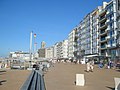
Ostend (category Pages using infobox settlement with image map1 but not image map)
system, Ostend has a marine west coast climate, abbreviated "Cfb" on climate maps. Ostend–Bruges International Airport located 5 km (3 miles) from Ostend is...
32 KB (2,882 words) - 15:32, 7 June 2025

Etterbeek (category Pages using infobox settlement with image map1 but not image map)
The village of Etterbeek (spelled Etterbeke) marked on the 18th-century Ferraris map...
17 KB (1,636 words) - 14:48, 13 June 2025

strictly subdivided using continuous axes and transverse lanes. The Ferraris map from 1771 to 1778 also shows the castle, but it is clear that it has...
8 KB (927 words) - 16:33, 9 April 2025

1771–1778 – Au Vieux Spijtigen Duivel [fr] is first attested on the Ferraris map. 1772 The Opéra flamand is established. Faro is first attested. 16 December:...
94 KB (8,568 words) - 18:21, 17 June 2025

Molenbeek-Saint-Jean (category Pages using infobox settlement with image map1 but not image map)
The village of Molenbeek (spelled Meulebeeck) marked on the 18th-century Ferraris map...
81 KB (7,268 words) - 13:17, 11 June 2025

Hasselt (category Pages using infobox settlement with image map1 but not image map)
Hasselt on the Ferraris map (around 1775)...
41 KB (3,992 words) - 10:58, 6 June 2025

Chapelot et Cie. Ferraris, Joseph-Johann-Franz (1777). "Sheet map of the Austrian Netherlands" (Map). Royal Library of Belgium, Maps and Plans Department...
35 KB (4,377 words) - 13:44, 13 February 2025