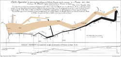
geographic location or geographic position). It is also called geospatial data and information,[citation needed] georeferenced data and information,[citation...
3 KB (259 words) - 13:26, 18 May 2025
A geographic information system (GIS) consists of integrated computer hardware and software that store, manage, analyze, edit, output, and visualize geographic...
103 KB (13,339 words) - 03:39, 19 June 2025
geographic information systems (GIS), which are the actual repositories of geospatial data, the software tools for carrying out relevant tasks, and the...
10 KB (992 words) - 08:59, 9 February 2025
South Korean geographic data and information is subject to several regulations which severely restrict its reuse. The South Korean government defends...
8 KB (768 words) - 23:55, 25 May 2025
Volunteered geographic information (VGI) is the harnessing of tools to create, assemble, and disseminate geographic data provided voluntarily by individuals...
11 KB (1,241 words) - 19:35, 12 September 2024
files and the tabular data are formatted so as to be easily linked for use in Geographic Information System software. NHGIS was launched in 2007 and is maintained...
3 KB (289 words) - 15:12, 17 May 2024
Data (/ˈdeɪtə/ DAY-tə, US also /ˈdætə/ DAT-ə) are a collection of discrete or continuous values that convey information, describing the quantity, quality...
24 KB (2,822 words) - 09:14, 1 June 2025
Under Chinese law, the use of geographic information in the People's Republic of China is restricted to entities that have special authorization from the...
29 KB (2,999 words) - 00:13, 17 June 2025
were in compliance. Geographic Information System Spatial Data Infrastructure "Steering Committee Members". Federal Geographic Data Committee. Retrieved...
8 KB (855 words) - 01:00, 1 February 2025
stages: geoparsing, text and geographic indexing, data storage, geographic relevance ranking with respect to a geographic query and browsing results commonly...
12 KB (1,184 words) - 17:03, 4 June 2025
historical geographic information system (also written as historical GIS or HGIS) is a geographic information system that may display, store and analyze data of...
5 KB (684 words) - 12:44, 12 June 2025
of a geographic information system, providing the ability to create, store, manage, query, analyze, and visualize geographic data, that is, data representing...
26 KB (2,782 words) - 17:47, 8 April 2025
Data and information visualization (data viz/vis or info viz/vis) is the practice of designing and creating graphic or visual representations of a large...
89 KB (8,241 words) - 08:17, 20 May 2025
The Arizona Geographic Information Council (AGIC) was established by executive order as Arizona's primary forum and oversight group for coordination efforts...
4 KB (384 words) - 20:21, 15 June 2025
The Cartography and Geographic Information Society (CaGIS) is a learned society in the fields of cartography and geographic information science. It includes...
2 KB (166 words) - 22:16, 29 July 2021
operations. Geographic information systems (GIS) first became widely available in the 1980s and 1990s, when the only source of geographic data for China...
9 KB (994 words) - 14:49, 2 May 2025
program and become a foremost promoter of geographic information systems (GIS). CGIS was designed to withstand great amounts of collected data by managing...
5 KB (580 words) - 01:26, 6 September 2024
Geospatial metadata (redirect from Geographic MetaData)
(also geographic metadata) is a type of metadata applicable to geographic data and information. Such objects may be stored in a geographic information system...
17 KB (2,003 words) - 07:56, 12 March 2025
intelligence, geoinformatics, geographic information science, and geographic information systems. Founded on values of excellence and inclusion, the mission...
3 KB (309 words) - 11:20, 30 May 2025
The Geographic Names Information System (GNIS) is a database of name and location information about more than two million physical and cultural features...
31 KB (3,688 words) - 04:11, 10 June 2025
spatial data infrastructure (SDI), also called geospatial data infrastructure, is a data infrastructure implementing a framework of geographic data, metadata...
11 KB (880 words) - 09:00, 6 June 2025
play an important role in geographic information systems (GIS), geospatial content and services, GIS data processing, and data sharing. A coverage is represented...
10 KB (1,365 words) - 17:26, 7 January 2023
"techniques of geographic analysis," "Geographic Information Technology," "Geography method's and techniques," "Geographic Information Science," "geoinformatics...
89 KB (9,097 words) - 02:36, 18 June 2025
Information privacy is the relationship between the collection and dissemination of data, technology, the public expectation of privacy, contextual information...
36 KB (4,116 words) - 13:45, 31 May 2025
Geomatics (redirect from Spatial information science)
processing, presentation of geographic data or geographic information". Under another definition, it consists of products, services and tools involved in the...
17 KB (1,712 words) - 19:18, 14 April 2025
Data analysis is the process of inspecting, cleansing, transforming, and modeling data with the goal of discovering useful information, informing conclusions...
66 KB (7,188 words) - 14:10, 8 June 2025
Geographic Information Laboratories in Europe (AGILE) was established to promote academic teaching and research on geographic information science and...
3 KB (437 words) - 12:49, 4 October 2023
MapInfo TAB format is a geospatial vector data format for geographic information systems software. It is developed and regulated by Precisely as a proprietary...
5 KB (713 words) - 11:55, 23 December 2023
of geographic analysis", "geographic information and analysis", "geographic information technology", "geography methods and techniques", "geographic information...
84 KB (8,615 words) - 16:58, 18 June 2025
Global Human Settlement Layer (category Geographic data and information)
settlement maps. This information is produced using new geographic data mining tools and knowledge and analytics based on empirical data. The GHSL processing...
3 KB (260 words) - 17:40, 30 October 2023


