A GIS software program is a computer program to support the use of a geographic information system, providing the ability to create, store, manage, query...
26 KB (2,782 words) - 17:47, 8 April 2025

A geographic information system (GIS) consists of integrated computer hardware and software that store, manage, analyze, edit, output, and visualize geographic...
101 KB (13,199 words) - 20:48, 17 May 2025
A historical geographic information system (also written as historical GIS or HGIS) is a geographic information system that may display, store and analyze...
5 KB (687 words) - 06:45, 6 March 2025
integration. Open Source Geospatial Foundation (OSGeo) Geographic information system software GIS Live DVD Idrizi, B.; Zhaku, S.; Izeiroski, S.; Kabashi...
12 KB (240 words) - 21:06, 7 February 2025
data are formatted so as to be easily linked for use in Geographic Information System software. NHGIS was launched in 2007 and is maintained by the Minnesota...
3 KB (289 words) - 15:12, 17 May 2024
The Canada Geographic Information System (CGIS) was an early geographic information system (GIS) developed for the Government of Canada beginning in the...
5 KB (580 words) - 01:26, 6 September 2024
GIS software is playing an increasing role in the way Chinese companies analyze and manage business operations. Geographic information systems (GIS)...
9 KB (994 words) - 14:49, 2 May 2025
MapInfo TAB format is a geospatial vector data format for geographic information systems software. It is developed and regulated by Precisely as a proprietary...
5 KB (713 words) - 11:55, 23 December 2023

data, software, and professional practice; it is more focused on how gis is applied in real life as opposed to being a geographic information system tool...
10 KB (992 words) - 08:59, 9 February 2025

laboratory information management system (LIMS), sometimes referred to as a laboratory information system (LIS) or laboratory management system (LMS), is...
22 KB (3,084 words) - 10:21, 5 March 2025

GRASS GIS (redirect from Geographic Resources Analysis Support System)
Geographic Resources Analysis Support System (commonly termed GRASS GIS) is a geographic information system (GIS) software suite used for geospatial data...
12 KB (1,324 words) - 20:47, 10 April 2025
interpret information. The term is also sometimes used to simply refer to a computer system with software installed. "Information systems" is also an...
50 KB (5,877 words) - 16:25, 17 May 2025
share of Safe Software. Safe Software wants to triple the net annual revenue in the next five years. Geographic information system software QGIS – Open-source...
12 KB (969 words) - 04:23, 12 February 2025
TerraLib (category Free GIS software)
TerraLib is an open-source geographic information system (GIS) software library. It extends object-relational database management systems (DBMS) to handle spatiotemporal...
7 KB (787 words) - 12:42, 26 April 2025

be done using specialized hydrologic modeling software such as WMS, geographic information system software like ArcGIS or QGIS, or with programming languages...
30 KB (3,165 words) - 18:17, 19 April 2025

shapefile format is a geospatial vector data format for geographic information system (GIS) software. It is developed and regulated by Esri as a mostly open...
16 KB (1,626 words) - 09:53, 2 April 2025
GIS in geospatial intelligence (redirect from Geographic Information System in Geospatial Intelligence)
Geographic information systems (GIS) play a constantly evolving role in geospatial intelligence (GEOINT) and United States national security. These technologies...
22 KB (2,582 words) - 16:38, 1 April 2025
The Geographic Names Information System (GNIS) is a database of name and location information about more than two million physical and cultural features...
31 KB (3,691 words) - 17:07, 12 March 2025
DIVA-GIS (category Cross-platform software)
free geographic information system software program used for the analysis of geographic data, especially species occurrence data. The software was first...
3 KB (289 words) - 16:07, 13 October 2024
telecommunications companies. This system encompasses the integration of Geographic Information Systems (GIS) and Operational Support Systems (OSS) to facilitate the...
3 KB (359 words) - 17:54, 13 January 2024
ArcView 3.x (category Esri software)
ArcView GIS was a geographic information system software product produced by ESRI. It was replaced by new product line, ArcGIS, in 2000. Regardless of...
6 KB (723 words) - 06:40, 6 September 2023
Geographic information retrieval (GIR) or geographical information retrieval systems are search tools for searching the Web, enterprise documents, and...
12 KB (1,184 words) - 07:45, 2 November 2024
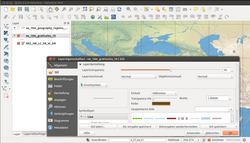
QGIS (category Free GIS software)
QGIS is a geographic information system (GIS) software that is free and open-source. QGIS supports Windows, macOS, and Linux. It supports viewing, editing...
10 KB (908 words) - 14:12, 27 March 2025

Specification 2), and in most geographic information system software. The map projection and the geographic coordinate system (GCS, latitude and longitude)...
21 KB (2,805 words) - 11:47, 25 December 2024
processing of services. Hospital information system is also known as hospital management software or hospital management system (HMS). More generally an HIS...
4 KB (454 words) - 05:34, 19 April 2025

collecting Global Positioning System locations along the dune-line and then downloaded using Geographic information system software. Originally, the island...
6 KB (555 words) - 05:12, 10 April 2025
Marble Geographics is a developer and provider of geographic information system software products focused on data translation. They provide software products...
8 KB (812 words) - 19:42, 25 January 2024
ArcGIS (category Esri software)
ArcGIS is a family of client, server and online geographic information system (GIS) software developed and maintained by Esri. ArcGIS was first released...
59 KB (5,839 words) - 19:09, 2 May 2025
ArcView (category Esri software)
is the entry-level licensing level of ArcGIS Desktop, a geographic information system software product produced by Esri. It is intended by Esri to be the...
2 KB (202 words) - 18:59, 15 September 2024

Software testing is the act of checking whether software satisfies expectations. Software testing can provide objective, independent information about...
78 KB (10,044 words) - 20:33, 1 May 2025